Places worth discovering

Things to Do

Find attractions, experiences and places to visit. Events remain the best way to see what is happening on a particular date.

Looking for a dated event? Explore Events

14856 places

Explore local places

Browns Forest Loop Trail
Image credit: Photo: John Spencer

Natural Attractions

Browns Forest Loop Trail

If you’ve ever wondered what Sydney looked like before the city took over, then head to Browns Forest loop trail, in the North Sydney suburb of St Ives. Immerse yourself in unspoilt bushland within Dalrymple-Hay Nature Reserve by taking advantage of its short and easy walking track. Just 30 minutes north of the central business district, it’s ideal for birdwatching enthusiasts, nature-lovers and botanists, and is a great walk for kids. You’ll enter a forest of majestic blue gums and magnificent blackbutts that hark back to pre-colonial times with a lush understorey of ferns. Following the clearly signposted path, the kids will enjoy the self-guided series of interpretation signs. In the spring, the ground cover of native flowers, such as the blue flax lily and pastel flower, burst into a colourful display. Any time of year, you’ll hear the chatter of birds such as rainbow lorikeets, crimson rosellas and king parrots echoing through the bush.

St Ives NSW

View place
Bruce Rock Museum and Machinery Museum
Image credit: Image from operators Facebook page

Galleries, Museums and Collections

Bruce Rock Museum and Machinery Museum

The old bank has been given a new lease on life, with the Bruce Rock Museum located within its walls. Some of the rooms have been refurbished with items from the early to mid-1900s to tell the history of the bank manager's premises. The museum site contains a rebuilt cottage with the traditional hessian and lime-rendered interior walls, a saddlery, a workshop and a school. The Bruce Rock Machinery Museum is located directly across the road from the Museum.

Bruce Rock WA

View place
Bruce Steer Pool
Image credit: David Rogers

Natural Attractions

Bruce Steer Pool

Take a dip in the pristine waters of Bruce Steer Pool on the edge of stunning Bermagui Harbour. At approximately 150-metres in length, this netted saltwater pool is ideal for morning laps followed by a coffee at the Bermagui Fishermen's Wharf. It is a lovely swimming and play place for young children with gentle water, a sandy beach, shade, seating and level parking. The newly installed all-abilities access ramp now allows wheelchair access to the pool. The ramp features handrails and non-slip FRP mini mesh. There is also an all-abilities amenities block, disabled parking and ramp access. The pool is named in honour of Colonel John Mansel Bruce Steer who served the community of Bermagui with great fervour and skill. He was at the forefront of an agitation for Bermagui harbour improvements which eventuated in a project involving major reclamation and harbour construction. He also fought hard and constantly for improved conditions for professional fishermen. The pool is located on the western side of Bermagui Point, just a short stroll from the main street.

Bermagui NSW

View place
Bruno bay
Image credit: BBC

Parks and Gardens

Bruno Bay

Bruno Bay is located on the edge of Cobdogla and just over 7km from the township of Barmera. It contains a riverside area with shelter and BBQ facilities, public toilets and boat launching facilities. Home to the Bruno Bay Fireworks Spectacular which is usually held at the beginning of the year in January.

Cobdogla SA

View place
Brunswick Cow

Historical Sites and Heritage Locations

Brunswick Cow

You can't miss the life-size Brunswick Cow statue which stands proudly in the centre of the farming town of Brunswick. The big Friesian cow statue is affectionately known as Daisy by the locals, and she stands as a testament to the significant role dairy farming has played in the development of the town. Be sure to take the opportunity to taste some of the wonderful fresh dairy produce the town is famous for. Visit Brunswick during October and be a part of the largest one-day agricultural show in Australia. Brunswick is just two-hours drive south of Perth and a leisurely 20-minute drive from Bunbury, the gateway to the southwest..

Brunswick WA

View place
Brunswick Heads Nature Reserve

National Parks and Reserves

Brunswick Heads Nature Reserve

Brunswick Heads Nature Reserve offers all the pleasures of the great outdoors within easy reach of civilisation. Whether you're into fishing, canoeing, birdwatching or picnicking with a view, come and explore this charming reserve nestled between the townships of Ocean Shores and Brunswick Heads. Spend the whole day fishing on Brunswick River or New Brighton Beach. Drive and walk or cycle all the way to Harrys Hill Beach, on the north bank of the river, for a picnic under shady trees. Head to the north wall to watch for migrating whales in winter. Eagles and kites can also be seen hunting along this northern New South Wales coastline all year round. Take an easy walk from North Head carpark through endangered littoral rainforest on North Head track, or hike a short distance to Marshalls Creek for some more birdwatching. Canoe, boat or paddleboard on Brunswick River and you might just see an endangered loggerhead turtle or a vulnerable green turtle coming up for air. These are just two of the reserve's many threatened animal species.

Brunswick Heads NSW

View place
Brunswick River picnic area

Natural Attractions

Brunswick River picnic area

Brunswick River picnic area is a great place to enjoy this peaceful coastal reserve, with views of the river and easy-to-access fishing spots. Enjoy lunch with friends and family in the shade of cottonwood hibiscus, which shows its large yellow flowers in the warm weather, and listen to the wind gently whoosh through the swamp oaks. Then cast a line and relax. The access road to this picnic area is lined with many threatened rainforest trees, such as marblewood and stinking laurel (which doesn’t actually stink). In spring, the brilliant purple flowers of the hovea bush decorate the way as well. This quiet spot is ideal for birdwatching. Pied oystercatchers feed on the rocks, while birds of prey - brahminy kites and white-bellied sea eagles – soar overhead. If you’re really lucky, you’ll see an osprey stealthily snatch a fish from the water.

Ocean Shores NSW

View place
Aerial of Brunswick River Pool
Image credit: Destination Harvey Region

Sports and Recreation Facilities

Brunswick River Swimming Hole and Walk

Located along the South West Highway, just north of the Brunswick town site, Brunswick River Swimming Hole is a picturesque section of the Brunswick River. Enjoyed by locals and tourists alike for an invigorating dip on a hot summer day. Plenty of shady grassed areas, BBQs, toilets, and a playground make it ideal for gathering the family and enjoying an outdoor BBQ while cooling off in the water. While you're there, take a look at the outstanding artwork on the wall of the toilets, created by the local youth of Brunswick. Or, stretch your legs on the Brunswick River Walk Trail that winds along the Brunswick River to Shines Crescent, Brunswick. Please note: The wall for the Brunswick River Swimming Hole is removed at the end of every warm season to accommodate increased rainfall in winter.

Brunswick WA

View place
Brunswick Street Fortitude Valley

Entertainment Venues

Brunswick Street Fortitude Valley

At the heart of Brisbane's entertainment precinct, Brunswick Street spills from the pedestrian-only Brunswick Street Mall, across Ann Street and into New Farm. Along the lively street you can find a thrilling assortment of bars, cafes, restaurants and stores. While daytime is chilled out and relaxed, by night this street truly comes to life. If you love live music, check out who is playing at the mega venue The Fortitude Music Hall, or drop into Black Bear Lodge next door or Ric's Bar across the road for live and local acts. Further along the street, The Press Club often has jazz acts. Add to this The Empire Hotel, Heya Bar, Our Place, Finn McCool's The Flying Cock and plenty more bars that make a night out on the street very entertaining. Head along the street towards New Farm, and you'll find a multicultural mix of restaurants from Fat Dumpling to Bloodhound Bar and Pig 'n' Whistle. Towards New Farm, you'll also find fashion boutiques, art galleries, and homewares stores, including Jan Murphy and Philip Bacon galleries.

Fortitude Valley QLD

View place
Bruny Island Honey - Bruny Island

Agritourism

Bruny Island Honey - Bruny Island

A family owned and operated apiary business. Producing pure, natural Tasmanian honey, sourced from the pristine forests of Bruny Island. They have been collecting honey from the Island for 20 years, and currently, have approximately 400 hives on the Island. The brand new honey shop is a "hive" of activity! Including a wide variety of local honey, free tastings, Leatherwood honey ice cream, a live hive - to watch the bees at work, local gifts and a Manuka cosmetic range. Providing an educational, interpretive and fun experience for all guests, open seven days.

Great Bay TAS

View place
Bruny Island Neck

Natural Attractions

Bruny Island Neck

Bruny Island Neck is an isthmus of land connecting north and south Bruny Island in southern Tasmania and offers stunning 360 degree views. Just 40 kilometres from Hobart, Bruny is Tasmania's fourth-largest island. The Neck is an important habitat for Bruny Island's native wildlife. Boardwalks and viewing platforms let you observe short-tailed shearwaters and little penguins (also known as fairy penguins). You'll see these remarkable birds returning to their burrows in the sand dunes at dusk—little penguins making their way up the beach in tight groups and shearwaters gliding in from the sea. The best viewing period is during the warmer months of September to February. There's also a campground just 20 metres from the beach with car parking, picnic facilities and toilets. Access to the island is by passenger-vehicle ferry from Kettering.

Bruny Island TAS

View place
Bruny North
Image credit: Virginia Dowzer

Galleries, Museums and Collections

bruny NORTH

bruny NORTH does lots of good things: It is an exhibition space, a general store, a studio for workshops and a base for a film festival @biff_on_bruny, holding screenings, conversations, analogue filmmaking workshops and celebrating the making of film. It has also developed its very own alcohol-free lager @chainsawlager bruny NORTH is interested in good ideas, good people, making things happen, sharing good times and creating 'slow tourism' reasons to come to the island Come play at bruny NORTH soon @brunynorth Opening hours and 'What's On' vary - so check in before venturing up the dirt track.

Dennes Point TAS

View place
Brush Turkey Track
Image credit: Photo: John Spencer/NSW Government

Natural Attractions

Brush Turkey Track

Starting right from Woko campground, Brush Turkey track is just as interesting as it is convenient. The loop twists through a sampling of the park’s dry rainforest habitat, with brush turkeys foraging in the undergrowth for grubs and insects, giving the trail its name. Their scratching actually serves an important purpose in the ecosystem, turning over soil and encouraging new growth. Bring binoculars for other species: whipbirds, lyrebirds, grey fantails and scrub wrens are all common in the area, making up a memorable chorus. The trail begins in colonising rainforest, where hibiscus and acacia trees create the shade that then allows for the next stage in flora development. Be sure to take note of how the atmosphere cools as you move into older forest, where a canopy of Port Jackson fig and shatterwood blocks out the sun. The track won’t take you long and is perfect for walking with children. You might like to bring a packed lunch and make a day of it, taking advantage of the free barbecues and picnic tables near the river camping sites.

Dewitt NSW

View place
Brushbox Falls lookout

Natural Attractions

Brushbox Falls lookout

Brushbox Falls lookout can be reached via an easy walk along Palm Forest walking track from Sheepstation Creek campground, and is a great spot for families as well as larger groups of children. Tall brushbox and dainty Christmas orchids are dotted along the mostly downhill walk, with strangler figs and Bangalow palms adding to the charming scenery. Bring along your binoculars for birdwatching, as this World Heritage-listed park is teeming with birdlife. Keep a look out for green catbirds, paradise riflebirds, rose-crowned fruit-doves and wompoo fruit-doves. Brushbox Falls is particularly impressive during the wet season in late summer, or after heavy rains at any time of year. Take a virtual tour of Brushbox Falls lookout captured with Google Street View Trekker.

Border Ranges NSW

View place
Bryce Gorge Circuit Walk

Natural Attractions

Bryce Gorge Circuit Walk

The Bryce Gorge Circuit hike starts at the carpark on the Howitt Road, 23.5 kilometre north of Arbuckle Junction (46.5 kilometre north of Licola via Tamboritha Road). From the carpark follow the well defined track across open snow plains for about 1.7 kilometre to the waterfall on Pieman Creek. The best view is from a lookout about 50 metres beyond the sign. Return to the main track and continue around the clifftops of Bryce Gorge for two kilometres to Conglomerate Falls. From the falls the track follows Conglomerate Creek through Black Sallee woodlands and across open plains to a junction with the Wonnangatta Track. Guy's Hut is reached a further three kilometres though groves of Snow Gums. Built in 1940, the hut is an excellent example of bush architecture and well worth a visit. Continue one kilometre south east from the hut to the carpark. Bryce Gorge Circuit is a 7.6 kilometre, Grade 3 hike located in the Alpine National Park, Victoria. The hike should take around three hours to complete. For detailed trail info visit Bryce Gorge Circuit (7.6 kilometres), Alpine National Park, Victoria.

Reynard VIC

View place
Bubba wetlands walk
Image credit: Alistair Smith

Historical Sites and Heritage Locations

Bubba Wetlands Walk

A popular spot with nature-lovers and bird-watchers, at Bubba Wetlands you’ll see plants and animals typical of Kakadu. Enjoy the colours of Kakadu - the stark white trunks of the ghost gums, the slender white egrets, and enjoy the presence of Nourlangie Rock in the distance. Explore billabongs and swamps dotted with lilies and fringed with paperbarks and freshwater mangroves. This is a lovely walk to add to your itinerary if you have extra time in the Nourlangie region. This Burrungkuy (Nourlangie) region walks starts at the Djarradjin (Muirella Park) camping area and takes you through several wetland habitats. 4 km loop | 2 hours See it: August to November during the dry season only - check the daily Kakadu access report for details. A park pass is required to enter Kakadu National Park. Save time on your holiday and purchase your Kakadu park pass online before you leave home.

Kakadu NT

View place
Bucasia Beach - Queensland
Image credit: MIT

Natural Attractions

Bucasia Beach

Bucasia Beach is located in Mackay's beautiful Northern Beaches, Bucasia Beach is a relaxed coastal destination loved by locals and visitors alike. With approximately four kilometres of soft white sand, it is one of the longest beaches in the Mackay Region and the perfect place to enjoy a leisurely stroll, cast a fishing line, cool off with a swim, or simply soak up the peaceful seaside atmosphere. Take in stunning views across the coastline towards Dolphin Heads and the picturesque Cumberland Islands while enjoying the gentle sea breeze. The beach is a favourite among anglers, particularly at high tide when Flathead can often be caught from the shore. The southern end of the beach, near the sandy spits and mangroves of Eimeo Creek, is a popular fishing spot and also features a convenient boat ramp for easy access to the water. Bucasia Beach is also a great destination for pet owners, with a designated off-leash area between Williams Avenue and Symons Avenue where dogs can run and play along the sand. For families and day-trippers, Seaview Park on the Bucasia Esplanade offers excellent facilities including barbecues, shaded picnic tables, public toilets, drinking fountains and a children's playground. A café located nearby provides the perfect spot to enjoy a coffee or meal by the beach.

Bucasia QLD

View place
Bucca Crossing

Natural Attractions

Bucca Crossing Picnic Area

Just 25 minutes from Bundaberg, Bucca Crossing is a local favourite for a refreshing dip, riverside picnic or lazy day on the water. Paddle the Kolan River by canoe, float downstream in an inflatable ring, or simply relax on the riverbank while the kids splash nearby. The river can flow quite quickly, so it's best to stick to the upstream section and supervise children at all times. You'll find a well-maintained picnic area, shady lawns and toilet facilities, making it easy to spend a full day by the water. Local's tip: Round out your visit with a meal at the historic Bucca Hotel. A country pub since 1897, it's known for hearty feeds, cold drinks and legendary Sunday sessions featuring local and travelling musicians. Grab a spot in the beer garden beneath the mango tree and settle in for a classic Aussie afternoon.

Bucca QLD

View place
Scenic Flight over Buccaneer Archipelago
Image credit: Tourism Western Australia

Natural Attractions

Buccaneer Archipelago

The Buccaneer Archipelago in the Kimberley is a vast and largely untouched island group north west of Derby, renowned for its dramatic tides, remote beauty and exceptional on-water and aerial experiences. Made up of more than one thousand islands scattered across turquoise tropical waters, the archipelago offers a powerful sense of scale and isolation that defines the Kimberley coast. Sheer sandstone cliffs, secluded beaches, mangrove-lined inlets and pockets of rainforest are shaped by some of the largest tidal movements in the Southern Hemisphere. These immense tides surge through narrow channels and bays, creating natural spectacles such as the Garaanngaddim Horizontal Falls in Talbot Bay. Visitors can experience the region in a variety of ways, from day boat tours and sea safaris that navigate tidal waterways, to extended expedition cruises that explore the islands, creeks and offshore reefs in depth. Scenic flights by fixed wing aircraft and helicopter reveal the full extent of the archipelago from above, showcasing intricate island patterns, powerful tidal flows and remote coastal scenery that is inaccessible by land. The Buccaneer Archipelago holds deep cultural significance for Traditional Owner groups and forms part of a network of protected marine environments that support its rich biodiversity.

Derby WA

View place
Buchan Caves Reserve on Krauatungalung Country
Image credit: #visitgippsland

National Parks and Reserves

Buchan Caves Reserve

Buchan Caves Reserve on Krauatungalung Country, is highly significant to Gunaikurnai Traditional Owners due to its remarkable Aboriginal cultural heritage. Buchan Caves Reserve is one of the jointly managed parks within Gippsland. The Joint Management agreement recognises the fact that the Gunaikurnai people hold Aboriginal Title and maintain a strong connection to Country. Discover Victoria’s largest cave system, a landscape perfect for a picnic and a place to camp under the stars. Book a guided tour of Buchan Caves - a honeycomb of spectacular limestone formations carved by an underground river almost 400 million years ago. Choose from Fairy Cave, Royal Cave, or both and marvel at the magnificent stalactite and stalagmite forms, pillars and rim pools, as well as vast open caverns and an ancient flowing stream. A guided tour is the only way to see this remarkable cave system. Tickets must be purchased 24 hours in advance. Conditions can change in parks for many reasons. Before your visit, check the relevant park page on the Parks Victoria website for updates and familiarise yourself with important bushfire safety information. Visit Fire Danger Ratings and Total Fire Bans visit www.emergency.vic.gov.au.

Buchan VIC

View place
Looking south to Red Cliff from Plumbago.
Image credit: My Clarence Valley

Natural Attractions

Buchanan's Head

On the north coast NSW, approximately two kilometres of straight beach south from Shelley Caves lies Buchanan's Head, or, as most people call it, Plumbago. It's a grey and beautiful punctuation mark of stone on a long stretch of beach. Plumbago is directly in front of Lake Arragan. (Lake Arragan is best accessed by an umbilical-type tributary that winds north from Red Cliff camping area) There's some little sea caves here at Plumbago. The nearshore ocean gets a bit moody around Plumbago, so swimming is hazardous. Most commonly, Plumbago is accessed by walking 2.5 kilometres north from Red Cliff. If you're up for a bit of a bike ride along the beach, this is the place to do it. Remember- Unpatrolled waters can be unpredictable. Choose patrolled beaches for a safer experience and swim only between the flags. Avoid jumping into unknown water depths or areas with unseen hazards. Be aware of currents, rocks, and sudden drops, and always make sure you're swimming in safe areas to protect yourself and your loved ones!

Yuraygir NSW

View place
Buckingbong Boat Ramp
Image credit: Narrandera Shire Council

National Parks and Reserves

Buckingbong Reserve

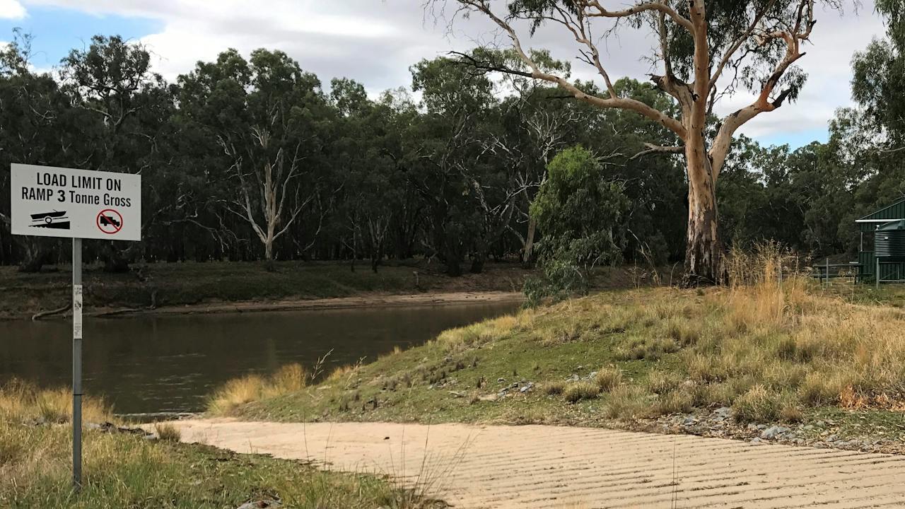
Buckingbong Reserve is located seven kilometres along Buckingbong Road from the Sturt Highway and offers free camping for travellers. There's a boat ramp with access to the Murrumbidgee River, picnic tables and shelter, plenty of shade and a toilet at the site. The site is maintained by the Narrandera Fishing Club who request that visitors read and obey all signage at the reserve.

Sandigo NSW

View place
Buckland Church

Historical Sites and Heritage Locations

Buckland Church

Buckland in the 1830’s or Prosser Plains as it was then known, was isolated and dangerous. It was the habitat of bushrangers and convict labour sent from the gaols of Richmond and Oatlands to work on the development of farming properties. It was rough and wild and there were many souls to be saved. The Lt-Governor in Hobart Town realised in 1836 that a service had not been performed in Prosser Plains by a clergyman for 7 years and the convict servants should not continue without the word of God being preached to them, and so it was very quickly decided a church should be built. The Buckland Church was completed in 1846 and is a replica of the parish church at Cookham Dean in Sussex from where the first referend, Reverend F.H. Cox originated. The Buckland Church stands large and solid as the most authentic example of early Medieval English church architecture in Tasmania. It possesses a very memorable east-facing stained glass window with stories that involve medieval monks, a churchyard, a Marquis, an Earl, William the Conqueror, the Tudors, Roundheads and Royalists, gemstones and pirates. The Buckland Church has been deconsecrated and purchased by the community (Friends of the Buckland Church Inc.). The Church is available for hire for weddings, funerals, community events, theatre, musical concerts and photo shoots.

Buckland TAS

View place
An easy walk, big views, and the sound of rushing water at Buckley Falls.
Image credit: Tourism Greater Geelong and The Bellarine

Historical Sites and Heritage Locations

Buckley Falls

Pack your bikes, scooters and picnic supplies into the car and head off for an afternoon adventure at Buckley Falls in Highton. With the River Red Gum Walk leading right up to the lookout over the stunning waterfall, you can make your way there on foot or on wheels. You may like to park at Queens Park carpark and take in the sights as you make your way up the trail to the lookout. Or park at the small carpark located alongside the falls providing easy access for a quick pit stop to appreciate the view. On your walk, keep an eye out for tawny frogmouths, gang-gang cockatoos and rainbow lorikeets – all commonly spotted in the area along with many others. You may even be lucky enough to spot a swamp wallaby along the water’s edge. After you’ve taken in the view at the falls, follow the River Red Gum Walk downstream, cross the bridge when you reach the Barwon Aqueduct River Trail and make your way up to Fyansford Paper Mills for some quick refreshments and to explore the makers hub with a gallery, ceramist and unique wares. For the adventurous, take on the continuous 20 kilometre loop of the Barwon River Trail, which takes you on a picturesque journey along the banks of the river through Fyansford and South Geelong.

Highton VIC

View place

What is happening now?

Search dated events, markets, live music, sport and community activities.

Explore Events

Planning by place?

Use Things to Do for attractions and experiences that are not tied to one event date.