Places worth discovering

Things to Do

Find attractions, experiences and places to visit. Events remain the best way to see what is happening on a particular date.

Looking for a dated event? Explore Events

14856 places

Explore local places

Brett Whiteley Studio, Surry Hills, featuring artworks by Brett Whiteley
Image credit: Wendy Whiteley/Copyright Agency © Art Gallery of New South Wales

Galleries, Museums and Collections

Brett Whiteley Studio

Brett Whiteley Studio has reopened after extensive upgrades to revitalise and preserve the site for generations to come. Explore one of Sydney's best kept secrets: the Brett Whiteley Studio, where one of Australia's most celebrated artists of the 20th century lived and worked from 1988 to 1992. The Studio exhibits a selection of Whiteley's work where glimpses of his private world can be seen in his sketchbooks, photographs, music collection and personal memorabilia. The studio is located close to the Central Business District, in the cosmopolitan suburb of Surry Hills. Brett Whiteley (1939–92) bought the former warehouse in 1985 and converted it into a studio and exhibition space. He lived there from 1987 until 1992, when he died in Thirroul, south of Sydney. The studio has been managed as a museum by the Art Gallery of New South Wales since 1995. Visitors are offered the unique opportunity to experience the atmosphere of the space – the studio with his unfinished paintings, art equipment and collections of reference books, and the graffiti wall covered with quotes and images. The living area has memorabilia such as photographs, objects, postcards, furniture, his music collection and sketchbooks.

Surry Hills NSW

View place
Brewarrina Fish Traps (Baiame's Ngunnhu)

Historical Sites and Heritage Locations

Brewarrina Fish Traps (Baiame's Ngunnhu)

The Brewarrina Fish Traps, or as they are traditionally known Baiame's Ngunnhu, are a complex network of river stones arranged to form ponds and channels that catch fish. Known as one of the oldest human-made structures in the world. The fish traps reflect an ancient genius in the simplicity of their design, which was adaptable to the seasons and changing water levels. The fish traps work by using stone walls to guide fish that are swimming upstream into the holding ponds where the Aboriginal People traditionally caught them with their bare hands, used their spears or blocked them in ponds to be caught later. According to Aboriginal tradition, the ancestral creation being, Baiame, created the design by throwing his net over the river and, with his two sons Booma-ooma-nowi and Ghinda-inda-mui, built the fish traps to its shape. But according to oral history, the fish traps (and the technology behind them) were inspired by nature—by the pelican, with the traps acting like a pelican's beak to scoop fish out of the water. The creation of the fish traps, and the Aboriginal Lore governing their use, helped shape the spiritual, political, social, ceremonial, and trade relationships between Aboriginal groups from across the greater landscape. The fish traps were an important site of food production, work, trade and consumption.

Brewarrina NSW

View place
Brweery Flat with Caravan
Image credit: Narrandera Shire Council

Landmarks and Buildings

Brewery Flat

The red brick tower of the former Oakbank Brewery is a distinctive and prominent Narrandera landmark that stands ninety feet high beside the Murrumbidgee River, just off the Newell Highway. The tower represents an industry that had its heyday in the Riverina between the 1890s and mid-1920s. The Oakbank Brewery was amongst the most modern in NSW. Run with the latest equipment from England, it employed up to 100 men. During 1921, the brewery had a capacity of 20,000 gallons of stout and bottled and draught beer and could produce 10,000 bottles of beer and 15,000 bottles of cordial daily. Branches sprang up throughout the Riverina and fifty hotels in the region were controlled by the brewery. In 1924 the brewery was sold to Tooths of Sydney for a reported price of £200,000. The new owners closed down the brewing operation, but the Oakbank Cordial Factory – followed by a number of other operators – continued with the production of cordials at the site until 1986. The walls of the red brick tower survive today and the National Trust has listed it as a building of historical significance. There is a free-camping site for caravans and RVs at Brewery Flat.

Narrandera NSW

View place
Briagolong ANZAC Park

Parks and Gardens

Briagolong ANZAC Park

Within ANZAC Park lies the Briagolong War Memorial. The monument commemorates those who served in World Wars One and Two. Originally erected to commemorate those who served in World War One, two smaller obelisks were placed on either side at a later date to commemorate those who served and those who died in World War Two. A marble tablet was placed on ANZAC Day 1924 as a tribute to Mrs. Mills, who unveiled the monument, for her work with the soldiers during World War One. On the tablet are inscribed the words "Friend of the Soldiers." The memorial was officially unveiled on the 29th January 1921 by Mrs Mills in front of a large gathering.

Briagolong VIC

View place
Briagolong State Forest

National Parks and Reserves

Briagolong State Forest

Two and a half hours drive from Melbourne, north of the town of Briagolong on the southern fall of the Great Dividing Range, lies the Briagolong State Forest. These forests have a rich history. The original inhabitants of the area were the Briakoloong people who utilised the vast forest resources for canoes, shelter, food, clothing and tool making. The early European explorers relied heavily on Koori guides during the exploration that was responsible for the opening up of the region. In the late 1800’s, these forests teemed with prospectors searching for that ever-elusive gold to bring them instant wealth. These days, the forests provides for a variety of activities including picnicking, camping, walking, swimming, sightseeing, and car touring. The Freestone Creek area offers a variety of walks, ranging from five minutes to three days in duration are an excellent way to discover the many wonders of the forest. Walks are all marked and easy to follow. The Briagolong State Forest comprises of mostly dry forest types. Common lower storey species of trees and shrubs include Common and Shiny Cassinia, Hop Bitter Pea, Common Heath, Snow Daisy Bush and Burgan. Briagolong State Forest supports a range of native animals, many of which are best viewed at night.

Briagolong VIC

View place
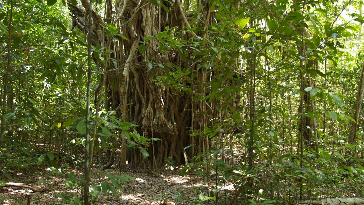
Fig Trees at Brian Creek
Image credit: Parks and Wildlife Commission NT

Natural Attractions

Brian Creek Monsoon Forest

Brian Creek Monsoon Forest walk, in the Mary River National Park which is an hour's drive from Darwin, is a short walk through a pocket of monsoon forest. Along the way, you will notice the contrast between the wildlife here and in the surrounding woodlands. These pockets are significant examples of remnant vegetation communities that are surrounded by dry lowland woodland savanna. Allow 45 minutes for this relatively easy 2 kilometre return walk. A picnic table at the start of the track provides a quiet spot to rest and enjoy the surrounds.

Darwin NT

View place
Walking Path Bicentennial Walks on Bribie Island near Brisbane
Image credit: Moreton Bay Region Industry & Tourism

Natural Attractions

Bribie Island Bicentennial Trails

If you enjoy a stroll through eucalypt forest and paperbark wetlands, then make your way to the Bribie Island Bicentennial Trail. A 3.8km circuit, the Bribie Island Bicentennial Trails begin at the Bribie Island Community Arts Centre on Sunderland Drive. The sandy track features Banksia, Palm Grove, and Melaleuca Bribie Island walks which branch off the main circuit giving visitors the chance to enjoy strolls through eucalypt forests, paperbark wetlands, and even wallum heathlands. Allow about 1 hour to complete the full circuit at a leisurely pace. Don’t forget to bring along a hat, sunscreen and a water bottle, especially on extra sunny days! There’s a range of birdlife to see, so take your phone/camera along too. You may catch a glimpse of rainbow bee-eaters, red-backed wrens, and eastern yellow robins, as well as a host of other beautiful and well-camouflaged birds. Please Note: Dogs and horses are not allowed on the trails. Bring along a picnic or drop into the Bribie Island Community Arts Centre Cafe and enjoy their homemade goodies.

Banksia Beach QLD

View place
The main entrance to the Bribie Island Butterfly House situated behind the Bribie Orchard Society.
Image credit: Bribie Island Butterfly House

Zoos, Sanctuaries, Aquariums and Wildlife Parks

Bribie Island Butterfly House

Walk into a wonderland of flying butterflies! Around 700-1000 butterflies are housed in an outdoor sanctuary where they are safe to fly, feed, breed, lay their eggs and continue their magical life cycle which you can explore up close and personal. At the butterfly breeding lab viewing area you can see the volunteers at work, looking after the eggs and chrysalises and feeding the hungry caterpillars. Wonder through the tunnel and watch a short video capturing the life cycle of a Monarch butterfly, then emerge into the magical, flower-filled butterfly sanctuary where you can see hundreds of butterflies flying on any day. Tip: Wear bright colours and have your camera ready when a butterfly lands on you. Bribie Island Butterfly House is a not-for-profit community of passionate volunteers sharing their knowledge and experience on butterfly-attracting plants and how to care for butterflies. Bribie Island Butterfly House is 100 per cent run by volunteers, and 100 per cent of surplus funds are donated to charities.

Bongaree QLD

View place
Bribie Island Community Arts Centre

Galleries, Museums and Collections

Bribie Island Community Arts Centre

The Bribie Island Community Arts Centre began as a Chamber of Commerce project to celebrate Australia's bicentenary. The Centre was designed by leading Gallery Architect Paul Wallace and was opened on the 11th of December 1988. What has resulted is one of Australia’s largest and busiest arts centres, with space for display, retail, workshops and studios, and catering for more than twenty kinds of arts and crafts. The Gallery and studios are for hire and the Centre has a range of different spaces to suit. The precinct is also home to the Bribie Island Woodcrafters and the Bribie Island Gem and Fossicking Club. Numerous other groups such as quilters, photographers, yoga groups and garden clubs use the space to meet and create. The Centre attracts over 53,200 visitors a year and is a growing community of artists and crafters who foster creativity in the local area. With permanent pottery and glass kilns and a wealth of knowledge amongst the experienced members, the Bribie Island Community Arts Centre is the place to be for creativity!

Banksia Beach QLD

View place
Bribie Island is flanked by the Pumicestone Passage and Moreton Bay Marine Park.
Image credit: Queensland Government

Natural Attractions

Bribie Island National Park and Recreation Area

Bribie Island National Park and Recreation Area offers beautiful coastal scenery, low-key bush camping spots, popular boating and fishing areas in Pumicestone Passage, excellent birdwatching opportunities and spring wildflowers. Bribie Island, about an hour's drive from Brisbane, is a treasure trove of plants and animals. The island is fringed by sandy beaches and sand dunes. Heaths, paperbark wetlands and freshwater creeks and lagoons, along with open forests are home to varied birdlife. Tidal wetlands and waters around Bribie Island are part of Moreton Bay Marine Park. Fish, crabs and prawns breed in nearby Pumicestone Passage and dugong feed on its seagrass communities. Thousands of shorebirds feed and roost here, making great birdwatching opportunities. Marine turtles also use the beaches during nesting and hatchling season of the summer months (Nov–March). Explore the easy Bicentennial walking tracks. Go boating or paddle a kayak around Pumicestone Passage. Try your luck at fishing or crabbing. Picnic at Lighthouse Reach or Lions Park. Pitch a tent at Mission Point, or in one of other camping areas that are accessible only by four-wheel drive. Camping permits and vehicle access permits are required. When driving, stay on tracks and off the dunes. Fore dunes are important habitat for wildlife. Shorebirds lay their eggs on the sand and marine turtles bury eggs in the sand.

Bribie Island QLD

View place
Fish Collection
Image credit: Moreton Bay Regional Council

Galleries, Museums and Collections

Bribie Island Seaside Museum

Discover your next day out at the scenic Bribie Island Seaside Museum. Located only metres from the waterfront overlooking the iconic Pumicestone Passage, the museum celebrates the rich and fascinating history and stories of Bribie Island. The museum features First Nations Elder stories, a theatre showing films about the famous S.S Koopa (1180-1953), stories of Bribie Island’s important role during World War II, and the story of internationally renowned artist Ian Fairweather. Visitors can explore the intriguing and unique people and places of Bribie Island through the immersive and interactive displays throughout the museum or extend their experience through the museum’s diverse range of events and workshops.

Bongaree QLD

View place
Brickendon Historic Farm and Convict Village, World Heritage Site

Historical Sites and Heritage Locations

Brickendon Historic Farm and Convict Village, World Heritage Site

Part of Tasmania's World Heritage Convict Sites, Brickendon Historic Farm and Convict Village is located just outside Longford, in Northern Tasmania. Built by William Archer in 1824, the Estate is still owned and farmed by his direct descendants, currently in their 7th generation. You have a rare chance to explore the convict-built Brickendon Farm Village with buildings including the quaint little Gothic chapel, Sussex barns, poultry shed, blacksmith shop, cookhouse and shearing shed. Whilst you are wandering, QR codes will provide a modern interpretation of the early convict history of northern Tasmania. Hear the stories of the convicts Assigned to the Archer family and read about their lives. The Farm Village is also alive with many friendly farm animals with animal feeding daily at 10.15 am or purchase a bag of feed and wander at your leisure. The four-hectare historic garden surrounding the Georgian homestead, feature beds of old fashioned roses and perennials to complement the house's historic façade. Explore the 'garden rooms', each with their own mood and ambiance and stand beside the amazing 1830s English and exotic trees including oaks, elms, cedars and pines, sourced throughout the world. Overnight guests at Brickendon can stay at a number of historic or farm cottages and have free entry to all the attractions. Longford is about a 15-minute drive (27 km) from Launceston.

Longford TAS

View place
Brickpit Ring Walk
Image credit: Destination NSW

Historical Sites and Heritage Locations

Brickpit Ring Walk

The Ring Walk is an elevated circular walkway that allows visitors to access and view the Brickpit from above while preserving the habitat of the endangered Green and Golden Bell frog. The Ring Walk is 550 metres in circumference and is raised 18.5 metres above the sandstone floor of the Brickpit. The Ring Walk allows many people to experience the Brickpit while fully recognising it as a fragile habitat. Once home to the State Brickworks, a self-guided walk past information panels outlines the location's environmental and heritage significance.

Sydney Olympic Park NSW

View place
Bricks n Things LEGO Fan Space
Image credit: Kevin Evans

Entertainment Venues

Bricks n Things LEGO Fan Space

Looking for the ultimate school holiday activity? Join them at Bricks n Things LEGO Fan Space for their LEGO Experience and Build Sessions. Whether your kids are aspiring Master Builders or just love to get creative with bricks, their space is the perfect place to spend the morning. You can walk around and get inspired by their 14 massive LEGO displays created by Kevin, Angela, and Tristan.

Taylors Beach NSW

View place
Bridal Veil Falls

Natural Attractions

Bridal Veil, Champagne and No Name Falls

All three falls are on one 2.5 hour return walk from Lemonthyme Lodge at Moina, on the way to Cradle Mountain. The Bridal Veil Falls cascade 20 metres into Bulls Creek. In full flow they form a rectangular curtain of water and at lower flow form a series of vertical columnar strands draping the underlying rock wall. The walk leaves Lemonthyme Lodge and at first follows a four wheel drive track past the manager’s residence, uphill. After about 40 minutes the walk levels out then descends. As the descent begins, there is a spur to Champagne falls. Continue past this point to get to Bridal Veil Falls – the track loops around to reconnect to the Champagne falls anyway. Staff at Lemonthyme Lodge ask that you register your walk with them.

Moina TAS

View place
Bridestowe Lavender Estate

Galleries, Museums and Collections

Bridestowe Lavender Estate

Bridestowe Lavender Estate is one of Tasmania's premier tourist destinations, located a 50-minute drive from Launceston in Tasmania's scenic North East. Bridestowe Lavender Estate is the largest lavender farm in the Southern Hemisphere, famous for the spectacular view of the lavender in bloom in December and January. Visitors are welcomed to the Estate all year round to see the seasons of Tasmania beautifully reflected in the ornamental gardens, manicured fields and native bushland set against the striking backdrop of Mount Arthur. The visitor centre is stocked with unique products containing Bridestowe's famous lavender oil and dried flower. An extensive range of fragrant Australian-made gifts created for the bath, body and home and, of course, the world-famous Bobbie the Bear. The Woodcroft Cafe offers a delicious range of lavender inspired delicacies including our signature range of lavender ice-creams and light seasonal meals. You can take home the experience with a purchase from Bridestowe's gourmet range, which includes seasonal lavender flower honey, artisan jams, gourmet loose leaf teas and culinary lavender, which is used in many of foods available in the cafe.

Nabowla TAS

View place
Ribbon cutting for the newly opened precinct

Shopping and Markets

Bridge Mall Shopping Centre

Experience the eclectic charm of Ballarat's Bridge Mall heritage precinct. There's something for everyone, ranging from unique speciality stores and exclusive boutiques to the big brand stores you know and love. The newly redeveloped Bridge Mall features a vibrant entertainment space perfect for gatherings, a dynamic new playground where the kids can run free, and plenty of seating areas to enjoy afternoon tea at one of the many cafés. Don't miss the monthly Bridge Market on the first Saturday of the month, which delights with its vast range of fresh produce, gourmet items, and locally made design ware. Throughout the year, the mall also hosts seasonal events around Christmas, Easter, Mother's Day, Father's Day, and Ballarat Heritage Weekend. Stroll along the tree-lined boulevard and enjoy the smart lighting that highlights Ballarat's architectural history. Located in central Ballarat with plenty of parking, why not experience regional living for yourself?

Ballarat Central VIC

View place
Bridgetown Police Station Museum
Image credit: Bridgetown Historical Society Inc.

Galleries, Museums and Collections

Bridgetown Police Station Museum 1880

The Bridgetown Police Station Museum 1880 is a fine example of an early Western Australian Police Station and lockup which was built in 1880 and one of the earliest government buildings in Bridgetown. The building is in original condition with three cells, a booking room, a kitchen and an exercise yard - although a tin roof now covers the shingles. The museum tells the stories of early policing in Bridgetown and its effects on the Pibbulmun/Wadandi/Kaneang First Nations people of the region. There is an outside shed being converted into an orcharding museum, opening in late 2025. Exhibitions are shown each year on contemporary subjects.

Bridgetown WA

View place
Bridgewater Bay
Image credit: Mornington Peninsula Shire

Natural Attractions

Bridgewater Bay

Bridgewater Bay is popular with families for it's extensive rock pools which are great to explore at low tide. The bay forms a large natural amphitheater surrounded by impressive sandstone cliffs. There is a sandy section of beach between the rock formations. The beach is not patrolled and considered dangerous for swimming due to the exposed rocks, reefs, and surf. Keep an eye on the tides and waves, and wear sensible footwear as some of the rocks are covered in slippery seaweed. A walking track to the bay starts at a small car park at the end of St Johns Wood Road and a steep staircase descends from the cliffs to the beach below. Stunning views are available from the walking track west towards Spray Point and as you descend the staircase to the beach. The beach is also accessible as part of the Coastal Walk.

Blairgowrie VIC

View place
Bridgewater Foreshore Walking Trail

Natural Attractions

Bridgewater Foreshore Walking Trail

From Gunn Street the coastal track follows the Derwent River foreshore to the east around Bridgewater and Green Point to the East Derwent Highway Bridge for 5.2 km. There are picnic areas with picturesque views along the way. Plenty of birdlife can be seen as you walk or ride around the shallow wetlands along the foreshore including black swans, cormorants, pelicans and white faced herons. There are great views up and down the river and towards kunanyi / Mount Wellington. It is possible to continue walking from the East Derwent Highway Bridge along Swan Park Trail.

Hobart TAS

View place
Bridle Trail

Natural Attractions

Bridle Trail

Retrace history along an easy walking 1.2-kilometre return track, Bridle trail, near Trial Bay Gaol in Arakoon National Park, five kilometres east of South West Rocks.  In days gone by, horses would haul the massive steam crane used in the granite quarry during the construction of the ill-fated breakwater. You won’t see any exhausted horses along this trail today. Accessed from Little Bay picnic area, this historic short track is now a beautiful walk through regenerated coastal heathlands and majestic gums. Passing cool patches of rainforest, look for remnants of the old iron water pipe that was used to supply water to the gaol. If you feel like exploring a little more, an easy track links to both Powder Magazine walking track and Little Bay Beach, where you can also enjoy a refreshing swim.

South West Rocks NSW

View place
Iconic Old Pier beach at low tide

Natural Attractions

Bridport Walking Track

Bridport's walking track is a breathtaking showcase of natural foreshore, beaches, wildflowers, forest and river landscape. Walk, run, ride and ramble along the 11 kilometre circuit which takes you through ancient forests, wildflower reserves, native grasslands, tidal estuarine and river environments. You will also travel along a natural foreshore with granite rocks and many secluded beaches. The fauna and flora is rich and varied; many species of high conservation value. Along the way enjoy special places of tranquility and the significant periods of human occupation in the area. The Bridport Walking Track is a special unforgettable place of natural beauty for all to experience. Bridport is known for its numerous unspoilt beaches, breathtaking beauty and the magnificent vistas of Andersons Bay and striking mountain backdrops. The village is fully serviced and only one hour from Launceston. From Bridport you can easily discover the scenic beauty, colourful history and heritage of North East Tasmania such as the stunning patchwork of farmlands, tall rainforests and spectacular waterfalls. Nearby attractions include internationally renowned mountain bike trails, world class golf courses at Barnbougle Dunes and Lost Farm as well as Bridestowe Estate Lavender Farm.

Bridport TAS

View place
Brien Gorge waterfall also known as Jubilee Falls in the Warby Ovens National Park
Image credit: Rural City of Wangaratta

Natural Attractions

Briens Gorge (Jubilee Falls)

Briens Gorge is a picturesque picnic area nestled in a charming valley, featuring Jubilee Falls. Visitors can reach the base of the falls by following a stony track, which is perhaps the shortest walking trail in the Warby Ovens National Park. It's worth noting that the waterfall may be dry most of the time, and only becomes visible during periods of heavy rain. The water cascades down rocks for approximately 25-30 meters before disappearing at the base of the falls. It then resurfaces in nearby springs. To get to Briens Gorge, take Wangandary Road and turn into Jubilee Road, then make a left turn into Grandview Road. Follow the track past the Golf Course until you reach the parking area, where you'll find picnic tables and a fireplace.

Wangandary VIC

View place
Brig O’Johnston Bridge

Landmarks and Buildings

Brig O’Johnston Bridge

The Brig O'Johnston Bridge sits over the Williams River at Clarence Town and was built in 1880 and is the oldest surviving timber truss bridge in NSW. The bridge is one of 26 bridges identified for conservation in the Roads and Maritime Timber Truss Bridge Conservation Strategy, which was developed in consultation with the Heritage Council of NSW. The strategy was developed to address the long-term management of these structures and aims to establish a balance between infrastructure provision and heritage conservation. The strategy was displayed for stakeholder and community comment in 2011. Given its heritage significance the Brig O'Johnston Bridge was identified for rehabilitation to meet current vehicle load standards while preserving its heritage feature. A new bridge is currently being constructed next to the Brig which will become a pedestrian bridge.

Clarence Town NSW

View place

What is happening now?

Search dated events, markets, live music, sport and community activities.

Explore Events

Planning by place?

Use Things to Do for attractions and experiences that are not tied to one event date.