
Places worth discovering

Things to Do

Find attractions, experiences and places to visit. Events remain the best way to see what is happening on a particular date.

Looking for a dated event? Explore Events

192 places

Explore local places

The schoolhouse
Image credit: Derby Schoolhouse Museum

Galleries, Museums and Collections

Derby Schoolhouse Museum

The Derby Schoolhouse Museum is a local history museum situated in the heritage school building, which was built in 1897. The Museum’s collection includes many photographs, documents and artefacts dating from the early days of European settlement in the region, with a focus on the mining era. Derby was originally established in the 1870s during Tasmania's mining boom, and flourished as a hub for tin mining and timber milling. The Museum is staffed by passionate volunteers with unrivalled knowledge of this history so you can learn more from them, or simply wander the museum at your leisure. No visit to Derby is complete without understanding the people and the stories of this beautiful Tasmanian town. Entry is by donation.

Derby TAS

0.4 km away

View place
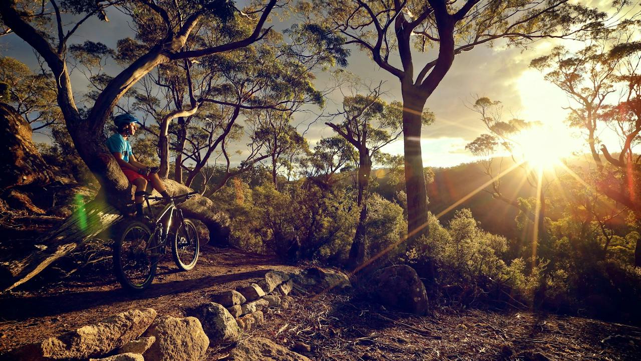
Blue Derby Mountain Bike Trails

Sports and Recreation Facilities

Blue Derby Mountain Bike Trails

Blue Derby is the crown jewel of Australian mountain biking located in the temperate rainforest of north-eastern Tasmania. The Blue Derby network encompass some of the most stunning landscapes in the state, if not the world, with an adventure to match. Once a thriving mining town, Derby now encompassed 135km of single track purpose build trails along with a pump track for the young and the young at heart. The network features trails for all abilities including Cuddles that was specifically built for the most recent Enduro World Cup, to Hazy Days, a green-rated airflow trail designed to complement Air Ya Garn. Blue Derby is littered with jump lines, long flowy and techy descents, granite rock slabs, all-day adventure trails and plenty of family friendly trails to find your "flow" with scope to cruise or just survive and thrive. Derby will take you to a euphoric place, meandering through an ancient myrtle beech forest, with seemingly every tree covered in vibrant green moss. You'll come back, they know you will, that's the Derby charm. The main trail head is located in the heart of the town and provides easy access to cafes, parking, public toilets, showers and a bike wash facility.

Derby TAS

0.5 km away

View place
Floating Sauna Logo
Image credit: Providence NDR

Natural Attractions

Floating Sauna Lake Derby

Floating Sauna Lake Derby was Australia's first floating wood-fired sauna. Located in Tasmania's world-class mountain biking town of Derby, the sauna allows visitors to re-connect with nature through the enjoyment of a traditional Finnish wood-fired sauna and cold plunge directly off the pontoon into the freshwater of Bresies Hole (otherwise known as Lake Derby). Australians are quickly discovering what Scandanavians have known for literally hundreds of years. Mountain bikers love the idea of recovering more quickly from a day's ride and being able to ride again tomorrow. It does help that the sauna has been architecturally designed and sits on one of the most naturally beautiful lakes in the area. The sauna seats up to ten people and is open to the public and bookings for private sessions.

Derby TAS

0.8 km away

View place
Tailrace Sauna and Plunge showcasing the wildflowers
Image credit: James Cashion

Spas and Retreats

Tailrace Sauna and Plunge

Tailrace Sauna offers a private wood-fired sauna and cold plunge experience near Derby in Northeast Tasmania. Set in a peaceful natural setting near the Ringarooma River, it's the perfect place to relax and recover after exploring the Blue Derby mountain bike trails. Guests can enjoy contrast therapy, nature, and a unique wellness experience designed for both recovery and relaxation. Just minutes from Derby, Tailrace Sauna is ideal for mountain bikers, travellers, and anyone looking to unwind in the Tasmanian wilderness.

Branxholm TAS

6.2 km away

View place
Legerwood Carved Memorial Trees

Parks and Gardens

Legerwood Carved Memorial Trees

Legerwood Carved Memorial Trees are trees sculpted into World War One soldiers in Dorset, Tasmania. The 25 statues depict the fallen men they were planted for in 1918. During a ceremony at the railway reserve at Ringarooma Road (renamed Legerwood in December 1918) trees were planted in honour of fallen soldiers. As the names were called out, a relative of the soldier came forward to hold the tree before planting. In 2001, a report indicated that the trees were no longer safe and the community were devastated that the memorials would be lost. By 2004, it was decided that each of the stumps would be carved into the likeness of each soldier. A chainsaw carver, Eddie Freeman of Ross, was asked by the Legerwood Hall and Reserves Committee to sculpt the masterpieces. Various scenes depicting world War One were also carved. Walk along the avenue of trees and take in the World War One history displayed. Notice the Weymouth Pine at each end of the avenue representing Gallipoli and the Anzac soldiers who fought during this time. Enjoy the picnic area and peaceful surroundings. Dorset is approximately one hours’ drive (86 kilometers/53 miles) from Launceston.

Legerwood TAS

12 km away

View place
Ralphs Falls

Natural Attractions

Ralphs Falls

Located near St Columba Falls, Ralphs Falls is a long thread of water cascading down a forested cliff face. Take the A3 highway from St Helens, then follow the C428 road from Pyengana towards St Columba Falls. The turnoff is marked shortly before the St Columba Falls State Reserve. Take the 20-minute return walk through the myrtle rainforest or the 50-minute circuit via Cashs Gorge Loop to reach the lookout for sweeping views of the falls and surrounding farmland. Easy access, unsealed road (narrow), not suitable for towing with caravans.

Ringarooma TAS

18 km away

View place
Bay of Fires Trail - St Helens Mountain Bike Trails

Sports and Recreation Facilities

Bay of Fires Trail - St Helens Mountain Bike Trails

Part of the St Helens MTB network, this is an adventure trail like no other! Starting high up on the Blue Tier in sub-alpine terrain you are instantly treated to endless vistas of the surrounding mountain ranges and stunning coastline. Before you know it you'll be ducking through majestic myrtle trees and whizzing by huge tree ferns. Giant Ash trees will tower over you before you drop in to an eye watering descent shaped in to perfect dirt. A traverse along a forestry road allows you to gather your thoughts before you are taken in to a totally new style of environment. The wide open and untouched terrain after Ansons Bay Rd is a stark contrast to where this journey began. It's hard to keep your eyes on the trail as you contour and climb through monolith granite boulders and suddenly catch glimpses of the world renowned Bay of Fires. The final descent darts across endless ridge lines before delivering you to the pure white sands of Swimcart beach.

Lottah TAS

19 km away

View place
a group stops to read a sign along the path
Image credit: Tasmania Parks and Wildlife Service

Natural Attractions

Goblin Forest Walk - Great Short Walk

Goblin Forest walk is one of Tasmania's 60 Great Short Walks. The 60 Great Short Walks offer the best of Tasmania's day walking opportunities. Twenty minute circuit - 400m. Grade 1. No bushwalking experience required. Flat even surface with no steps or steep sections. Suitable for wheelchair users who have someone to assist them. This 400m loop walk takes visitors through some beautiful rainforest. This rainforest is regenerating strongly after the ravages of tin mining. Leaving from Poimena car park, the Goblin Forest Walk is short, easy and wheelchair-friendly. This acknowledges the strong community work of a local identity, Clarence Strochnetter, who was a wheelchair user. His is one of many fascinating local stories told in some on-site interpretive panels. The track surface is compacted gravel and elevated boardwalk. There is an accessible toilet next to the carpark. The carpark is flat and gravelled, but there are no designated disabled car spaces. The wider Blue Tier area has a series of other tracks that offer a variety of experience, length, and level of challenge for both walkers and mountain bike riders. Please refer to the Parks and Wildlife Service Tasmania website for up-to-date information about this walk, alerts, closures, safe walking guidelines, leave no trace principles and National Park entry fees where applicable.

Lottah TAS

19 km away

View place
Matt Donovan

Natural Attractions

Little Blue Lake

Little Blue Lake, just metres off the B82 between Derby and Gladstone, is a natural phenomenon resulting from the pioneering mining days of South Mount Cameron and the surrounding areas of the Far North East of Tasmania. Originally a mine hole, the lake reflects a vivid aqua blue from the minerals in its base. Now popular with locals for waterskiing, swimming is, nevertheless, not recommended due to the high mineral content in the water.

South Mount Cameron TAS

22 km away

View place
St Columba Falls
Image credit: Kathryn Leahy

Natural Attractions

St Columba Falls

For those that delight in falling water, this 15 minute short track leads you to the base of one of Tasmania’s highest falls at 90 metres high. The walk is on a high-quality track through cool and shady rainforest. Located at Pyengana in the north east farmland region of Tasmania.

Pyengana TAS

22 km away

View place
Halls Falls

Natural Attractions

Halls Falls

Halls Falls is a small but beautiful waterfall in Tasmania's northeast corner. This may not possess the well-known reputation of waterfalls like Russell Falls, however, the locals will tell you this hidden gem is a must-see when in northeast Tasmania. The calm beauty, peaceful and lush forest surroundings and lack of crowds make Halls Falls a memorable attraction. Visiting Hall Falls doesn't require much of a detour if you're touring the state's northeast region. It is near to Pyengana and its famous cheese factory, the beer-drinking pig at Pub in the Paddock, as well as the popular St Columba Falls. It's also not far off the major route that runs between St Helens and Scottsdale, connecting the inland of northwest Tasmania to the east coast. The Halls Falls walking track is accessed from Anchor Road, which runs off the Tasman Highway in Pyengana (northeast Tasmania). Drive about one kilometre north on Anchor Road and lookout for a small sign.

Pyengana TAS

23 km away

View place
Welcome to Scottsdale RSL Military Museum

Galleries, Museums and Collections

Scottsdale RSL Military Museum

The Scottsdale RSL Military Museum was opened in October 2015. The museum contains an extensive display of Military memorabilia from the Boer War, World War I, World War II, Korea, Vietnam, Iraq, Afghanistan, the Middle East and current conflicts. The centerpiece is A2-295 UH-1H Iroquois helicopter synonymous with the Vietnam War. This helicopter is the only one on public display in Tasmania. Visitors are able to sit inside the helicopter. The museum is open daily from 10 am until 3 pm. Visit our website or like us on Facebook for more details. Tour groups by appointment. Opposite the museum and also of interest are Children's Reserve Memorial Park, Simpson and his Donkey, Kokoda Trail, ANZAC Walk of Honour, memorial tree carvings and children's playground, BBQs and public toilets.

Scottsdale TAS

24 km away

View place
North East Tasmania Rail Trail
Image credit: Dorset Council

Sports and Recreation Facilities

North East Tasmania Rail Trail

The North East Tasmania Rail Trail offers an easy, family-friendly ride through Tasmania's stunning north-east countryside following the path of the old railway line. Start your adventure at Scottsdale - the major regional centre of the North East. Here there are plenty of accommodation options including free camping at Northeast Park, supermarkets, a micro brewery, bakery, and numerous cafes with some great coffee and tasty local treats on offer to start your adventure. The trail officially commences at the old Scottsdale Railway Station where it heads south out of town and descends through picturesque farmland and bushland. A trail connection links 3km out of town with Northeast Park for those camping or wanting a small detour. Heading behind the old timber mill at Lings Sidling the trail crosses the Tasman Highway twice (good sight lines) before crossing over the Great Forester River at Tonganah. From Tonganah the trail heads steadily up through tall forests, tree fern lined cuttings and huge embankments across gullies to the former railway station at Tulendeena (the top of Billycock Hill). Here the trail officially ends, however, you can continue down the Snake Track into Legerwood (approximately 3.4km) to see the historical tree carvings. (Note: This road is gravel and steep in places). The trail itself is two-directional and consists of a good gravel surface, suitable for all weather riding.

Scottsdale TAS

24 km away

View place
Mathinna Falls

Natural Attractions

Mathinna Falls

Mathinna Falls, located in the Mathinna Falls Forest Reserve, approximately 10 km north of Mathinna, Tasmania, is a series of four excellent waterfalls totalling over 100 metres in height, with different difficulties to get to. The first waterfall, the easiest to access, is a short walk 15 minutes return from the carpark on an established bush trail, that guides you directly to the base of the waterfall. Mathinna Falls is a very pretty waterfall, with the waterfall pictured above having a height of approximately 25 metres. The upper tiers of Mathinna Falls are not on the main trail, nor are they easily accessed. It is possible to scramble to the second waterfall via a steep scramble to the right of the lower falls, however, getting beyond the second falls is extremely difficult and potentially dangerous. Lots of research, and extreme care is required to try and find the third and fourth waterfalls, as accessing them involves scrambling up unstable, near-vertical rock faces. Access to Mathinna Falls Forest Reserve is along a rather poor forestry gravel roads. Extra care should be taken driving along these roads, especially in wet conditions. Although the falls can be accessed by smaller vehicles, SUVs or 4WDs are desirable.

Mathinna TAS

29 km away

View place
Barnbougle Lost Farm

Sports and Recreation Facilities

Barnbougle Lost Farm

Barnbougle Lost Farm is the second of the two World Top 100 Golf Courses at the Barnbougle Golf Resort. Designed by world renown US golf architect duo Coore and Crenshaw, Lost Farm is located on the ocean dunes adjacent to the Barnbougle Dunes Course. Opened for play in December 2010, Barnbougle Lost Farm is currently rated #3 golf course in Australia and #23 in the world.

Bridport TAS

32 km away

View place
Barnbougle Dunes

Sports and Recreation Facilities

Barnbougle Dunes

Barnbougle Dunes is a links golf course with breathtaking views near Bridport, north-east Tasmania. The dramatic scenery and challenging 18-hole championship course is among the best links courses worldwide. The layout is a mix of voluptuous dunes, sandy waste and rough typical of a links course. The same blend of fescue grass extends from tee to green, and there is dramatic movement in its bumpy fairways and rolling greens. This is best exemplified by the outward nine, which plays through a series of saddles that both shelter and direct play lines. The back nine is striking with multiple panoramas of the course, adjoining the bay and the town of Bridport in the distance. Enjoy the par-71 design which does not require brute strength, but allows you to exert power to an advantage at certain points. No matter what your ability, this course lends itself well to strategy and plotting a suitable path. There is a driving range, putting green and chipping green with bunkers for you to hone your technique. At the end of the day enjoy the spectacular public clubhouse or stay in the Barnbougle cottages. Barnbougle Dunes is approximately a one-hour drive north-east of Launceston (83 km).

Bridport TAS

34 km away

View place
The Shop in the Bush

Shopping and Markets

The Shop in the Bush

The Shop in The Bush is located on the tippety top of the Great Eastern Drive (near St. Helens) on the East Coast of Tasmania. It is a family-owned business that has been in operation for 44 years and offers a wide range of high-quality Antiques, Vintage Jewelry, Collectible Books, and Tasmanian made Souvenirs. The Shop in the Bush is highly rated on Trip Advisor, Instagram, Facebook, and Google. It is frequently described as "unique and unusual" and a "must see" destination. If you are travelling down the beautiful east coast road, to or from Pyengana from St. Helens, you will find The Shop in the Bush to be a delightful and surprising shopping experience.

St Helens TAS

36 km away

View place
Ferntree Falls

Natural Attractions

Ferntree Falls

The Launceston Creek near St. Helens is home to Ferntree Falls, a waterfall with a height between 5 to 10 metres. The waterfall comes to life after a good rainfall, flowing down multiple tiers, making it a very good waterfall for photographers and waterfall enthusiasts. A short 15-minute drive from St. Helens is required to reach Ferntree Falls. Heading west, you must drive down Argonaut Road, passing the St. Helens Golf Course. The road is bitumen to begin with, but soon becomes unsealed. At this point, you will need to drive a little further before turning left down Trafalgar Track, a decent unsealed road that is not signed. Some GPS systems, including in-car systems do not have Trafalgar Track on their maps. Once on Trafalgar Track, you will need to drive between 1- 1.5 kilometres to a point the track forks. At this juncture, there will be a track with a gate leading to properties, with the other branch of the track continuing on. Park here and begin your hike. The waterfall is very close to the road but cannot be seen from it, however, it can be easily heard when the waterfall has a good flow. There isn't a developed track as such, but some pink markers tied to trees assist in guiding you through to the waterfall.

St Helens TAS

37 km away

View place
Iconic Old Pier beach at low tide

Natural Attractions

Bridport Walking Track

Bridport's walking track is a breathtaking showcase of natural foreshore, beaches, wildflowers, forest and river landscape. Walk, run, ride and ramble along the 11 kilometre circuit which takes you through ancient forests, wildflower reserves, native grasslands, tidal estuarine and river environments. You will also travel along a natural foreshore with granite rocks and many secluded beaches. The fauna and flora is rich and varied; many species of high conservation value. Along the way enjoy special places of tranquility and the significant periods of human occupation in the area. The Bridport Walking Track is a special unforgettable place of natural beauty for all to experience. Bridport is known for its numerous unspoilt beaches, breathtaking beauty and the magnificent vistas of Andersons Bay and striking mountain backdrops. The village is fully serviced and only one hour from Launceston. From Bridport you can easily discover the scenic beauty, colourful history and heritage of North East Tasmania such as the stunning patchwork of farmlands, tall rainforests and spectacular waterfalls. Nearby attractions include internationally renowned mountain bike trails, world class golf courses at Barnbougle Dunes and Lost Farm as well as Bridestowe Estate Lavender Farm.

Bridport TAS

38 km away

View place
Bridestowe Lavender Estate

Galleries, Museums and Collections

Bridestowe Lavender Estate

Bridestowe Lavender Estate is one of Tasmania's premier tourist destinations, located a 50-minute drive from Launceston in Tasmania's scenic North East. Bridestowe Lavender Estate is the largest lavender farm in the Southern Hemisphere, famous for the spectacular view of the lavender in bloom in December and January. Visitors are welcomed to the Estate all year round to see the seasons of Tasmania beautifully reflected in the ornamental gardens, manicured fields and native bushland set against the striking backdrop of Mount Arthur. The visitor centre is stocked with unique products containing Bridestowe's famous lavender oil and dried flower. An extensive range of fragrant Australian-made gifts created for the bath, body and home and, of course, the world-famous Bobbie the Bear. The Woodcroft Cafe offers a delicious range of lavender inspired delicacies including our signature range of lavender ice-creams and light seasonal meals. You can take home the experience with a purchase from Bridestowe's gourmet range, which includes seasonal lavender flower honey, artisan jams, gourmet loose leaf teas and culinary lavender, which is used in many of foods available in the cafe.

Nabowla TAS

39 km away

View place
Keeper Presentation
Image credit: Serp

Amusement and Theme Parks

Serpentarium Wildlife Park Tasmania

A world-class indoor reptile exhibit, based just out of St Helens, displaying exotic captive-bred reptiles presented in a quality museum setting. A keeper presentation and reptile interaction occur daily at midday. Outdoor cafe serving coffee, light snacks, and lunch. Accessible facilities provided. Presenting a unique hands-on visitor experience in herpetology with keeper-assisted handling. Interactive educational billboards stimulate the imagination into the mysteries of the natural world, conservation ideals, mythology, sustainability and reptile husbandry. The park features juvenile reptiles housed within extra-large feature sized enclosures to grow up into the Serpentarium family. Displaying hidden wonders of the world with natural gem displays, treasures, cultural, indigenous artefacts and custom presentations. The highlight offer of the Serpentarium is the hands-on visitor experience, provided through displaying educational billboards, offering keeper presentations and keeper-assisted handling. The Serpentarium shares a small library on the natural world and reptile husbandry, a microscope research station desk, and an outdoor rope climb play area for young adventurers. Enjoy a coffee, light snack or lunch at Rios Cafe, seated under the veranda alongside Rio, our Blue & Gold Macaw, while overlooking an open bush pasture, with accessible facilities. Located only five minutes drive from St Helens CBD. Gift sales available, offering unique jewellery, natural stone and other memorabilia.

St Helens TAS

40 km away

View place
Bay of Fires
Image credit: Tourism Tasmania

Natural Attractions

Bay of Fires

Bay of Fires is a truly special region north of St. Helens on Tasmania's north-east coast with clean white beaches, blue water and granite rocks splashed with orange lichen. It's not surprising that Lonely Planet named the Bay of Fires as one of the world's hottest travel destinations. Beach activities and bird-watching are popular in this beautiful reserve. You may even see a pod of dolphins as they cruise along parallel to the beach. The area is also known for its snorkelling and diving, with scenic reefs, corals, underwater caves and abundant sea life. The Bay of Fires Conservation Area offers beach-side camping and the elevated sites amongst the trees have amazing views of the coast and sea. There are camping grounds along a 13-kilometre section of road at the southern end of the conservation area, approached via St Helens. The bay was named by Captain Tobias Furneaux in 1773 in response to the many Aboriginal fires he saw burning on its shore.

Binalong Bay TAS

40 km away

View place
The Gardens Binalong Bay - East Coast Whale Trail
Image credit: Karen Skews

Natural Attractions

The Gardens Binalong Bay - East Coast Whale Trail

The East Coast Whale Trail is a series of coastal stops you can visit with information signs about the whales and where you have a good chance of seeing them. There are 14 trail sites scattered all along the coast from The Gardens in the larapuna/Bay of Fires area near St Helens in the north to Eaglehawk Neck on the Tasman Peninsula. At each East Coast Whale Trail site, you will find a sign with information and stories about them and big sea views to search for signs of whales. There are binoculars installed at two of the Trail sites to help you get a closer view. Whales can throw their fins and flukes, or even their bodies, high out of the water, making great explosions of foam on the sea surface that can be seen from far away. Sometimes they come within a few hundred metres of shore.

The Gardens TAS

40 km away

View place
Policemans Point

Natural Attractions

Policeman's Point to the Gardens Walk

Policeman's Point to the Gardens Walk is a long beach walk in the Bay of Fires, Tasmania. Explore this 26.2-kilometre out-and-back trail near Ansons Bay, Tasmania. Generally considered a moderately challenging route, it takes an average of 6 hours 10 minutes to complete. This trail is great for backpacking, camping, and walking, and it's unlikely you'll encounter many other people while exploring. The area is known for its white sandy beaches, blue water and granite rocks with a unique orange tinge. This walk is just a section of the long coastal walk through the area. It runs from Policeman's Point to The Gardens, both have campsites. It can be done as a point-to-point walk if drop and prick off are arranged. It can be difficult to walk the whole way when the tide is high.

Ansons Bay TAS

40 km away

View place

What is happening now?

Search dated events, markets, live music, sport and community activities.

Explore Events

Planning by place?

Use Things to Do for attractions and experiences that are not tied to one event date.