Places worth discovering

Things to Do

Find attractions, experiences and places to visit. Events remain the best way to see what is happening on a particular date.

Looking for a dated event? Explore Events

592 places

Explore local places

Cathedral Ranges Southern Circuit
Image credit: John Feeney

Natural Attractions

Cathedral Ranges Southern Circuit

The Cathedral Range – Southern Circuit hike explores the southern section of the range, taking in some fascinating features such as Wells Cave, The Canyon, Sugarloaf Peak, The Razorback, The Farmyard and South Jawbone. Rock scrambling is required on parts of the track. High fitness level is required. There is no water tap so bring plenty of water.

Taggerty VIC

3.0 km away

View place
Northern Circuit

Natural Attractions

Northern Circuit

The Northern Circuit is a 12.5km grade 5 hike in the Cathedral Ranges State Park that starts and ends at the Neds Gully Carpark, climbs steadily up rocky steps and uneven ground to Neds Saddle. The hike takes you to various vantage points for sweeping views across the Acheron Valley below and the rugged and rocky ridge line of the ranges including Little Cathedral Peak, North Cathedral Peak and Cathedral Peak. Keep a close lookout for trail markers along the track and wear proper hiking footwear and attire.

Taggerty VIC

5.3 km away

View place
Cathedral ranges State Park
Image credit: Parks Victoria

National Parks and Reserves

Cathedral Range State Park

The jagged ridges of the Cathedral Range offer spectacular views and some of the best hiking in the state. Take a gentle walk along the Friends Nature Trail or prepare to tackle the rugged and challenging Razorback Trail or circuit routes. Either way you won't forget the awesome views. Spend a night under the stars in the company of native wildlife such as kangaroos and lyrebirds. Camp by the ruins of Cooks Mill or escape the crowds at The Farmyard hike-in camping area. There's also rock climbing for beginners and experts. Practice bouldering at The Boulders or try the tricky Sugarloaf Saddle or North Jawbone. A small stand of the world's tallest flowering tree, the Mountain Ash, can be found at Sugarloaf Saddle. Some of these amazing plants approach 90 metres in height. Parks Victoria respects the deep and continuing connection that Taungurung Traditional Owners have to Cathedral Range State Park, and recognise their ongoing role in caring for Country. Conditions can change in parks for many reasons. Before your visit, please check the relevant park page on the Parks Victoria website for updated changes of conditions and familiarise yourself with important bushfire safety information to ensure your experience is safe and enjoyable. For information about fires, Fire Danger Ratings and Total Fire Bans please visit the Emergency Victoria website.

Taggerty VIC

5.3 km away

View place
South Jawbone Peak

Natural Attractions

South Jawbone Peak

South Jawbone Peak is located in the Cathedral Range State Park and can be accessed by a 3.5-kilometre grade 3 return hike from the Jawbone Car Park. Follow the Jawbone Creek Track from the car park until you reach the Farmyard where you will see the signposted South Jawbone Track. This will lead you to the peak for some sweeping views of the ridgeline and state park below. This track has some short steep sections and a few obstacles; some bushwalking experience recommended.

Taggerty VIC

7.6 km away

View place
North Jawbone Peak

Natural Attractions

North Jawbone Peak

North Jawbone Peak is located in the Cathedral Range State Park and can be accessed by 3.7-kilometre grade 3 return hike from the Jawbone Car Park. Follow the Jawbone Creek Track from the car park until you reach the North Jawbone Track which will lead you to the peak for some amazing views of the ridge-line and Sugarloaf Peak in the distance. It has some short steep sections and a few obstacles; some bushwalking experience recommended.

Taggerty VIC

7.6 km away

View place
Cathedral Ranges Northern Circuit

Natural Attractions

Cathedral Ranges Northern Circuit

The Cathedral Ranges Northern Circuit explores the northern range taking in South Jawbone Peak, North Jawbone Peak (optional side trip), the Farmyard, Little Cathedral Peak, Neds Peak and Neds Gully. Rock scrambling is required on parts of the track. High fitness level is required. Tap water is not available, so bring plenty of water.

Taggerty VIC

7.6 km away

View place
Tumbling Waters Reserve

Parks and Gardens

Tumbling Waters Reserve

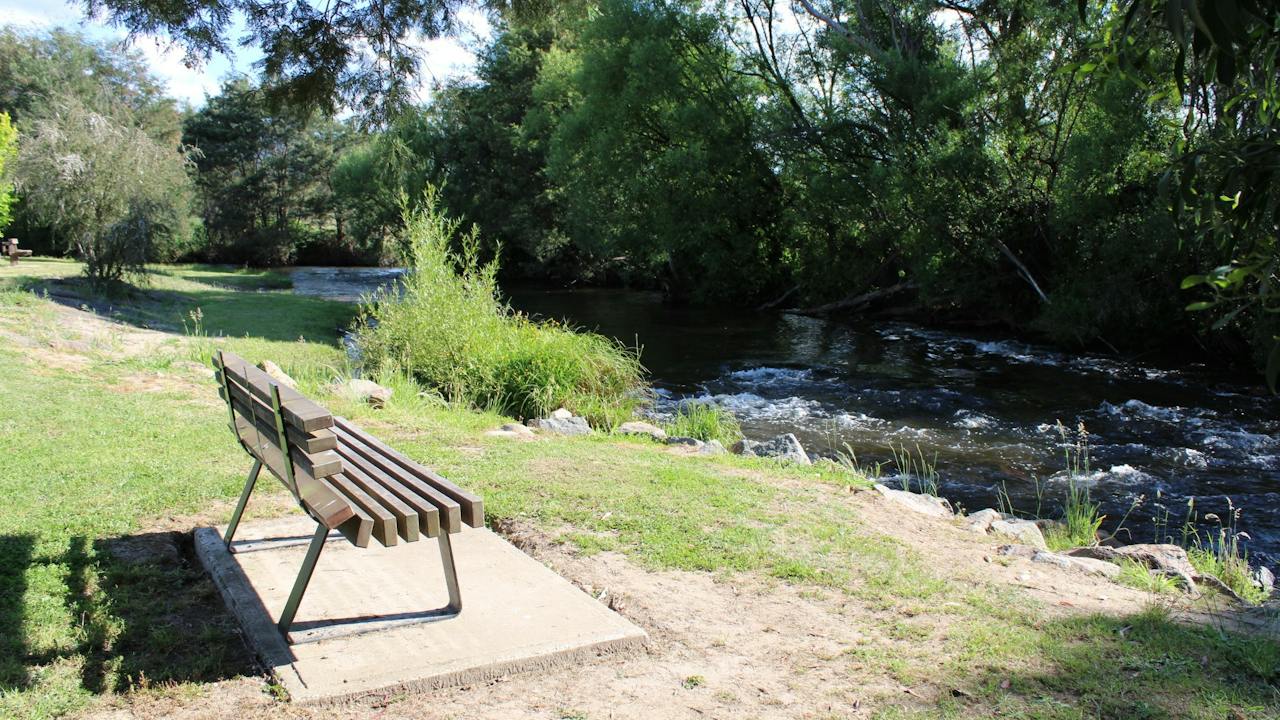
Tumbling Waters Reserve is a great spot for a picnic, has been enjoyed by locals and visitors for generations. Paddle in the shallows of the Rubicon River or play on the children's playground. Located off Taggerty - Thornton Road, next to the Rubicon River bridge, is this picturesque reserve with public toilets, a playground, unsheltered picnic tables and benches looking overlooking the Rubicon River and the Rubicon State Forest in the distance. Located to nearby Caravan Parks it is also on route to Lake Eildon if you are travelling from Melbourne.

Thornton VIC

8.9 km away

View place
Razorback Loop

Natural Attractions

Razorback Loop

This grade 5 challenging and steep track in the Cathedral Range State Park links The Farmyard to Sugarloaf Peak, crossing very exposed rocky outcrops, providing impressive views. There is limited signage along the way so look for orange markers to help you keep to the track. Beware of rapidly changing weather conditions and strong winds and wear proper hiking footwear and attire. The also connects Jawbone Carpark and Sugarloaf Saddle Carparks, both suitable places to start the loop from or park a car at both car parks for a shorter hike.

Taggerty VIC

9.1 km away

View place
Acheron Cutting Lookout

Natural Attractions

Acheron Cutting Lookout

Acheron Cutting Lookout is a roadside lookout located on the Maroondah Highway, 7.2 kilometers (six minutes drive) from Alexandra and 11 kilometers from Taggerty (eight minutes drive). The lookout has now taken its place and has become one of the district's most used scenic lookouts. The view extends over the Goulburn River and the Acheron Valley farms to the east and beyond up to the Thornton Valley towards Eildon. The view changes with the seasons and is highly photographic all year. Be sure to check out this place at sunrise for the best views over the countryside.

Acheron VIC

9.3 km away

View place
Wells Cave Track Loop

Natural Attractions

Wells Cave Track Loop

This grade 5 hike is extremely difficult and is suitable for very experienced bushwalkers only. It climbs 550 metres north from Sugarloaf Saddle Day Visitor Area to Sugarloaf Peak, the highest point on the range and is a challenging approach. The route involves short sections of free climbing, up near-vertical rock faces, which is not recommended for small children. Avoid this track if you are uncomfortable in high open and exposed places and do not attempt in wet or windy conditions. Carrying backpacks is not recommended, as the track involves squeezing through the very narrow passage of Wells Cave and is recommended as an ascent route only. Descend via the steep rock face of the 650m Canyon Track.

Taggerty VIC

11 km away

View place
Buxton Mountain Bike Park

Natural Attractions

Buxton Mountain Bike Park

Buxton Mountain Bike Park is situated within the Black Range State Forest with around 20 kilometres of purpose built mountain bike single track fills the park. Trails can be ridden in a number of different length loops, but are only ridden in one direction. Gentle climbs and fast flowing descents characterise the trails of the Buxton Mountain Bike Park. When ridden carefully, many of the trails are suitable for all riders, but when ridden faster the trails can provide a challenge.

Buxton VIC

11 km away

View place
Buxton Recreation Reserve

Parks and Gardens

Buxton Recreation Reserve

Buxton Recreation Reserve is located on the corner of Mareeba Avenue and Maroondah Highway, right at the entrance of the Buxton township. The reserve has a range of activities for the little ones, including Bikemania, an area for young BMX riders which includes a range of fun and exciting obstacles, as well as a shaded playground equipped with swings, mini rock climbing wall, slide and more. There is also a fantastic exercise station for those looking to fit in a quick workout, as well as a large sheltered area to relax, with a barbecue's, picnic tables and large grassed space with seating that overlooks the river.

Buxton VIC

12 km away

View place
Lucky Mine Lookout

Natural Attractions

Lucky Mine Lookout

Lucky Mine Lookout, named after one of the most successful early gold mines, which was located just below the top of the hill, overlooks the township of Alexandra and the valley it lies in. Located off Webster Street and up a gravel road within the Alexandra Bushland Reserve, this amazing lookout helps you to appreciate how nice this part of the Victorian countryside is. It is especially beautiful during vibrant sunrises and sunsets and offers an excellent star gazing location.

Alexandra VIC

13 km away

View place
Rubicon Falls Walk

Natural Attractions

Rubicon Falls Walk

Located in the stunning Rubicon Valley Historic Area, 2.5 hours drive north east of Melbourne, the Rubicon Falls walk starts at the Rubicon Hydro Power Station. On the right of the power station, follow the Rubicon River Road (service access track only) for approximately 3.7 kilometre upwards through the steep sided valley which follows the river and passes Rubicon Falls Power Station on your right. The 40 metre high Rubicon Falls comes into view as you climb higher up the road and viewing is restricted to the elevated roadside due to the harsh inaccessible terrain. Nevertheless it's definitely worth the hike. You can continue up the road even further to Rubicon Falls Dam or combine it into a longer walk and do the circuit to Royston Power Station and the 15,000 ft Siphon Bridge.

Rubicon VIC

13 km away

View place
McKenzie Flora Reserve

Historical Sites and Heritage Locations

McKenzie Flora Reserve

McKenzie Flora Reserve covers 47 hectares and was originally set aside to provide timber for gold mines and as you walk the three walking tracks which link to form short circuits of almost two kilometres each you will pass several excavations and other evidence of past mining activity. Located on the south side of the Alexandra township, it spans out over the hills and valleys, creating a place to walk and enjoy the country atmosphere. Mckenzie Reserve is well known for its wildflowers in spring. Rest and enjoy the bush sounds where flora and fauna abound, making this a popular site for bird and nature lovers. McKenzie Flora Reserve borders Mount Pleasant Reserve where you will find McKenzie Lookout and the Alexandra Bushland Reserve where you will find Lucky Mine Lookout.

Alexandra VIC

13 km away

View place
Rotary Park

Parks and Gardens

Rotary Park

Rotary Park is a beautiful recreation reserve, situated right at the entrance of the Alexandra township, on the corner of Grant Street and Vickery Street. A popular spot to park your car and explore the town further. Enjoy a peaceful stroll across the swing bridge and along the creekside, which will take you across to a well-equipped playground for the kids to enjoy. Park facilities also include an undercover barbecue and eating area, picnic tables, toilets and lots of space to relax enjoy the natural surrounds. The park is picturesque all year round, particularly in Autumn when the surrounding trees begin changing colour for the season. Also situated within the park is the busy Alexandra Information centre, where you can pop in to plan your next stop.

Alexandra VIC

15 km away

View place
Leckie Park

Parks and Gardens

Leckie Park

Leckie Park is located on Vickery Street, in the picturesque township of Alexandra. Enjoy a leisurely stroll on one of the well-formed walking tracks which will take you through to the well-equipped children's play area, local sports oval, barbecue facilities, toilets, picnic tables and undercover rotunda. One of the walking tracks starting from Leckie Park will lead you across the footbridge and through to the beautiful and well manicured Jack Shiel Gardens, where you can enjoy a picnic by the river or under the shade of one of the nearby oak trees.

Alexandra VIC

15 km away

View place
Alexandra Outdoor Swimming Pool

Sports and Recreation Facilities

Alexandra Outdoor Swimming Pool

With three pools to choose from at the Alexandra Outdoor Swimming Pool, you are bound to find the perfect spot to relax, exercise or simply cool off on a warm day. The main pool is 25 metres long and six lanes wide with a maximum depth of 2.2 metres. Entry is by steps and ladders. The second pool has a beach entry and a depth of 0.9 metres. It's a great place for those learning to swim or building their confidence in the water. A third, semi-circular toddler pool, with water features and protected by shade sails, offers the perfect spot to help the smallest members of the family cool off. The facility also offers all access change rooms with full amenities, shade sails, tables and seating and there's plenty of grass to spread out for the day.

Alexandra VIC

15 km away

View place
Victorian Truck Drivers Memorial
Image credit: Caolan O'Connor

Landmarks and Buildings

Victorian Truck Drivers Memorial

The trucking industry plays an important role in the day to day lives of everyone in the community, from freight transport, mining, waste collection and emergency services, without trucks and most importantly the drivers, society would not function as it does. The Memorial is an initiative of the Creative Ministries Network, and the collaboration of a devoted group of women whose family members were heavily involved in the trucking industry. The Victorian Truck Drivers Memorial is dedicated to truck drivers who have lost their lives while working, and those who have worked as truck drivers and passed away. Go along and pay your respects to these dedicated men and women. The annual Memorial Service is conducted on the Saturday of the long weekend in June each year.

Alexandra VIC

15 km away

View place
Rubicon Historic Area

Natural Attractions

Rubicon Heritage and Dam Walk

The Rubicon Heritage Walk is a spectacular 3.9 kilometre loop walk, a 2 hour drive north-east of Melbourne. It winds through lush Mountain Ash - the tallest flowering tree in the world - and down into cool temperate rainforests of ancient myrtle beech trees. The Rubicon Valley Historic and Cultural Features Reserve was set aside to protect the area's historic sites and values. Timber harvesting used to be the major industry of the region, beginning in the early 1900s. There were eight sawmills operating in the forest in the first half of the century. Highlights along the way include crossing an impressive timber trestle bridge, a look inside a small heritage-listed sawmill and walking along the aqueduct that feeds the Royston Power Station. You can extend the walk by continuing on past the power station to the Rubicon Dam, creating a 11.6 kilometre return walk. The track through the forest here follows the aqueduct and is wide and relatively flat. You'll pass smaller wooden trestle bridges before arriving at the dam wall. Enjoy a picnic at the picnic shelter at the dam and take photos of the cascading water and peaceful dam below. Return back along the same track to rejoin the heritage loop track at the power station.

Rubicon VIC

15 km away

View place
Snobs Banyarmbite Falls (Snobs Creek Falls)

Natural Attractions

Snobs Banyarmbite Falls (Snobs Creek Falls)

Located in the foothills of the Rubicon State Forest, approximately two and a half hours north east of Melbourne, Snobs Banyarmbite Falls, also known as Snobs Creek Falls, is a striking tiered waterfall with a total drop of around 100 metres. Its pristine waters are an important supply to the Snobs Creek Fish Hatchery 6 kilometres below. From the carpark, take the winding 150-metre stepped path as it descends under the large blanket of trees, down to the 2 viewing platforms, which offer wonderful opportunities to take photos of the impressive, tiered waterfall rushing and tumbling down over the large boulders. Please note there is no public toilet at this site.

Eildon VIC

16 km away

View place
Wilhelmina Falls

Natural Attractions

Wilhelmina Falls

If you're looking for a challenging trek with a stunning waterfall, put Wilhelmina Falls Walk on your must-do list. It in the Murrindindi Scenic Reserve at the northern end of the Toolangi State Forest, two hours drive north east of Melbourne. The falls can be reached via a 3.15 kilometre walk, 6.3 kilometre return. The Wilhelmina track begins at Water Gauge Camp and heads over the suspension bridge along the Murrindindi River Walk. Here the track climbs over rocky steps to the base of Wilhelmina Falls. Stop to take in the view and enjoy a well-earned rest. Then continue up the metal stairs over and between the granite boulders to the lookout at the top of the falls. The lookout has spectacular views of the surrounding mountain range including Mt Despair. You'll need a good level of fitness for this grade 4 walk, which features a long, slow incline with short steep sections.

Murrindindi VIC

17 km away

View place
Skyline Road Lookout

Natural Attractions

Skyline Road Lookout

Skyline Road is a great ride and drive where you can grab glimpses of the lake as you follow the route, culminating in an incredible panorama not far from the junction with UT Creek Road. With a spot where you can get out of the car or dismount your bike, Skyline Road Lookout is the perfect spot to take in the stunning surrounds of Lake Eildon National Park. From Eildon loop out of town and over the dam wall before heading for Skyline Drive via Skyline Road. The roadside lookout is located on the right side of the road about 7.6km along Skyline Road from Eildon. The lookout area is marked by a sharp bend in the road that is signed by yellow arrows. You can drive in here and park your car off the road. Continue your drive along Skyline Road for stunning views across Lake Eildon and the rolling hills of Lake Eildon National Park.

Taylor Bay VIC

17 km away

View place
Eglinton Cutting Lookout

Natural Attractions

Eglinton Cutting Lookout

Eglinton Cutting Lookout is located on the Great Victorian Rail Trail, a 134 kilometre bike trail that stretches from Tallarook to Mansfield. The 13-kilometre Alexandra branch includes the moderate climb of Eglinton Cutting; however, it is not too difficult, and riders are well rewarded with sweeping views of the Cathedral Range. The lookout has a small shelter and picnic table so you can sit and enjoy the stunning views of the countryside. If you are not riding, this lookout can be accessed by car off Maroondah Highway near the township of Alexandra at Eglinton Cutting. You can park your car at the side of the road here but be aware of oncoming traffic as it is a busy road. Walk the gravel rail trail through a corridor between the hill to the Eglinton Cutting Lookout.

Alexandra VIC

17 km away

View place

What is happening now?

Search dated events, markets, live music, sport and community activities.

Explore Events

Planning by place?

Use Things to Do for attractions and experiences that are not tied to one event date.