Places worth discovering

Things to Do

Find attractions, experiences and places to visit. Events remain the best way to see what is happening on a particular date.

Looking for a dated event? Explore Events

592 places

Explore local places

Rotary Park

Parks and Gardens

Rotary Park

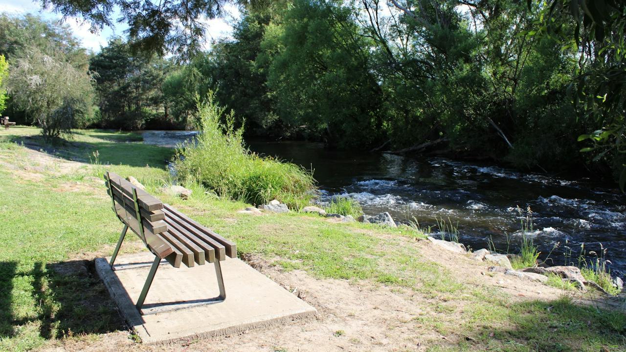
Rotary Park is a beautiful recreation reserve, situated right at the entrance of the Alexandra township, on the corner of Grant Street and Vickery Street. A popular spot to park your car and explore the town further. Enjoy a peaceful stroll across the swing bridge and along the creekside, which will take you across to a well-equipped playground for the kids to enjoy. Park facilities also include an undercover barbecue and eating area, picnic tables, toilets and lots of space to relax enjoy the natural surrounds. The park is picturesque all year round, particularly in Autumn when the surrounding trees begin changing colour for the season. Also situated within the park is the busy Alexandra Information centre, where you can pop in to plan your next stop.

Alexandra VIC

0.0 km away

View place
Victorian Truck Drivers Memorial
Image credit: Caolan O'Connor

Landmarks and Buildings

Victorian Truck Drivers Memorial

The trucking industry plays an important role in the day to day lives of everyone in the community, from freight transport, mining, waste collection and emergency services, without trucks and most importantly the drivers, society would not function as it does. The Memorial is an initiative of the Creative Ministries Network, and the collaboration of a devoted group of women whose family members were heavily involved in the trucking industry. The Victorian Truck Drivers Memorial is dedicated to truck drivers who have lost their lives while working, and those who have worked as truck drivers and passed away. Go along and pay your respects to these dedicated men and women. The annual Memorial Service is conducted on the Saturday of the long weekend in June each year.

Alexandra VIC

0.2 km away

View place
Leckie Park

Parks and Gardens

Leckie Park

Leckie Park is located on Vickery Street, in the picturesque township of Alexandra. Enjoy a leisurely stroll on one of the well-formed walking tracks which will take you through to the well-equipped children's play area, local sports oval, barbecue facilities, toilets, picnic tables and undercover rotunda. One of the walking tracks starting from Leckie Park will lead you across the footbridge and through to the beautiful and well manicured Jack Shiel Gardens, where you can enjoy a picnic by the river or under the shade of one of the nearby oak trees.

Alexandra VIC

0.3 km away

View place
Alexandra Outdoor Swimming Pool

Sports and Recreation Facilities

Alexandra Outdoor Swimming Pool

With three pools to choose from at the Alexandra Outdoor Swimming Pool, you are bound to find the perfect spot to relax, exercise or simply cool off on a warm day. The main pool is 25 metres long and six lanes wide with a maximum depth of 2.2 metres. Entry is by steps and ladders. The second pool has a beach entry and a depth of 0.9 metres. It's a great place for those learning to swim or building their confidence in the water. A third, semi-circular toddler pool, with water features and protected by shade sails, offers the perfect spot to help the smallest members of the family cool off. The facility also offers all access change rooms with full amenities, shade sails, tables and seating and there's plenty of grass to spread out for the day.

Alexandra VIC

0.5 km away

View place
McKenzie Flora Reserve

Historical Sites and Heritage Locations

McKenzie Flora Reserve

McKenzie Flora Reserve covers 47 hectares and was originally set aside to provide timber for gold mines and as you walk the three walking tracks which link to form short circuits of almost two kilometres each you will pass several excavations and other evidence of past mining activity. Located on the south side of the Alexandra township, it spans out over the hills and valleys, creating a place to walk and enjoy the country atmosphere. Mckenzie Reserve is well known for its wildflowers in spring. Rest and enjoy the bush sounds where flora and fauna abound, making this a popular site for bird and nature lovers. McKenzie Flora Reserve borders Mount Pleasant Reserve where you will find McKenzie Lookout and the Alexandra Bushland Reserve where you will find Lucky Mine Lookout.

Alexandra VIC

1.6 km away

View place
Lucky Mine Lookout

Natural Attractions

Lucky Mine Lookout

Lucky Mine Lookout, named after one of the most successful early gold mines, which was located just below the top of the hill, overlooks the township of Alexandra and the valley it lies in. Located off Webster Street and up a gravel road within the Alexandra Bushland Reserve, this amazing lookout helps you to appreciate how nice this part of the Victorian countryside is. It is especially beautiful during vibrant sunrises and sunsets and offers an excellent star gazing location.

Alexandra VIC

1.9 km away

View place
Eglinton Cutting Lookout

Natural Attractions

Eglinton Cutting Lookout

Eglinton Cutting Lookout is located on the Great Victorian Rail Trail, a 134 kilometre bike trail that stretches from Tallarook to Mansfield. The 13-kilometre Alexandra branch includes the moderate climb of Eglinton Cutting; however, it is not too difficult, and riders are well rewarded with sweeping views of the Cathedral Range. The lookout has a small shelter and picnic table so you can sit and enjoy the stunning views of the countryside. If you are not riding, this lookout can be accessed by car off Maroondah Highway near the township of Alexandra at Eglinton Cutting. You can park your car at the side of the road here but be aware of oncoming traffic as it is a busy road. Walk the gravel rail trail through a corridor between the hill to the Eglinton Cutting Lookout.

Alexandra VIC

3.6 km away

View place
Acheron Cutting Lookout

Natural Attractions

Acheron Cutting Lookout

Acheron Cutting Lookout is a roadside lookout located on the Maroondah Highway, 7.2 kilometers (six minutes drive) from Alexandra and 11 kilometers from Taggerty (eight minutes drive). The lookout has now taken its place and has become one of the district's most used scenic lookouts. The view extends over the Goulburn River and the Acheron Valley farms to the east and beyond up to the Thornton Valley towards Eildon. The view changes with the seasons and is highly photographic all year. Be sure to check out this place at sunrise for the best views over the countryside.

Acheron VIC

6.0 km away

View place
Perfect Cure Creek Nature Trail

Natural Attractions

Perfect Cure Creek Nature Trail

Located in the Fraser Block of Lake Eildon National Park is the Perfect Cure Creek Nature Walk, named after early settler John Merlo who found a gold nugget in the creek - for him it was a perfect cure. A casual and relaxing scenic stroll through open woodland that highlights the remnants of earlier mining days, gold rush history and local wildlife in 18 interpretive signs along the way. The 1.5 kilometres Grade 2 circuit starts from the Perfect Cure carpark and takes about one hour. Birds and animals are often visible, especially during the early morning and late afternoons. Keep an eye out for grazing kangaroos and wallabies.

Devils River VIC

12 km away

View place
Candlebark Gully Nature Trail

Natural Attractions

Candlebark Gully Nature Trail

Located in the Fraser Block of Lake Eildon National Park is the Candlebark Gully Nature Trail, an easy two kilometres Grade 3 circuit walk through candlebark forest. Spot kangaroos, wallabies, echidnas and the remnants of a once thriving gold mining industry. Learn about Lake Eildon's history and ecology through the 16 of the 20 interpretative signs that are still in place and enjoy a casual and relaxing circuit walk through beautiful Victorian bush.

Devils River VIC

12 km away

View place
Blowhard Spur Circuit

Natural Attractions

Blowhard Spur Circuit

This grade three circuit walk starts from Perfect Cure Creek car park at the start of Kegs Spur Track, ascending to High Camp, then along the picturesque Blowhard Spur Track to Blowhard Summit before heading down Merlo Lookout Track to Merlo Lookout and back to the car park. Another popular way to walk this track is to start at Devil's Cove Campground, adding in the Wallaby Bay track and Keg Spur track. This turns the walk into a 12 kilometres circuit that will take you about four hours to complete. The track starts and ends at Devil's Cove Campground, running through blowhard summit and along the edge of Lake Eildon. The Blowhard Summit provides amazing views of Lake Eildon, Cathedral Range, Mt Torbreck, Mt Buller and The Bluff.

Devils River VIC

12 km away

View place
Skyline Road Lookout

Natural Attractions

Skyline Road Lookout

Skyline Road is a great ride and drive where you can grab glimpses of the lake as you follow the route, culminating in an incredible panorama not far from the junction with UT Creek Road. With a spot where you can get out of the car or dismount your bike, Skyline Road Lookout is the perfect spot to take in the stunning surrounds of Lake Eildon National Park. From Eildon loop out of town and over the dam wall before heading for Skyline Drive via Skyline Road. The roadside lookout is located on the right side of the road about 7.6km along Skyline Road from Eildon. The lookout area is marked by a sharp bend in the road that is signed by yellow arrows. You can drive in here and park your car off the road. Continue your drive along Skyline Road for stunning views across Lake Eildon and the rolling hills of Lake Eildon National Park.

Taylor Bay VIC

12 km away

View place
Dindi Naturals

Galleries, Museums and Collections

Dindi Naturals

Dindi Naturals luxurious skincare and body products harness the power of rare native botanicals, Australian plant oils and pure essential oils to soothe, nourish and revitalise the skin. Their products are produced by hand by a small team at their solar powered eco-factory. The products are proudly palm oil free, cruelty-free and gentle on both the earth and you. The luxurious skincare and body products are carefully blended in our solar-powered boutique factory located in Yarck in Victoria's High Country. You will find Dindi Naturals Flagship Store on the Maroondah Hwy in the town's main street, so if you are heading towards Mansfield, Lake Eildon or Mt Buller be sure to stop in. Stop by Dindi Naturals to explore their range of skincare, soaps, essential oils, gifts and more, and enjoy a relaxing coffee fix at the Dindi Store which is accessible directly from the Great Victorian Rail Trail. There's plenty of parking for cars or push bikes. Open 7 days.

Yarck VIC

13 km away

View place
Tumbling Waters Reserve

Parks and Gardens

Tumbling Waters Reserve

Tumbling Waters Reserve is a great spot for a picnic, has been enjoyed by locals and visitors for generations. Paddle in the shallows of the Rubicon River or play on the children's playground. Located off Taggerty - Thornton Road, next to the Rubicon River bridge, is this picturesque reserve with public toilets, a playground, unsheltered picnic tables and benches looking overlooking the Rubicon River and the Rubicon State Forest in the distance. Located to nearby Caravan Parks it is also on route to Lake Eildon if you are travelling from Melbourne.

Thornton VIC

13 km away

View place
Estate Spur Circuit

National Parks and Reserves

Estate Spur Circuit

The Estate Spur Circuit is a grade three hike (5.6km circuit) in Lake Eildon National Park. The circuit begins from the Parks Office along Lakeside Road where there is a trailhead for 'Estate Spur Track' directing to Point Mibus and Bedrock Creek. The track climbs steeply to the top of the hill, turning east (left) onto Estate Spur, the track is open and undulating, offering expansive views of the lake before the steep descent down to Lakeside camping ground. Once here follow the track along Lakeside Road for a gentle stroll back to the car. For a slightly longer walk, at the top of the Estate Spur turn west (right) and south (left) down the well-shaded track which descends to 'Bedrock Creek' as per the sign, and follow the Bolte Bay Track to Point Mibus. Return along the lakeshore to Point Mead and the Lakeside Camping Area.

Devils River VIC

13 km away

View place
Cathedral Ranges Southern Circuit
Image credit: John Feeney

Natural Attractions

Cathedral Ranges Southern Circuit

The Cathedral Range – Southern Circuit hike explores the southern section of the range, taking in some fascinating features such as Wells Cave, The Canyon, Sugarloaf Peak, The Razorback, The Farmyard and South Jawbone. Rock scrambling is required on parts of the track. High fitness level is required. There is no water tap so bring plenty of water.

Taggerty VIC

16 km away

View place
Family walking dog at Eildon Pondage

Natural Attractions

Eildon Pondage Walk

The Eildon Pondage Walk around the lower pondage is flat and easy to navigate. It's a perfect walk for beginner hikers or those with little ones in tow. It is also a popular cycling loop. The six kilometre circuit starts from Eildon Lions Park and takes about an hour to complete, but you can jump onto the trail from almost any of the pondage visitor areas along the waterfront. On your circuit you'll find plenty of Instagram worthy shots, passing two picturesque jetties and crossing over the Goulburn Valley Highway Bridge which overlooks the Eildon Dam Wall in the distance.

Eildon VIC

18 km away

View place
Splash Park

Parks and Gardens

Baanh ba Djila Splash Park

Walter Moore Reserve in Eildon is a vibrant community space packed with fun and recreation for all ages. The park features a skate park, a flying fox, a swing set and a senior play space, making it a hotspot for outdoor activities. Families can enjoy the adventure playground and Baanh ba Djila splash park, which means Water and Play in the Taungurung language, while the Barbeque facilities and picnic areas provide the perfect setting for a leisurely day out. The reserve also includes upgraded toilet and change facilities, ensuring comfort for visitors and access for all abilities. It's a fantastic spot to unwind, play, and connect with nature in the heart of Murrindindi Shire. The Eildon Swimming Pool is also located within the reserve.

Eildon VIC

18 km away

View place
Eildon Outdoor Swimming Pool

Sports and Recreation Facilities

Eildon Outdoor Swimming Pool

Centrally located in the town, the Eildon Outdoor Swimming Pool offers a main pool which is 33 metres long and eight lanes wide, accessible by step or ladder. The depth of the pool ranges from 1.4m to 3.6m. The adjacent toddler pool with imitation rock sides, and fun water features provides plenty of opportunity for water play. This pool is 0.2 to 0.9m deep with step access. Plenty of shade, and lots of tables, seating and a grassy area provides a wonderful place for visitors to relax and enjoy the visit. The facility offers all access change rooms, with cold water showers.

Eildon VIC

18 km away

View place
Cheviot Tunnel

Historical Sites and Heritage Locations

Cheviot Tunnel

The historic Cheviot Tunnel is a key feature of the Tallarook to Mansfield Rail Line which operated between 1883 and 1970 and now the Great Victorian Rail Trail open to walkers, cyclists and horse riding enthusiasts. The Great Victorian Rail Trail meanders through undulating farmland along the majestic gum lined Goulburn River with stunning views into the foothills of the Victorian High Country. Being the only tunnel on this line, and made using handmade bricks using local clay, which remain in excellent condition today it has tremendous heritage values. The Cheviot Tunnel was constructed to pass trains across the Black Range at McLoughlin's Gap roughly half way between Yea and Molesworth. The tunnel was constructed from an estimated 675,000 handmade bricks using local clay. This was sourced from Quinlan's pit in a nearby paddock just west of the Tunnel. Some steel hooks that held lanterns in emergencies still exist near the four indented safety alcoves. These are located at regular intervals along the eastern wall. The Cheviot Tunnel is situated between the towns of Yea and Molesworth on the Great Victorian Rail Trail.

Yea VIC

19 km away

View place
Lake Eildon National Park

National Parks and Reserves

Lake Eildon National Park

Camp by Lake Eildon and enjoy a whole world of watersports in a spectacular setting. Go swimming, canoeing, waterskiing, sailing, boating and fishing in the shadow of the Victorian Alps. Enjoy bushwalking or cycling along a network of trails. You'll share the picture-perfect surroundings with kangaroos, wombats and a huge variety of beautiful birds. The park is also an important home for a number of significant species including large forest owls, bats and the endangered Spotted Tree-frog and Brush-tailed Phascogale. Take a day trip to Lake Eildon or stay overnight at one of the picturesque campgrounds. Choose from the well-equipped Devils Cove, Candlebark and Lakeside Campgrounds or the more basic Mountaineer, O'Toole Flat, Coopers Point, Taylors Creek or Jerusalem Creek Campground. Take a walk and stop at Merlo Lookout or trek up to Blowhard Summit for unrivalled views over Lake Eildon and out towards Mount Buller or you could stay on a houseboat for a more sedate holiday. You can also visit the Stones Outstation Heritage Hut, which is located just 100 metres above the high water mark in Stones Bay. Follow Parks Vic water safety advice to make sure your day out at Lake Eildon National Park is a safe and enjoyable one. Before undertaking water activities or visiting any park, check for: Parks Victoria's safety, and be bushfire ready, it is your responsibility

Eildon VIC

19 km away

View place
Cathedral ranges State Park
Image credit: Parks Victoria

National Parks and Reserves

Cathedral Range State Park

The jagged ridges of the Cathedral Range offer spectacular views and some of the best hiking in the state. Take a gentle walk along the Friends Nature Trail or prepare to tackle the rugged and challenging Razorback Trail or circuit routes. Either way you won't forget the awesome views. Spend a night under the stars in the company of native wildlife such as kangaroos and lyrebirds. Camp by the ruins of Cooks Mill or escape the crowds at The Farmyard hike-in camping area. There's also rock climbing for beginners and experts. Practice bouldering at The Boulders or try the tricky Sugarloaf Saddle or North Jawbone. A small stand of the world's tallest flowering tree, the Mountain Ash, can be found at Sugarloaf Saddle. Some of these amazing plants approach 90 metres in height. Parks Victoria respects the deep and continuing connection that Taungurung Traditional Owners have to Cathedral Range State Park, and recognise their ongoing role in caring for Country. Conditions can change in parks for many reasons. Before your visit, please check the relevant park page on the Parks Victoria website for updated changes of conditions and familiarise yourself with important bushfire safety information to ensure your experience is safe and enjoyable. For information about fires, Fire Danger Ratings and Total Fire Bans please visit the Emergency Victoria website.

Taggerty VIC

19 km away

View place
Northern Circuit

Natural Attractions

Northern Circuit

The Northern Circuit is a 12.5km grade 5 hike in the Cathedral Ranges State Park that starts and ends at the Neds Gully Carpark, climbs steadily up rocky steps and uneven ground to Neds Saddle. The hike takes you to various vantage points for sweeping views across the Acheron Valley below and the rugged and rocky ridge line of the ranges including Little Cathedral Peak, North Cathedral Peak and Cathedral Peak. Keep a close lookout for trail markers along the track and wear proper hiking footwear and attire.

Taggerty VIC

19 km away

View place
Rubicon Falls Walk

Natural Attractions

Rubicon Falls Walk

Located in the stunning Rubicon Valley Historic Area, 2.5 hours drive north east of Melbourne, the Rubicon Falls walk starts at the Rubicon Hydro Power Station. On the right of the power station, follow the Rubicon River Road (service access track only) for approximately 3.7 kilometre upwards through the steep sided valley which follows the river and passes Rubicon Falls Power Station on your right. The 40 metre high Rubicon Falls comes into view as you climb higher up the road and viewing is restricted to the elevated roadside due to the harsh inaccessible terrain. Nevertheless it's definitely worth the hike. You can continue up the road even further to Rubicon Falls Dam or combine it into a longer walk and do the circuit to Royston Power Station and the 15,000 ft Siphon Bridge.

Rubicon VIC

20 km away

View place

What is happening now?

Search dated events, markets, live music, sport and community activities.

Explore Events

Planning by place?

Use Things to Do for attractions and experiences that are not tied to one event date.