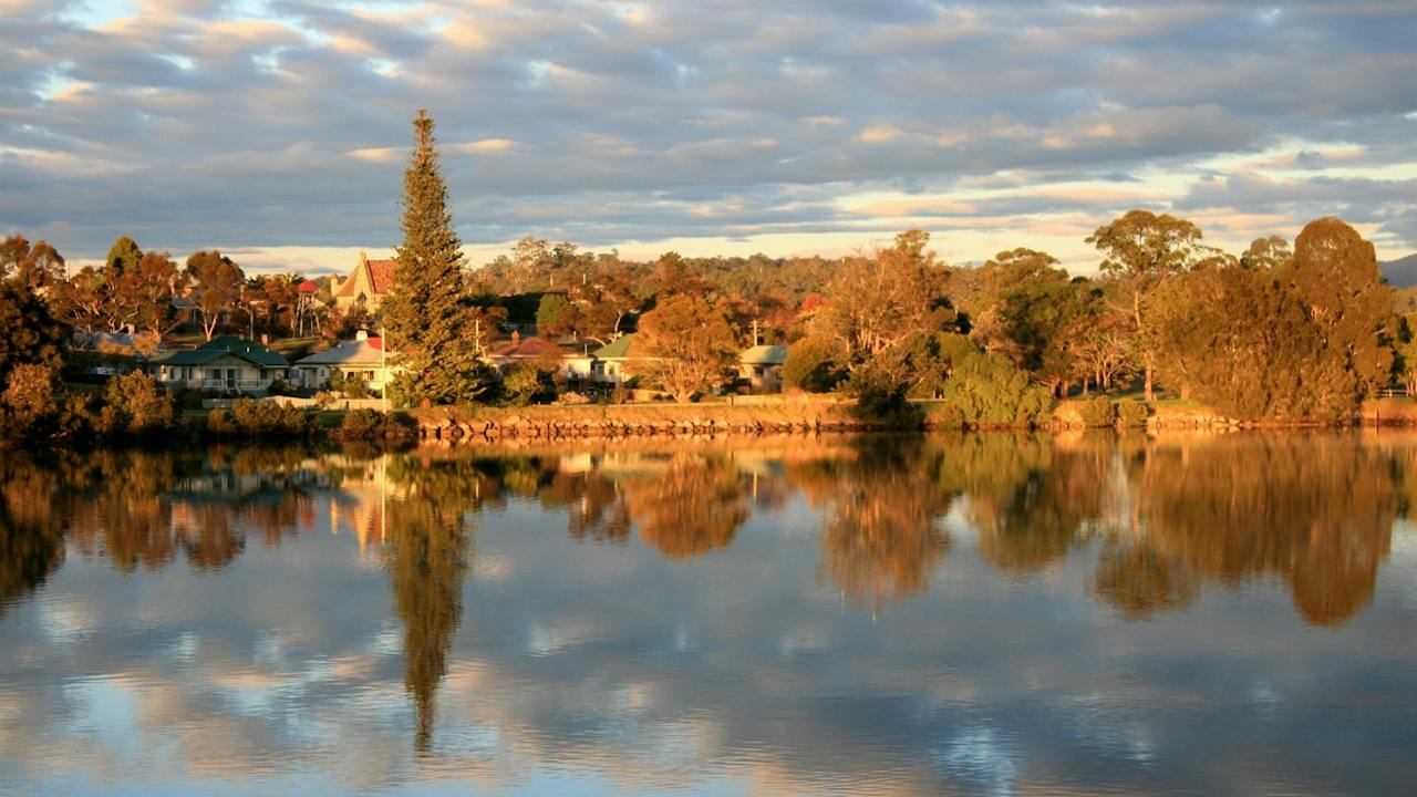
Paddle 12 kilometres west of Moruya up to the bridge on Araluen Road by launching from the Moruya town boat ramp on the east side of Moruya Bridge.
The river winds through farming land and forest. Above the Araluen Road the course may become shallow. A short side trip up Womban Creek at high tide is interesting.
Further up, the main river changes its name to the Deua River and winds through the Deua River Valley. Access to the upper reaches of the river is dependent on water level and there are many obstructions, so checking maps and conditions is recommended.
The Moruya Cycleway is a stunning ride that winds its way along the Moruya River. Starting at the water gardens in Moruya town, you can ride along the shared pathway to Riverside Park. If you're out on Saturday morning, be sure to stop and enjoy the Moruya Country Markets with a great reputation for local arts and crafts, fresh produce and bric-a-brac.
Follow the cycleway to Preddey's wharf. Here you can stop for a spot of fishing or merely watch the locals cast their line. Continue onto Moruya Heads and amazing Dolphin Beach where you can stop for a swim or surf with locals and if you're really lucky, you may find yourself surfing with the local dolphins. The return journey is the same, but if you want to enjoy a cool lager then divert into Vulcan Street and stop at one of the quaint country pubs in town.
The Moruya Museum houses a collection of furniture, books, artefacts and memorabilia, intended to show visitors the lives of ordinary people living in the district from the middle of the 1800s. Most items on display were donated by local families, resulting in an eclectic mix of considerable charm and interest.
Curated and managed by the Moruya and District Historical Society Inc., the museum collection is displayed in The Emmott House
Abraham Emmott, a migrant from Yorkshire, reached Moruya in 1859 and set up a general store on Vulcan Street, and the name of Emmotts held good for over a century. In 1875, Abraham built a pair of semi-detached houses, using a standard North of England design. The bricks were made locally and now show their age and the lack of firing in their making. Abraham's house is now home to the Moruya Museum and the genealogy research room and library.
Moruya Heritage Area on the Eurobodalla South Coast is best known for its granite, which has been quarried since the mid-1800s and was used to build the pylons of the iconic Sydney Harbour Bridge. Between 1925 and 1932, more than 250 stonemasons from 13 countries, employed by Dorman, Long and Company, supplied, cut and dressed the granite slabs.
A flood in the early 1840s scoured the sandbar and opened the Moruya River to shipping, and the government abandoned Broulee in favour of Moruya, gazetted as a village in 1851. The river's deep channels shifted often and vessels regularly grounded, so a pilot was stationed at Moruya South Head from 1860. Moruya became an important port for the Araluen goldfields and the district's producers, and grew into a regional and administrative centre.
Today, visit the Moruya Museum to see the State Heritage-listed Abernethy and Co stonemason's lathe, then follow the Historic Town Walk past Moruya's delightful historic buildings.
Drive to Moruya Heads (Toragy Point), where the former Pilot Station (1861-1953), now a private residence, stands nearby, or walk the beautiful 14-kilometre Bingi Dreaming Track from Congo to Coila Lake, linking camp and ceremonial sites, water and food sources
Moruya Bowling and Recreational Club pride themselves on being the friendliest club on the coast. 'A small club, but big on value', they strive to provide the best customer service in the area.
The Shore Street Dining offers you a very clever blend of bistro favourites and stunning, contemporary Australian Cuisine for a great dining experience.
Stay for a game of bare foot bowls, trivia, or take advantage of the many other facilities at the club.
The Basil Sellers Exhibition Centre, known as The Bas, is Eurobodalla’s premier exhibition space in Moruya, New South Wales. Owned by the Eurobodalla Shire Council, The Bas is named after philanthropist Basil Sellers AM, who has significantly contributed to the arts, sports, and community development.
The Bas is celebrated for its diverse exhibition program, showcasing contemporary art forms like painting, sculpture, digital media, and installations. It provides a platform for both emerging and established artists, with exhibitions designed to engage and inspire audiences.
A highlight is the prestigious Basil Sellers Art Prize, a biennial award with a prize pool exceeding AUD50,000, attracting talented artists from across Australia. The Bas also hosts various workshops, artist talks, and educational programs, including the popular Bas Kids program and the Little Sellers Art Prize.
Additionally, The Bas is a hub for cultural events, hosting performances, film screenings, and community gatherings. Supported by a dedicated team of staff and volunteers, along with generous donors and sponsors, The Bas continues to thrive as a cultural landmark.
The Bas acknowledges the Traditional Custodians of the land, the Yuin people, and pays respect to Elders past, present, and emerging.
Historic Quarry Park is an idyllic picnic area located on the shores of the beautiful Moruya River. Bring a picnic or some supplies to throw on the barbecue and sit back and enjoy the view.
If you want to stretch the legs take a walk on the boardwalk up to the rotunda and read about the history of the area. Due to its quality, Moruya 'granite' was used in the river's breakwaters, in buildings and monuments in NSW and in cladding the pylons and piers of the Sydney Harbour Bridge.
If you have time, try your luck fishing from the jetty or just admire the water views. Toilet facilities available.
Retrocade Arcade Experience in Moruya offers visitors a hands-on journey through classic arcade gaming and modern virtual pinball. Guests can view and play a collection of locally built arcade cabinets, bartop machines and virtual pinball systems while discovering how each machine is designed, assembled and customised.
The experience showcases Australian arcade craftsmanship, including cabinet construction, personalised artwork, gaming controls, lighting and electronic components. Visitors can compare different cabinet styles, enjoy nostalgic games and learn what goes into creating a custom arcade machine.
Suitable for families, gaming enthusiasts, collectors and visitors looking for something different on the NSW South Coast, Retrocade Arcade Experience provides an entertaining look behind the scenes of arcade machine building. Visits are available by appointment, allowing guests time to explore the machines, ask questions and experience the sights and sounds of classic arcade gaming.
The region's rural heritage and unique granite is evident along the banks of this river which winds past the historic town of Moruya. For a 14 kilometre return trip launch into shallow water at North Head campground near the airport, or at the Moruya town boat ramp in Riverside Park, east of Moruya Bridge. Look out for mangrove forests along the way.
A short side trip at high-tide up Ryan's Creek, on the southern side of the river two kilometres east of Moruya Bridge, is worthwhile to see the mangroves and granite boulders in the water. Take the left fork at the junction.
Toilets are at North Head campground and both picnic tables and toilets are near the Moruya town boat ramp.
Moruya Main Beach is a lovely long, wide stretch of sand, gently curving in a slight crescent as it runs several kilometres south, ending at Pedro Point. It's a wonderful place for a beach walk, a swim or simply a day by the sea.
At the northern end, near the Moruya Surf Lifesaving Club, a grassy reserve is well set up for a family day out, with picnic tables, toilets and a playground.
For a fantastic view of Main Beach and the surrounding coastline, follow Coronation Drive and Shelly Beach Road up to Moruya Heads Lookout at Toragy Point. It's the perfect spot to take in the sweep of the beach from above.
Shelly Beach Picnic Area at Moruya Heads, on the Eurobodalla South Coast, is a pretty, family-friendly spot at the entrance to the Moruya River, just west of Toragy Point. The crescent-shaped beach faces north towards the Moruya rock wall and Bengello Beach, which keeps it well protected.
A walkway from the car park leads to a timber viewing platform overlooking the beach. Behind the sand, the picturesque picnic area has picnic benches, barbecues and toilets, as well as the car park.
The beach is not patrolled. Waves average 0.5 to 1 metre over a low tide terrace, with small boundary rips that intensify in higher waves. It's suitable for swimming and is relatively safe close to the beach, but tidal currents and channels form further out and near the entrance walls, so exercise caution. Tidal shoals at the river entrance can also produce a nice left-hand wave for surfing.
Shelly Beach is within Eurobodalla National Park, and dogs are not permitted.
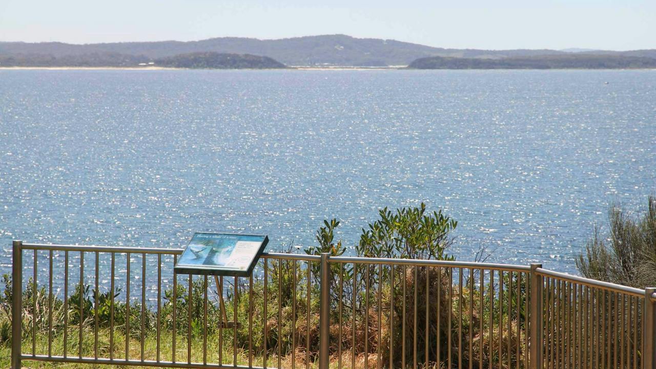
Moruya Heads lookout offers superb coastal views taking in the scenic mouth of Moruya River. In spring, bring your binoculars for whale watching as these gentle giants migrate south back towards the Southern Ocean for another summer of feeding on krill. Enjoy a picnic with friends and family in this beautiful part of Eurobodalla National Park.
Keep a lookout on the beach as there are plenty of birdwatching opportunities, with the endangered little tern and hooded plover calling the area home. Come spring, Moruya Heads is enlivened with wildflowers, including coastal wattle, banksia and pittosporum for you to feast your eyes on. And, with beaches nearby, you can also seize hotter days with swimming, surfing or a bout of fishing.
Close to Moruya Heads lookout is historic Moruya Heads cemetery, where 20 burials are on record and some headstones remain visible. The earliest recorded burial is from 23 August 1858 – a reminder of early European heritage in the area.
Just a 12-minute drive from Moruya, set in the magnificent Eurobodalla National Park, is a gallery and studio developed in harmony with this unique environment. Although only a few kilometres from the Princes Highway, you'll feel like you're a million miles away.
Here in this delightful coastal village, Jim Simms creates and sells his wood and gas-fired stoneware ceramics and paintings.
The variety of finishes, styles and quality of work on display, all at affordable prices, provides a perfect souvenir or gift from a talented craftsman.
If you want to commission some work, just ask. And if the opening times don't suit you, please call and arrange a time to your liking.
Congo Crafts Gallery can be reached via phone or email.
Broulee, North Head to Mossy Point Cycleway is a great flat route with a mixture of shared pathways and on-road riding. Park in Heath Street near the Surf Club to begin your journey but really, you can start at any point.
Travel south along the back of the sand dunes of Bengello Beach, a renowned surf beach for enthusiasts and locals. This is where you may encounter wildlife. Keep an eye out for kangaroos, echidnas, wallabies, or goannas, as well as lots of birdlife. At the end is the Moruya airport, where you may like to enjoy some extreme adventure like skydiving! Turn around and head north passing the start point, and continuing to Mossy Point; a great place to stop to enjoy much-needed refreshments.
Hit the trail for the final leg past popular Broulee Beach back to the beginning. You can enjoy a swim and, if you bring a camera, there is a great lookout near the car park.
Broulee Island is home to some of the best snorkelling on the Eurobodalla Coast, offering clear, sheltered waters and an abundance of marine life.
How to get there: Accessible from Broulee, follow George Bass Drive to Broulee Road (which becomes Grant Street), then turn right onto Heath Street, left onto Bayside Street, and right onto Harbour Drive. A convenient car park is located at the end of the road.
Two popular snorkelling locations can be found around the island. The first is the sheltered bay near Pink Rocks on the island's north-eastern side. With depths ranging from two to four metres and protection from ocean swell, this area is ideal for beginner snorkellers and families. Snorkellers can explore seagrass meadows that provide habitat for a variety of marine species, including stingrays and the occasional banjo shark.
The southern side of Broulee Island also benefits from calmer, protected conditions. Its shallow waters and diverse marine environment make it a rewarding location for both novice and experienced snorkellers.
The southern side is an extremely productive area, with different habitats around the reef system such as sand flats, big reef walls and shallow reefs, all combining to make it a superb spot for snorkelling. You may be lucky enough to spot a green turtle, the endangered weedy sea dragon or eastern blue devil fish.
Broulee Heritage Area on the Eurobodalla South Coast has a rich and vibrant history, although much of it is now hidden from view. This was the region's first port. In the 1830s, a sandbar blocked the entrance to the Moruya River, so local settlers loaded and unloaded from ships anchored in Broulee Bay.
Surveyed and gazetted in 1837, Broulee had developed a brisk sea trade with Sydney by mid-1841 and became a depot for Jervis Bay's whaling fleet. The port had six buildings and 46 residents, mostly convicts employed by landowner Captain William Oldrey, and was the centre of court and police districts stretching from Jervis Bay to Eden.
After a flood scoured out the bar at the Moruya River in 1841, Moruya became the preferred port. The court and hotel moved there in the 1850s and Broulee was abandoned, until holidaymakers discovered it in the 1920s.
Explore the story on foot. In the park on the northern bank of Candlagan Creek, a memorial honours the settlers and Traditional Owners who rescued survivors from the wreck of the schooner Rover in 1841. Then walk around Broulee Island, a nature reserve since 1964, to see the site of the 1840-41 Erin-Go-Bragh Hotel and an interesting 1842 grave.
Broulee Island is joined to the mainland by a permanent sandbar and is always accessible. Find it at the southern end of North Broulee Beach or park at Broulee Surf Club and head north around the rocks to Shark Bay, where a short beach walk leads you to the island. Photographers will enjoy the ocean vistas across pristine rock pools. The walk features native plants and is known for birdlife, including the superb fairy wren and white-bellied sea eagle.
Length: four kilometres return
Time: one hour, two hours including the beach walk
Grade: Moderate
Start: Walk north from Broulee Surf Club, or south along North Broulee Beach
Broulee Surf School was founded in 1996. Surfing is their business and business is swell! They are the longest-running surf school in the Eurobodalla region. The famous beginner surfing lessons are held at Broulee Beach near Batemans Bay.
Broulee is regarded as the best and safest learn-to-surf waves on the NSW south coast. It is an unforgettable experience for the whole family.
Situated 20 kilometres south of Batemans Bay, Broulee is a long sweeping beach protected by Broulee Island. This is a favourite beach with tourists, and is ideal for families.
It's long sandy shoreline is perfect for stretching your legs on a beach walk.
The fishing is great at Broulee, there's good diving and snorkelling in the area and the surfing is some of the best on the South Coast. Broulee Beach is well protected and the sand dips gradually, which makes it a family favourite. Explore Broulee Island, a nature reserve with outstanding views along the coast.
The village of Broulee is close by and has options for refreshments, takeaway or eating in.
Candlagan Creek, Mossy Point is a favourite spot for children and families in the Eurobodalla and plays an important part in the marine ecosystem with juvenile fish hidden amongst the seagrass beds and mangroves. The estuary extends from the northern end of Broulee Beach to approximately five kilometres inland.
At its mouth, Candlagan Creek is quite shallow and sheltered from adverse ocean conditions by a wide sandbar. On its northern edge, there is a grassy bank with shady trees and picnic tables. Being a shallow estuary type environment, it is a good snorkelling spot for beginners with weedy rocky outcrops, marine molluscs, small fish, and small rays common sights.
Be aware that the current can be very strong where the creek meets the sea, especially on an outgoing tide, while sharp oysters attached to the rocks can be hazardous to feet.
How to get there: Turn off the Princes Highway at Mogo onto Tomakin Road. Follow Tomakin Road to George Bass Drive, and turn right. Shortly after the Tomago River bridge, turn left onto Annetts Parade. Follow Annetts Parade through Mossy Point until it turns onto Beach Road. You'll see a small carpark on the left just before you cross the bridge over Candlagan Creek.
Tucked away at Mullimburra Point near Bingie, Cathedral Rocks are a spectacular natural attraction on the Eurobodalla coast. On the southern side of the point, a small cove known as Cathedral Beach is where the striking rock formations rise close to the sand.
Different in composition to the well-known Glasshouse Rocks in Narooma, they make a superb subject for photographers. Visit in the late afternoon, when the setting sun gives the rocks an incandescent glow.
Mullimburra Point Beach lies on the northern side of the headland, so there's more coastline to explore while you're here.
To get there, follow Bingie Road in from the Princes Highway at Bergalia. At the final T-intersection, turn left onto Mullimburra Point Road, which ends at a carpark at the headland.
A clean, clear river with options for short paddles or a 22 kilometre return trip from Mossy Point to the end of Mogo Creek. Take the eastern tributary at the junction of Jeremadra and Mogo Creeks for this route. The junction is seven kilometres from Mossy Point.
Parts of the river are shallow above oyster leases and there is a strong tide near the mouth, so stay in the shallows when paddling against the tide.
If you are set up for kayak fishing, the river offers great estuary angling. Protected as a recreational fishing haven, the waterway is renowned for producing quality catches like dusky flathead, whiting, bream, and mulloway.
Launch into shallow water near the boat tamp at Annetts Parade but note that this is directly into the river's tidal current. Novices could use the boat ramp at Kingston Place, Tomakin to avoid strong tides near the river mouth.
Toilets are near the boat ramps at both Mossy Point and Tomakin.
Take in the beautiful views over Tomakin, Mossy Point and Broulee from the Mossy Point Anchor Lookout.
The lookout and the anchor memorial is located on the headland on the south side of the Tomaga River.
The anchor was raised from the Tomaga River where it had served as an aid to navigation in the early part of last century.
Down by the river you will also will find a boat ramp, the Boatshed Cafe and kayak hire, and carparking.
Set on the grassy banks of the spectacular Tomaga River in Tomakin, Jack Buckley Memorial Park is a must for all visitors. This park is the perfect place for a relaxing, well shaded riverside picnic or fire up the barbecue as the kids burn off some of their energy on the playground equipment or basketball court. Toilet facilities and picnic tables also on site.
Jack Buckley was a local character who was the local Fire Captain, training young local volunteer firefighters and regularly writing to Tomakin landowners about the fire hazards on their blocks