Places worth discovering

Things to Do

Find attractions, experiences and places to visit. Events remain the best way to see what is happening on a particular date.

Looking for a dated event? Explore Events

335 places

Explore local places

Tumbarumba Pump Track

Parks and Gardens

Tumbarumba Pump Track

Tumbarumba's Pump Track is a fantastic spot for kids to build confidence and bike skills on a professionally designed course featuring rollers, jumps and sweeping turns. Right next door, the Tumbarumba Skate Park adds to the fun, often buzzing with local kids practising tricks on scooters and BMX bikes in the bowls. The town also boasts an impressive network of walking and cycling paths, winding along the creek, around sporting fields, out to the showgrounds and through to the main shopping area—perfect for exploring at your own pace. There's no better way to experience Tumbarumba than by bike, especially as a family. The area offers gentle rides around town, scenic routes to natural attractions and dedicated spaces to build skills, including the pump track and skate park.

Tumbarumba NSW

0.1 km away

View place
Art show openings
Image credit: emma ernst

Galleries, Museums and Collections

Artists On Parade Art Gallery

Tumbarumba Artists On Parade Co-operative Ltd is a not for profit, community based gallery and artist workspace, run by local artists and volunteers. They have regularly changing exhibitions showcasing local and visiting artists. Expressions of interest for exhibitions, sale of unique, artist made items or hire of the workspace are welcomed. Visit one of Australia's best regional artists initiatives with their regularly changing gallery space and unique gift shop stocking local to international products, handmade and collectables.

Tumbarumba NSW

0.1 km away

View place
Mountain Bike Trails Tumbarumba

Natural Attractions

Mountain Bike Trails Tumbarumba

Tumbarumba is a rider's paradise with trails for every skill level and style. Whether you're a beginner, a seasoned shredder, or just looking for a laid-back ride, Tumbarumba's got you covered. Experience cross-country trails, gravel rides, and rugged mountain highs, with trails winding down through open forests with stunning views across Australia's alpine region. Whether you're a seasoned trailblazer or a first-time rider eager to try your first turns, you'll be welcomed with a wry smile, a firm handshake, and a true local's tour of the trails. For those who prefer a leisurely pace, the Tumbarumba to Rosewood Rail Trail offers 21 kilometres of fully sealed, traffic-free riding through rolling farmland (42 kilometres return). Check Trailforks for maps and more information.

Tumbarumba NSW

0.2 km away

View place
Snowy Valleys Way Touring Route
Image credit: DNSW

Historical Sites and Heritage Locations

Snowy Valleys Way Touring Route

A road trip to remember. Stop the clock, skip the highways and take the slow road through forested vales, rolling farmlands and vibrant villages. It's time to linger longer. Running from Gundagai, New South Wales to Beechworth Victoria, the Snowy Valleys Way is a touring route encompassing over 300 kilometres of breathtaking scenery and landscapes, and a whole swag of things to see and do 'along the way'. Starting in the hills of Gundagai, home of the famous 'Dog on the Tuckerbox', the Snowy Valleys Way winds south through Tumut, Batlow, and Tumbarumba, crossing the Murray River at Towong, and continuing south through Corryong, and Yackandandah, ending in Beechworth, Victoria. A picturesque slice of Australia, the Snowy Valleys Way offers its travellers spectacular outdoor activities, colourful festivals, towns to explore, and a laid-back rural charm that distinguishes it from other popular tourist drives. Journey through misty valleys and snowgrass flats along the foothills of the Australian Alps or escape the route and unbridle your wanderlust. Whether you seek wine or wild swimming, farmgate foraging or hiking to Australia's highest peak, take your foot off the pedal and wander scenic trails, wade in mountain streams or simply put your feet up. Give yourself over to the lure of the road.

Tumbarumba NSW

0.2 km away

View place
Hume and Hovell Track Marker
Image credit: Hume and Hovell Track

Natural Attractions

Hume and Hovell Track

The Hume and Hovell Track is a 426-kilometre walking track stretching across South-Eastern NSW from Cooma Cottage in Yass to the Hovell Tree in Albury and passing through the regions of Wee Jasper, Tumut, Tumbarumba and Woomargama. The long-distance track traverses bushland, single track, farmland, forest fire trails and quiet country roads, following the historic 1824 expedition route of the two explorers Hamilton Hume and William Hovell. The fully signposted track crosses more than 100 footbridges and boardwalks, and runs along rivers' edges and through cool-climate forests, with numerous campsites along the trail. Walk the track in one go, plan an overnight camping trip, and complete short walks or sections as life allows. See the Hume & Hovell Track website and trip planner for further details.

Tumbarumba NSW

0.4 km away

View place
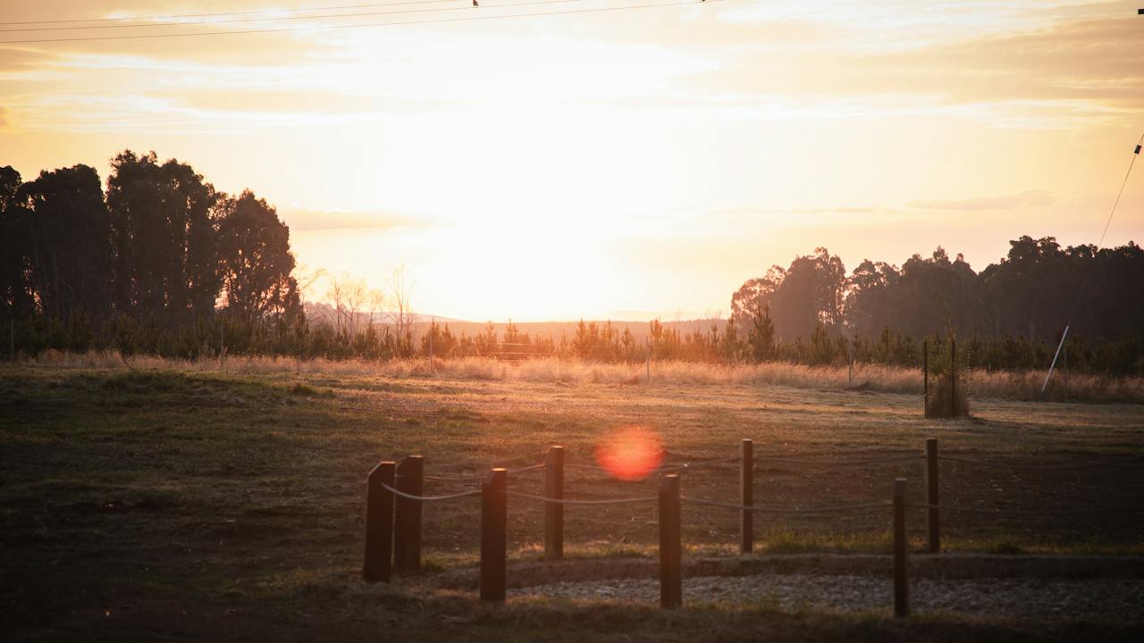
Sunset views over Tumbarumba from the top of Police Paddock
Image credit: Mt Tumbarumba

Natural Attractions

Police Paddock Trail

The Police Paddock is a shared walking and mountain bike (MTB) trail in Tumbarumba New South Wales. Cycle or walk the 30-minute round-trip Police Paddock trail from the car park at the top of Bridge Street, for views over the town. The path is shared and dogs must be on a lead. The Police Paddock was where it all began for Cycle Tumbarumba, and it's still a favourite. This straight-up, straight-down 2.7 kilometre loop is the ultimate fitness challenge. The tight berms and twisting descent only get more exciting the more you ride it—perfect for riders looking to test their limits and build endurance.

Tumbarumba NSW

0.7 km away

View place
Mt Tumbarumba Trails
Image credit: Mt Tumbarumba

Sports and Recreation Facilities

Mt Tumbarumba

Boasting a 300 meter vertical elevation, uplift services, and thrilling trails for riders of all skill levels. The stunning views won't be the only thing that takes your breath away. Welcome to Australia's first community-owned and operated mountain bike park. Nestled on the edge of the Snowy Mountains, our small town has created something truly special. Breathtaking landscapes, granite boulders, eucalypt forests, and stunning views are just the start. Check website for details. Muster the crew and come ride Mt Tumbarumba.

Tumbarumba NSW

1.1 km away

View place
Hikers on the walking trail on the summit of Mt Tumbarumba
Image credit: Mt Tumbarumba

Natural Attractions

Mt Tumbarumba Hiking Trail

The Mt Tumbarumba Hiking Loop isn't just a trail—it's a walk through the heart and soul of Mt Tumbarumba. The mountain that towers over a town that never gives up. The 8-kilometre "Sounding Ground" trail loop is perfect for hikers and experienced walkers to explore this backcountry terrain and soak up the stunning scenery. Winding through forests and over rugged granite outcrops, the trail is rated moderate to difficult with some steep sections, scrambling, and natural obstacles. Small sections of the trail are shared climbing mtb trails and fire trails, with Interpretive signage along the trail featuring the local history, bushfires, and native flora and fauna habitats. The trail gives you a chance to see what resilience really looks like, with nature bouncing back from bushfires and offering some seriously beautiful views along the way. Grade 3 - moderate - Some bushwalking experience recommended. Track has short steep hill sections, a rough surface and natural obstacles. Time: Allow 3-4 hours for the entire loop and ensure you carry sufficient water and snacks for the walk. As Mt Tumbarumba is a paid access facility all users of the park must hold a valid Mountain Pass. The Sounding Ground hiking trail can also be done as a descending walk by shuttling to the top of the mountain and walking down. Markers help with navigation.

Tumbarumba NSW

1.2 km away

View place
Tumbarumba to Rosewood Rail Trail

Historical Sites and Heritage Locations

Tumbarumba to Rosewood Rail Trail

Officially opened in April 2020 the Tumbarumba to Rosewood Rail Trail is an absolute must-do when visiting the Snowy Valleys. A vibrant, revitalised trail for walking, cycling, pushing, strolling, peddling, rolling and relaxing. With the Trailheads at Figures Street Tumbarumba and at McEachern Lane in Rosewood, there are over 21 kilometres of sealed trail with gentle gradients and sweeping curves. Relax and enjoy beautiful scenic countryside and spectacular mountainsides with safe trails for the whole family to enjoy. For the more serious rider, challenge yourself to complete the whole distance and try some of the other cycling opportunities in the Snowy Valleys. Make sure you have time to enjoy Wolter Cottages, the beginning of the Rail Line, with two heritage-listed buildings from the 1870's including a historical display. The Rail Trail itself has many historical displays and features four restored bridges from the original Rail line which are of significant historical importance, being of timber trestle construction. These have been preserved in the reconstruction and refurbishment process. Mannus Creek Bridge is a seven-span tall bridge which also features an inbuilt curve, a masterpiece of bridge building. No horses or dogs are allowed on the trail.

Tumbarumba NSW

1.4 km away

View place
Mannus Lake
Image credit: Hume and Hovell

Natural Attractions

Mannus Lake Tumbarumba

Mannus Lake sits within the peaceful Mannus State Forest, just a short 10‑kilometre drive from Tumbarumba along Mannus Lake Road. This scenic spot is a favourite for campers, caravanners and day visitors, offering relaxed waterfront camping and sweeping views across the lake. It's an easy place to unwind, enjoy nature, or simply stop in for a picnic by the water. To reach the lake, follow Jingellic Road and turn onto Mannus Lake Road, then continue on to the campground. Lake users should avoid areas with green-coloured surface algae, especially when it appears in large patches, and should keep themselves and pets out of the water in these conditions.

Tumbarumba NSW

4.9 km away

View place
Pioneer Women's Hut
Image credit: Tumbar

Galleries, Museums and Collections

Pioneer Women's Hut Museum

The Pioneer Women's Hut at Glenroy Heritage Reserve is one of the best and most unusual small museums in Australia. Thoughtfully curated, it reflects the ingenuity of women in finding solutions to the challenges of looking after a family in early rural Australia. The accessibility and provenance of the diverse collection add to its reputation. The Heritage Quilt Museum is a natural offshoot of the Pioneer Women's Hut, with each quilt telling a unique story. The Jackie Fox Button collection and scrapbook collections also add layers of distinctive histories to the Pioneer Women's Hut themes. Glenroy Cottage Crafts is a little shop nearby offering a wide range of useful and attractive goods. Other heritage displays include a machinery shed full of farm implements used by the hard-working pioneers of the Tumbarumba district.

Glenroy NSW

7.1 km away

View place
Hume and Hovell Track - Henry Angel Trackhead

Historical Sites and Heritage Locations

Hume and Hovell Track - Henry Angel Trackhead

Located around nine kilometres from the town of Tumbarumba on Tooma Road, the Henry Angel Trackhead is a popular camping area with quality facilities, including electric and gas barbecues. The picnic and camping area provide a base for short and longer walks along the Hume and Hovell Track, especially walking up and downstream exploring Burra Creek and its significant mining history. Information boards are located at the track head. The entire Hume and Hovell Track stretches 426 kilometres from Yass to Albury and retraces the footsteps of explorers Hamilton Hume and William Hovell on their expedition to Port Phillip in 1824. Walkers should be adequately clothed with sturdy walking boots. Dogs are not permitted on the track, which crosses private land. Maps and more information are available from the Tumbarumba Visitor Information Centre.

Tumbarumba NSW

7.3 km away

View place
Paddy's River Falls in the Snowy Valleys
Image credit: Snowy Valleys Council

Natural Attractions

Paddy's River Falls

Paddy's River Falls has long been a favourite with locals and is fast becoming a must-see stop for visitors to the region. Just a short walk from the car park, well-positioned lookouts offer sweeping views of the Falls and the river landscape below. For a closer perspective, follow the walkway down to the base of the Falls. In the warmer months, the cool mist rising from the cascading water as it crashes into the pool and rocks below offers welcome relief from the heat. Getting there: From Tumbarumba, follow Tooma Road for approximately 18 kilometres, winding through picturesque countryside along the way.

Tumbarumba NSW

13 km away

View place
Visitors take in Paddys River Dam views
Image credit: Forestry Corporation of NSW

Natural Attractions

Paddys River Dam, Bago State Forest

The beautiful Paddys River Dam is a peaceful and scenic spot and a popular attraction in the heart of the alpine ash forests of the Bago Plateau. A year-round great place to camp and relax, it's also popular in summer to go fishing or splash around in the waters of the Dam. Originally constructed as a source of water for gold mining activities in the late 1800s, Paddys River Dam is now the Snowy Valley locals' camping area of choice - a secret spot shared with tourists and visitors (but don't tell anybody else!). Passive water activities such as kayaking, swimming and recreational fishing are permitted on the Dam (no powerboats, jetskis or waterskiiing due to the small size of the Dam). Horse riding is popular in this State forest, and campers with horses are welcome in this forest (as in all NSW State Forests).   Paddys River Dam offers campsites, picnic areas, toilets and walking tracks, including access to the iconic Hume & Hovell walking track. A beautiful part of the world and a must-see in your Snowy Valley adventures.

Tumbarumba NSW

15 km away

View place
Braymont Gardens

Amusement and Theme Parks

Braymont Gardens

Home of the massive hedge/tree church nestled in the vineyard with magnificent views of Round Mountain, Jagungal and Blackjack this five- acre Open Garden with 100 Manchuria Pear driveway was born on 15 August 2013. The bare cow paddock has been transformed into an awesome garden with a large dam, island, bridges, ponds, bridal walk, grain silo bar, bbq fire area, hairy heaven cemetery, iris dam walkway and garden rooms, numerous seats to rest and enjoy. Colour abounds. Enjoy a great espresso overlooking the garden. At Braymont the visitor will also find the Miniature South African Meatmaster Sheep, Miniature Dunn Cattle, crested Indian Runner Ducks roaming through the garden, French Toulouse Geese and Ringneck Doves to release in the church. Bookings are essential for large groups.

Tumbarumba NSW

16 km away

View place
Aerial view - Paling Yards
Image credit: Forestry Corporation of NSW

Natural Attractions

Paling Yards, Bago State Forest

Paling Yards is a beautiful, grassed area on the edge of Paddys River, on the high country plains. Paling Yards features areas of Montane Peatland, an important high-altitude wetland system. Utilised by picnickers and campers, this area is popular with horse riders and as a result, horse yards/enclosures are available (free) for visitors to use during their visit. Visitors will also find armoured watercourse crossings to protect the surrounding Peatland and Swamp areas. Haenigs Horse Trail is the latest addition to this site.

Paddys River NSW

16 km away

View place
Sunset view form Lochinvar Rest Area
Image credit: Forestry Corporation of NSW

Natural Attractions

Lochinvar Rest Area, Green Hills State Forest

Lochinvar Rest Area is located along Batlow Road at Laurel Hill, only 22 kilometres from Tumbarumba and 47 kilometres from Tumut. This scenic forest is predominantly radiata pine plantations, clearly visible from any vantage point in the visitor area, and offering stunning sunset views. Lochinvar Rest Area is the perfect stop for travellers needing to stretch their legs, with picnic facilities and toilets available. It's also a great spot for overnight stays if travelling greater distances, and is an especially desirable rest option for travellers with RV/caravans or campervans, with plenty of space adjacent to the picnic area. Entry to Lochinvar Rest Area is via Lochinvar Feeder Road. Please note there is no RV/caravan dump point at Lochinvar Rest Area; Batlow and Tumbarumba are the nearest dump points.

Tumbarumba NSW

20 km away

View place
Walking the Alpine Ash Walk
Image credit: Forestry Corporation of NSW

Natural Attractions

Alpine Ash Walk, Bago State Forest

The Alpine Ash Walk can be found at Pilot Hill Arboretum in Bago State Forest. This walk is a beautiful one-way, one-kilometre easy-grade walk through Snowy Valley's forest. As part of the Bago Sculpture Forest, visitors can enjoy viewing sculptural artworks along the walking track as they move through this majestic Alpine Ash forest. The Alpine Ash Walk is accessed via Pilot Hill Arboretum, near the townships of Batlow and Laurel Hill, and is part of the broader Snowy Valley's Sculpture Trail. This attraction is free.

Batlow NSW

21 km away

View place
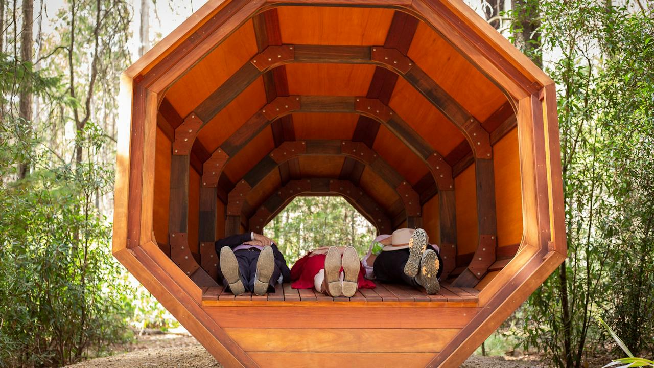
Lie down in the Sound Pod, Wellness Walk
Image credit: Forestry Corporation of NSW

Natural Attractions

Pilot Hill Wellness Walk, Bago State Forest

The Pilot Hill Wellness Walk is a unique experience that offers visitors the opportunity to walk under towering pines via an accessible track that incorporates sculptural features. Visitors can utilise the Sound Pod, a structure to lie inside and listen to the amplified sounds of the forest, and the Sky Seat, a place to rest as you gaze up through the trees. These form part of a range of 'Naturefix' stations along the track, designed to help visitors reconnect with nature and the sights and sounds of the forest. QR codes on signage helps visitors connect more deeply with forest activities via the Naturefix app. The Pilot Hill Wellness Walk can be found at Pilot Hill Arboretum in Bago State Forest.

Batlow NSW

21 km away

View place
Steinunn Thorarinsdottir's sculpture 'Contemplation'
Image credit: Forestry Corporation of NSW

Natural Attractions

Bago Sculpture Forest

The Bago Sculpture is a must-see for visitors to the NSW Snowy Valleys. Located in Bago State Forest between the townships of Batlow and Laurel Hill, the Bago Sculpture Forest includes stunning public art sculptures from local, national and international artists, within a beautiful forest environment. Visitors will find sculptures at three locations within Bago State Forest: Sugar Pines visitor area, Pilot Hill Arboretum grounds, and the Alpine Ash Walk (accessed from Pilot Hill Arboretum). There are also visitor facilities at each of these sites. Artists featured in the Bago Sculpture Forest include: Shen Lieyi (China), Václav Fiala (Czech Republic), Sean Henry (England), Steinunn Thorarinsdottir (Iceland), Andy Townsend & Suzie Bleach (NSW South Coast), Dale Miles (Loftus), Lorraine Connelly-Northey (Holbrook), Philip Spelman (Queanbeyan), Stephen King (Walcha), Robyn Sweeney (Batlow), Akira Kamada (South Coast), Tony Davis (WA), NEON (Britain Finland) & Clancy Warner (SA). The Bago Sculpture Forest was developed by Sculpture by the Sea in partnership with Forestry Corporation of NSW and the local community, in response to the Black Summer bushfires of 2019 – 2020. It is a one-of-a-kind experience. Entry is free.

Batlow NSW

21 km away

View place
Walking towards the wedding arbour at Sugar Pines in Bago State Forest
Image credit: Forestry Corporation of NSW

Natural Attractions

Sugar Pines, Bago State Forest

Sugar Pines visitor area offers a variety of activities for visitors, from a picnic area with children's nature playground to a wedding arbour amongst the Sugar Pines grove, high on the hilltop along the Sugar Pines walk. Sugar Pines is also home to some of the Bago Sculpture Forest artworks, with artist Stephen King's striking work 'Grid Study IV' visible from the Sugar Pines carpark. The Sugar Pines visitor area replaces the former iconic Sugar Pines walk, which was sadly destroyed in the Black Summer fires of 2019/20. The new Sugar Pines grove replaces those trees lost to the fires, and represents the resilience of the local Snowy Valleys community.

Laurel Hill NSW

21 km away

View place
Buddong Falls Walking Track
Image credit: Jo Caldwell

National Parks and Reserves

Buddong Falls Walking Track

Buddong Falls walking track starts from Buddong Falls campground, around 20 kilometres from Talbingo. Located in the remote northwest of Kosciuszko National Park, this walk takes you off the beaten track to two pretty, cascading waterfalls in the Buddong Creek valley. From the campground and picnic area, it’s an easy 400 metres to a view point above the upper falls, which drop 20 metres. Listen out for lyrebirds amongst the smooth barked ribbon gums, pale yellow blackwood wattles, and white tea tree. The walk to see the lower Buddong Falls is around 1.5 kilometres. Take care, as the lower section is quite steep and can be slippery during wet weather. The impressive lower falls cascade 60m down the granite and shale into a steep valley. It's a three kilometres return walk taking 1.5 hours.

Buddong NSW

26 km away

View place
Jim Newman's Lookout

Natural Attractions

Jim Newman Lookout

Located on the Murray River Road, Jim Newman's Lookout is a must see stop along the Great River Road drive. Overlooking the Murray River valley towards Welaregang and Ournie, Jim Newman's Lookout features breathtaking views, shaded picnic tables and a large scale metal art installation of a Bogong Moth. Stand under the Bogong moth's wings and watch the natural sunlight filter through the moth cutouts in its wings or face toward the Murray River Valley and take stunning photos of the river flats and surrounding mountains.

Tintaldra VIC

28 km away

View place
Tumut 3 Power Station

Historical Sites and Heritage Locations

Tumut 3 Power Station

Walk around Tumut 3 Power Station and see the size and scale of one of the engineering marvels of the modern world. View the power station from external viewing areas with informational signage. A picnic area with toilets is available for the visiting public. Unfortunately, as the power station is operational there is no internal access or tours available.

Talbingo NSW

34 km away

View place

What is happening now?

Search dated events, markets, live music, sport and community activities.

Explore Events

Planning by place?

Use Things to Do for attractions and experiences that are not tied to one event date.