Places worth discovering

Things to Do

Find attractions, experiences and places to visit. Events remain the best way to see what is happening on a particular date.

Looking for a dated event? Explore Events

376 places

Explore local places

The Rock - Military Memorial

Galleries, Museums and Collections

The Rock Heritage Trail

Park the car and step back in time as you stroll through The Rock's charming main streets. Heritage plaques guide you past beautiful Federation-era shopfronts and a quaint cluster of historic churches, offering a glimpse into the town's rich history. A standout feature of the trail is the Gallipoli Panels located in the Avenue of Honour, a moving tribute to the region's servicemen. While visiting, take the short drive west to explore The Rock Nature Reserve – Kengal Aboriginal Place, an important cultural site nestled in natural bushland.

The Rock NSW

0.2 km away

View place
The Rock Hall and Museum
Image credit: Lockhart Shire

Galleries, Museums and Collections

The Rock Hall & Museum

The Rock Museum is situated in The Rock Town Hall which was built by the Masonic Lodge in 1925. The Museum holds a variety of items of which holds history of the Rock and District including a millinery collection and pictorial banners of the Avenue of Honour. Explore the Rich Heritage at The Rock Hall & Museum.

The Rock NSW

0.2 km away

View place
The Rock War Memorial Swimming Pool Complex
Image credit: NSW Government

Sports and Recreation Facilities

The Rock War Memorial Swimming Pool Complex

The Rock War Memorial Swimming Pool Complex is located at the corner of Wilson and Mixner Streets in The Rock. The facility features two pools: a 25-metre outdoor pool perfect for laps and recreation, and an undercover baby pool ideal for young children. Canteen facilities are available on-site for refreshments. The amenities building offers easy-access toilets, hot water showers, and a community gym, making the complex a great spot for fitness and family fun.

The Rock NSW

0.2 km away

View place
The Rock Regional Observatory
Image credit: Lockhart Shire Council

Observatories and Planetariums

The Rock Regional Observatory

The observatory is used for educational astronomical observation and research activities for residents and visitors. Opening hours for this venue differ due to season, if wanting to know the current opening times, please check out The Rock Regional Observatory website. The facility features an array of telescopes and associated domes as well as an educational space, that can be used by the general community and educational institutions to encourage interest and research in astronomy. The project has been supported by the Community Building Partnership Program and Stronger Country Communities Fund by the NSW Government and the Australian Government's Local Roads and Community Infrastructure Program.

The Rock NSW

1.3 km away

View place
Kengal (The Rock) Picnic Area
Image credit: Photo: C Killick

Natural Attractions

Kengal (The Rock) Picnic Area

Kengal (The Rock) picnic area is a well-equipped base for viewing the scenic rock formation, with picnic tables, barbecues, an amenities block, and access to walking trails. A terrific place to settle down and admire the scenic splendour of The Rock is the nearby picnic area. Just off Lockhart-The Rock Road, this is both easy to access and equipped with everything you need to make the most of sunny afternoons. Pack a picnic hamper and a soccer ball to keep the family entertained, or bring along a paperback and take advantage of a shady spot beneath the box trees. How ever you travel, this is a prime picnicking spot for all types of visitors. In spring, the area blooms with native wildflowers, though woodland birds provide a soothing soundtrack at any time of year. Bring your binoculars for birdwatching, or perhaps some hiking boots to drum up an appetite on Yerong walking track, which leads you to the top of the rock formation. Kengal (The Rock) picnic area is just one place to visit at The Rock Nature Reserve.

The Rock NSW

3.2 km away

View place
Yerong Walking Track
Image credit: Photo: A Lavender

Natural Attractions

Yerong Walking Track

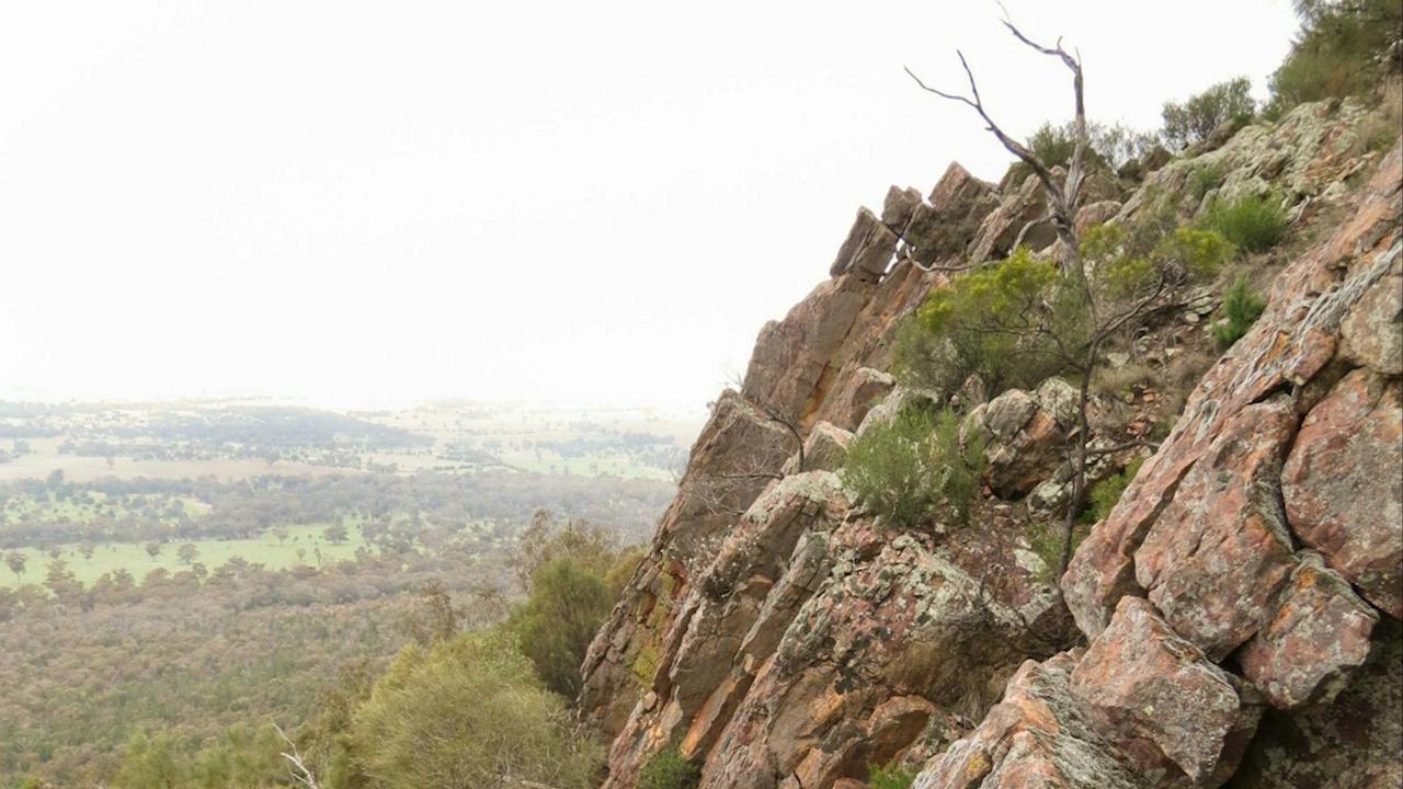
Yerong walking track offers a moderately challenging hike up the slopes of The Rock to a spectacular lookout over bush and farmland. Leaving directly from the carpark near the information point, this pleasant and accessible walk takes visitors to the top of the dramatic The Rock formation. It begins gently, crossing small gravelled slopes between graceful red gums. As you climb higher, the path begins to wind around recessed cliffs hiding cool woolly ragwort plants – a threatened species. You may see wallabies, lizards basking, black cockatoos or wedge-tailed eagles. Birdwatching only gets better the further you climb. This hike becomes steep towards the end, so make sure you bring sturdy shoes and plenty of water. The payoff is notable, with a spectacular scenic vista across bush and rolling farmland from the top of The Rock. Just a short trip from Wagga Wagga, this is one of the best lookouts in the region. Galore Hills is often visible to the west, and on clear winter days the snow-capped peak of Mount Kosciuszko rises in the distance.

The Rock NSW

3.2 km away

View place
The Rock Nature Reserve - Kengal Aboriginal Place

National Parks and Reserves

The Rock Nature Reserve - Kengal Aboriginal Place

Tucked away in quiet farmland, The Rock Nature Reserve - Kengal Aboriginal Place is a small but diverse haven surrounding a remarkable geological giant: The Rock, soaring 364m above the plains. There are things to do for every type of traveller at the reserve. Take the family and find a relaxing picnic spot, or if you're an avid adventurist, have a go at rock climbing with friends. Hikers looking for something short, vigorous, and with a big scenic view at the finish line will also appreciate the reserve. The unique biophysical position of the reserve means it's filled with varied habitats teeming with everything from turquoise parrots to swamp wallabies. Bring your camera and a pair of binoculars there's much to keep them in constant rotation here. Whether you're looking for something slow or something adrenaline-filled, the accessibility of The Rock Nature Reserve - Kengal Aboriginal Place makes it an appealing option just down the road from Wagga Wagga. On a clear day, you can even see as far as Mount Kosciuszko and the Victorian Alps.

The Rock NSW

3.2 km away

View place

The Towers
Image credit: Photo: A Lavender

Natural Attractions

The Towers

The Towers is a 100 metre stretch of the north-east face of The Rock, open to rock sports and also popular with photographers and birdwatchers who want to view peregrine falcons. The Towers, right near The Rock picnic area, offer a thrilling conquest for rock climbers, abseilers, orienteering groups and photographers alike. Located in The Rock Nature Reserve, the north-east cliff face of The Rock, is a challenge to anybody with experience and the necessary equipment. Peregrine falcons use The Towers as a nesting sight, offering birdwatchers close-up views of these magnificent creatures. Keep an eye out for peregrines on the cliff and observe their telltale whitewash streaks below their perches. To reach The Towers, follow a 670 metre narrow walking trail opposite the picnic shelter and look for the register book. The best time to climb is between January and the end of June. Photographers will love the remarkable view over the surrounding countryside.

The Rock NSW

3.4 km away

View place
The Rock lookout
Image credit: DPIE

Natural Attractions

The Rock lookout

The Rock lookout offers spectacular views, comprises the remains of an old trig point and is a rewarding way to end your hike along Yerong walking track. On a clear day you can see to Galore Hills in the west, and the snow-capped peak of Mount Kosciuszko far in the distance, as well as the Bogong Range and Victorian Alps. The Rock lookout is a great place for birdwatching, as native peregrine falcons nest at and around The Towers. Artistically inclined travellers might like to bring a sketchbook, or perhaps a camera to capture scenery. Keep your eyes peeled for wildflowers like bluebells and yellow wattle bloom. Near the bare cliff tops, Dwyer's mallee gum and drooping sheoak have taken root. After admiring the view, head for The Rock picnic area down below and enjoy a leisurely, well earned lunch.

The Rock NSW

3.4 km away

View place
Morrocka Emus
Image credit: Morrocka Emu Farm

Agritourism

Marrocka Emu Farm

Situated on the slopes facing the magnificent the Rock Nature Reserve -Kengal Aboriginal Place. Enjoy a guided tour of the farm with morning or afternoon teas on the patio with arguably the best view in the Lockhart Shire. Visitors can purchase emu products including eggs, oils, capsules, moisturisers and balms. Group bookings by appointment only.

The Rock NSW

3.6 km away

View place
Tootool Telstra Mural
Image credit: Lockhart Shire Council

Landmarks and Buildings

Tootool Telstra Telephone Exchange Building Mural

The Tootool Telephone Exchange Building mural vividly depicts an old telephone, the Tootool Public School badge, the historic Tootool Bridge, native flora and fauna, and a representation of the iconic swaggie familiar to the Tootool–French Park area. This remarkable mural was brought to life through a collaboration between the Tootool Rest Stop Committee and the local Council. Following extensive community consultations, the project was enthusiastically supported. The artwork was created by Damien Mitchell, an Australian-US based artist originally from the Riverina, known for his large-scale scare murals. Damien began painting on 25 May and completed the mural the very next day, adding a unique cultural landmark to the region.

Tootool NSW

11 km away

View place
Yerong Creek
Image credit: Lockhart Shire Council

Parks and Gardens

Stanley Galvin Park

Stanley Galvin Park is beautifully situated on the main Street of Yerong Creek and adjacent to the Yerong Creek Water Tower Mural. Surrounded by beautiful, shady trees are numerous war memorials and plaques. Playground, barbecue shelter with tables and chairs are all located within the park, as well as a water refill station and toilets.

Yerong Creek NSW

14 km away

View place
Yerong Creek Water Tower Mural
Image credit: Lockhart Shire Council

Galleries, Museums and Collections

Yerong Creek Water Tower Mural

The beautiful and bright Yerong Creek Water Tower Mural dominates the skyline and provides the perfect canvas to highlight the story of local life and history through the eyes of children, connecting the past, present and future. In many of the elements, the children are wearing white and blue coloured clothing representing the colours of the Yerong Creek Community. The story of 'Through Their Eyes' aims to celebrate life in and around this rural village, depicting the cultural and social fabric. The mural features six main elements: Agriculture, Education, Indigenous Culture, Military, Sport and Transport. Each element is further explored around the base of the Water Tower. The Mural was designed by world famous Melbourne-based artist Khosnaran Khurelbaatar (Heesco) who applied more than 140 litres of undercoat paint and used over 200 cans of spray paint covering the area of 836 square metres to complete his first water tower mural. The Yerong Creek Water Tower Mural is the third water tower mural to be painted in Lockhart Shire with the Milbrulong Water Tower Mural completed in 2020 and the Lockhart Water Tower Mural completed in 2018.

Yerong Creek NSW

14 km away

View place
Painting the mural March 2023
Image credit: Transgrid

Historical Sites and Heritage Locations

Uranquinty Water Tower Mural

The artwork around the water tower depicts the important role that Uranquinty played during the Second World War. Uranquinty 55 Service Flying Training School was one of eight SFTS set up by the RAAF to provide intermediate and advanced flight training as part of Australia’s contribution to the Empire Air Training Scheme which was the largest single aviation training program in history. The southwestern side of the tower depicts three women from the Women’s Auxiliary Australian Air Force (WAAAF) formed in March 1941, working on a Wirraway engine. By 1942 there were 123 airwomen stationed at Uranquinty who carried out flight operations, manned ambulances, fire tenders and, most importantly, flight riggers and airframe inspectors and flight mechanics. Beside the women is a view of the station buildings, the Uranquinty silos and The Rock. On the north eastern side is a picture of Leonard Victor Waters, the first and only Aboriginal fighter pilot to see action during WW2. He was posted to 78 Squadron and flew 95 missions in his Kittyhawk named “Black Magic” The water tower was painted over 10 days in February 2023 by the artist, Damien Mitchell, who grew up in Wagga Wagga. It was created using a mix of acrylic ad spray paint and serves as a memorial to the history of the Uranquinty area.

Uranquinty NSW

15 km away

View place
Milbrulong Water Tower
Image credit: Lockhart Shire Shire

Landmarks and Buildings

Milbrulong Water Tower

Located in the quaint village of Milbrulong, nestled between The Rock and Lockhart, the Milbrulong Water Tower mural proudly features the rosella bird. This artwork pays tribute to the village's name, which comes from the Wiradjuri word for rosella, honouring the region's Indigenous heritage. At the base of the water tower, visitors can enjoy the peaceful Rosella Walk, complete with nesting boxes, picnic tables, and heritage panels. It's a charming spot to relax, learn about local history, and soak in the tranquil village atmosphere.

Milbrulong NSW

19 km away

View place
Livingstone multi-use track

Natural Attractions

Livingstone multi-use track

Livingstone multi-use track is a 4.3km loop track, perfect for enjoying some of the loveliest parts of Livingstone National Park. If you’re hiking, mountain biking or horse riding, this track takes you through open woodlands full of tall cypress pines, scribbly gums and spectacular rusty spider flowers. In spring, areas are blanketed in gorgeous wildflowers, including yellow flowering kangaroo thorn and yellow clustered everlastings. As the only multi-use track in the region, it’s very popular. Members of the Wagga Wagga Wilderness Walkers and Wagga Wagga Mountain Bike Club frequently visit here, as do families and anyone wanting a dose of nature and fresh air. Birdwatchers should be sure to bring their binoculars; scarlet robins, brown tree creepers, speckled warblers and turquoise parrots are best spotted early morning or late afternoon.

Big Springs NSW

23 km away

View place
Birramal Conservation Area
Image credit: Visit Wagga Wagga

National Parks and Reserves

Birramal Conservation Area

The Birramal Conservation Area, known locally as ‘Birramal’, is a 128-hectare site designated for the purpose of environmental conservation. This site incorporates a section of the Wiradjuri Trail between the Olympic Highway and Holbrook Road where you can be immersed in nature, art, and spectacular views of Wagga Wagga and Surrounds on foot or bike. ‘Birramal’ in the local Wiradjuri language means ‘the bush’ and reflects the important connection between Wiradjuri peoples and the land they cared for which provided food, resources and sustenance in return. This area is home to an endangered White Box Woodland community which supports the locally endangered squirrel glider. The squirrel glider is a small grey marsupial with a thick brushy tail that can glide 80 metres through the air. In the Birramal Conservation area, you will see ‘glider poles’ that link areas of vegetation. While wandering through Birramal you will see many new tree-planting sites and artificial nest boxes. Native birds and mammals, such as the squirrel glider, make their nests in hollows of ancient trees. Through vegetation clearing, many natural tree hollows have been lost. New plantings provide food and shelter for native animals, and will in the years ahead offer natural tree hollows.

Lloyd NSW

23 km away

View place
Pomingalarna Reserve MTB experiences
Image credit: Visit Wagga Wagga

Natural Attractions

Pomingalarna Reserve

Pomingalarna Reserve is located along part of the Wiradjuri Trail, just ten minutes drive from the Wagga Wagga CBD, and is popular with bushwalkers, runners, bike riders and nature enthusiasts. Native bushland surrounds mean wildlife abounds with plenty of kangaroos (especially on the neighbouring golf green), wallabies, lizards and bird life to admire. A fun, flowing 13-kilometre bushland mountain bike trail is clearly marked for those looking for an adrenaline rush. Views from the top of Pomingalarna, looking east back over Wagga Wagga and the region, are some of the best in city. The trail to the top is achievable for anyone with moderate fitness. Pomingalarna Reserve is also home to Wagga Wagga's Multisport Cycling Complex, where riders of all skill levels can test out the Criterium track, BMX track, Jump Tracks, Pump Tracks, Cycling Education Area, Velodrome and the Mountain Bike Playground Loop.

Wagga Wagga NSW

24 km away

View place
My Floral Styling

Shopping and Markets

My Floral Styling

With many years experience in the flower industry, from the United Kingdom to locally, they love to tell your story through floral styling and help you create the perfect theme for your event. Or add a beautiful touch to your business or home, by creating stunning flowers that set off your space.

Henty NSW

25 km away

View place
Livingstone National Park

National Parks and Reserves

Livingstone National Park

Just 30km south of Wagga Wagga, Livingstone National Park and the nearby Livingstone State Conservation Area boast close to 2,000ha of richly varied bushland. Wherever you travel throughout the park, you'll be struck by the diversity of the ever-changing landscape. In spring, when all the native wildflowers burst with colour, including several species of orchids, the landscape is simply spectacular. Austral indigo, kangaroo thorn and clustered everlasting are a must-see at this time of year. Take a walk, mountain bike or enjoy a horse ride along Livingstone multi-use track. Birdwatchers will enjoy the chance to spot many threatened woodland birds, including turquoise and swift parrots and scarlet and hooded robins. You'll also glimpse eastern grey kangaroos, swamp wallabies, wombats and goannas on your adventure through Livingstone National Park.

Burrandana NSW

25 km away

View place
Overlooking Lake Albert at the Wagga Wagga Country Club
Image credit: Wagga Wagga Country Club

Sports and Recreation Facilities

Wagga Wagga Country Club

Located on the shores of Lake Albert and included in Australia's top 100 country courses. A beautiful tree-lined course with immaculate bent greens and all-weather fairways, it offers an outstanding 18-hole championship golf course measuring 6054 metres from the back markers. The Wagga Wagga Country Club is the ideal venue for any occasion, golfing, functions and dining.

Wagga Wagga NSW

25 km away

View place
Lake Albert
Image credit: Destination NSW

Natural Attractions

Lake Albert

Lake Albert is one of Wagga's most popular recreational facilities. It caters for boating, fishing, swimming and other aquatic activities. The five-and-a-half kilometre circuit walking track is commonly used by walkers, joggers and bike riders. Eight fitness stations have been installed in four locations along the walking track on the eastern side of Lake Albert. Set over 800 metres, the fitness stations are very popular with users of the lake. Boat ramps are located at Bosley Park, adjacent to the Wagga Wagga Boat Club on the lake’s western side, and at Apex Park on the eastern side. Also at Apex Park is a children’s playground with a separate fenced area for smaller children. Lake Albert is family friendly and dog friendly (on leads), and is a must for visitors to Wagga Wagga.

Wagga Wagga NSW

27 km away

View place
Little Company of Mary Sisters Blue Plaque
Image credit: Heritage NSW

Historical Sites and Heritage Locations

Little Company of Mary Sisters Blue Plaque

Visitors can discover the stories behind the people, places and events that have helped shape NSW - where the history happened. A Blue Plaque visit offers more than sightseeing. It creates a direct connection between place and story, turning everyday locations into places of discovery. Each plaque reveals a unique piece of history, encouraging visitors to explore local areas from a new perspective and uncover stories they may never have known. This blue plaque commemorates the Little Company of Mary Sisters. Also known as 'Blue Sisters' for the blue veils they wore, played a vital role in providing compassionate health care to the people of the Riverina district and beyond Visit the blue plaque at Calvary Riverina Hospital, 26–36 Hardy Ave, Wagga Wagga NSW 2650 and scan the QR code there to learn more.

Wagga Wagga NSW

28 km away

View place
Wagga Wagga Botanic Gardens
Image credit: Wagga Wagga City Council

Natural Attractions

Wagga Wagga Botanic Gardens

Located at the base of Willans Hill, the Wagga Wagga Botanic Gardens are set over 22 acres. A mini zoo, free flight aviary, children's adventure playground, and rainforest section will keep the kids occupied for hours. Other attractions within the gardens include the Tree Chapel and Chinese Pavilion. Various garden areas showcase camellias, cacti and succulents, proteas, Australian natives and roses. The Willans Hill Miniature Railway operates on the first and third Sunday of each month. The track runs through woodlands, a tunnel and over a bridge. Covered footwear is essential to ride the trains. Covered barbecues are also available. Need help finding your way? The Wagga Botanic Gardens Adventure Tour is a free, app-based adventure tour that will help you discover hidden treasures, rare plants and surprising facts about Wagga Wagga's beautiful Botanic Gardens.

Wagga Wagga NSW

28 km away

View place

What is happening now?

Search dated events, markets, live music, sport and community activities.

Explore Events

Planning by place?

Use Things to Do for attractions and experiences that are not tied to one event date.