Places worth discovering

Things to Do

Find attractions, experiences and places to visit. Events remain the best way to see what is happening on a particular date.

Looking for a dated event? Explore Events

1594 places

Explore local places

Winnererremy Bay
Image credit: Northern Beaches Council

Parks and Gardens

Winnererremy Bay

Winnererremy Bay is a family-friendly destination, with a beautiful grass reserve area on the foreshore of Pittwater. It is perfect for picnics with some shelters and electric barbeques. There is a large enclosed playground with a flying fox (fondly referred to as the Flying Fox playground), and a track for riding small bikes circles the grassy reserve. There is a dry creek with rocks featuring an array of sea creature carvings to explore. The Bay Bites cafe is located right next to the playground. With panoramic views overlooking the water & lush greenery, guests can relax and enjoy a tranquil ambiance that suits both casual and elegant events. Winnererremy Bay is open all year round, and entry is free.

Mona Vale NSW

1.2 km away

View place
Arial Newport
Image credit: Destination NSW

Natural Attractions

Newport Beach

Newport Beach is located to the north of Bungan and south of Bilgola Beach, approximately 40 minutes from Sydney's CBD and is easily accessible by bus or car. The 1.3 kilometres long beach with reddish golden sands faces east and extends from the rocks at Newport Head. This is the beach home of three times world surfing champion, Tom Carroll. The surf is however limited to The Peak, an inshore reef toward the northern end. Newport faces due east so is open to swell coming from any direction. A jumble of rocks 250 metres south of the north headland known as The Peak shapes two separate breaks that attract a highly skilled local surfing tribe. One of Newport's most distinctive features is a broad flat rock platform at the south end of the beach. The full-size saltwater lap pool atop the platform is an iconic feature of Sydney's northern beaches, having been a favourite subject of revered Australian photographer Max Dupain in the 1930s and 1950s. Swimming, body-boarding, wind-surfing and fishing are all popular activities at this beach. Newport not only has a beautiful beach but you will find a growing collection of great places to eat, including restaurants, pubs, diners and cafes.

Newport Beach NSW

1.7 km away

View place
Newport Rockpool
Image credit: Northern Beaches Council

Natural Attractions

Newport Rockpool

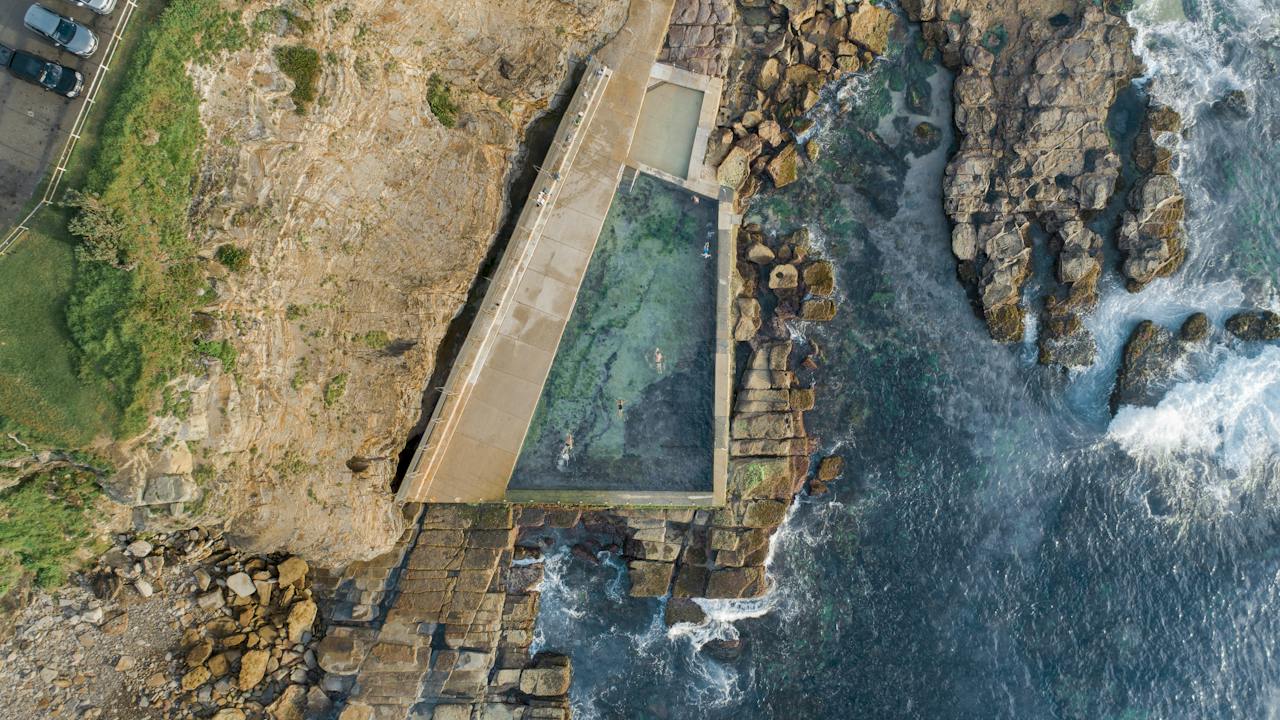
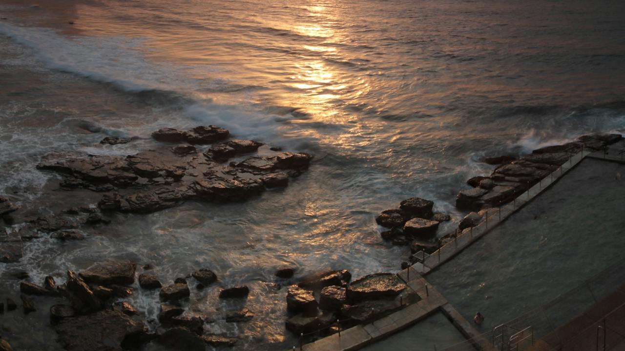
Located at the southern end of Newport Beach, this tranquil 50-metre rockpool is a beautiful place to go for a swim. Access is gained from the walkway at the corner of Calvert Parade and the Boulevard or along the beach from the beach carpark. Change rooms and toilets are available. Pay & Display parking available. A playground is located to the south of the surf club with large grass expanses and electric barbeques. Many cafes are located close by.

Newport NSW

1.7 km away

View place
Bungan Beach
Image credit: Northern Beaches Council

Natural Attractions

Bungan Beach

Bungan Beach is a surf beach that is 600 metres long running south-southeast between Bungan and Mona Vale Heads. A single bar runs the length of the beach with two strong rips against the rocks at either end and two or three shifting rips along the beach. The general conditions of Bungan Beach are good for swimming and body surfing. Excellent surfing conditions at the north end.

Newport NSW

1.8 km away

View place
Clareville Beach from above
Image credit: Northern Beaches Council

Natural Attractions

Clareville Beach

The beach runs from Taylors Point in the south and north along the Pittwater foreshore. Clareville Beach has a lovely grassy area perfect for picnicking. There is also a boat ramp and a barbeque area. Please note this beach is not patrolled by Lifeguards. Location: off Delecta Avenue at Clareville.

Clareville NSW

2.4 km away

View place
Mona Vale Rock Pool
Image credit: Destination NSW

Natural Attractions

Mona Vale Rock Pool

Mona Vale rock pool is situated on the tip of a sand spit near the northern end of Mona Vale Beach. There are two rock pools here: a larger pool measuring 30 metres long, and a smaller pool which is suitable for children and less confident swimmers. These pools become surrounded by water at high tide, creating the illusion of floating in the middle of the ocean. Apex Park, located just behind the rock pools, features a range of amenities including electric barbecues, picnic tables, public toilets, bicycle paths, and a children’s play area. You can also find a number of shops and cafes on nearby Darley Street. Change rooms and toilets are available. Please note, that Mona Vale rockpool is not available approximately three hours before listed cleaning times and approximately 12 hours after, depending upon prevailing seas. Pay and display parking are available.

Mona Vale NSW

2.6 km away

View place
McCarrs Creek Reserve
Image credit: Northern Beaches Council

Natural Attractions

McCarrs Creek Reserve

The McCarrs Creek Reserve designates a section for off-lead dog activities on weekdays, delineated by signage and situated to the west of the primary access road. It features accommodations for up to 100 dinghies on vertical racks – maximum length 3 metres Additionally, visitors can enjoy ample amenities including a spacious grassy expanse, complete with seating arrangements, barbecue facilities, and picnic areas. The reserve is conveniently situated along McCarrs Creek Road in Church Point.

Church Point NSW

2.6 km away

View place
Mona Vale Beach
Image credit: Destination NSW

Natural Attractions

Mona Vale Beach

Mona Vale is effectively two separate beaches separated by a broad ocean rock platform. Waves that roll in along the southern edge of the platform surge into a gully that allows them to break smoothly and with considerable power. The undertow this creates can be troublesome to swimmers, so it’s just as well the gully is right beside the surf club’s patrolled swimming area. Heading south towards Warriewood, Mona Vale opens up as a series of fun, uncrowded beach breaks known as Cooks Terrace. The bay to the north of Mona Vale proper is called The Basin, and here you’ll find a small right-hand reef break, perfect for cruising on a longboard. The Basin tends to be more sheltered than the main beach, however there is no patrolled area. The rock platform which splits the beach in two has a 25-metre ocean-fed lap pool (free entry) and a smaller pool for the children. The main beach is one kilometre long, very beautiful and great for walking. There is also a cafe located at the Surf Life Saving Club. Close by is a shaded playground and a large parking area.

Mona Vale NSW

2.7 km away

View place
Avalon Oceanpool
Image credit: Northern Beaches Council

Historical Sites and Heritage Locations

Avalon Rockpool

Avalon Rockpool is located at the southern end of Avalon Beach, nestled amongst the rocks. There is a shallow toddler pool that is great for the little ones to splash around in. Afterwards, head to one of the local cafes for a delicious healthy snack. Facilities include a kiosk nearby, public toilets, showers and change rooms. This area provides a playground, picnic area, and a skate bowl as well as a huge array of cafes located in Avalon. Access is from the car park off Barrenjoey Road. Pay and display parking is available. Please note, that Avalon Rockpool is not available approximately three hours before listed cleaning times and approximately 12 hours after, depending upon prevailing seas.

Avalon Beach NSW

3.1 km away

View place
Avalon Beach
Image credit: Andrew Gregory; Destination NSW

Natural Attractions

Avalon Beach

Over the last decade or so, Avalon has become the favoured "sea-change" destination for Sydney-siders looking to adopt the surfer lifestyle. As a result, the board-riding community here is large and enthusiastic, but the skill level varies greatly, so it's a good idea to watch for a bit before paddling into the fray. North Avalon breaks along the north headland and a nearby sandbank and attracts longboarders who don't always succeed in getting out of each other's way. South Avalon is centred on a triangle-shaped sandbank near the 25-metre ocean rock pool (free entry) that generates a mix of fun, easy waves. The edge of the south cliff is known as Little Avalon, and here the swell sucks up hard on a shallow rock shelf to produce fast-barrelling tube rides. Other facilities include a shady park, picnic and barbeque area as well as a skate park. Avalon shopping village is close by, where you will find a variety of shops that reflect the surf lifestyle of the area; surf shops, homeware and fashion boutiques, wholefood stores, bookstores, seafood joints and intimate cafes. Good swimming and body surfing conditions Strong shore break at times Excellent surfing conditions at the north end Good surfing breaks along the beach. Best in North Easterly winds.

Avalon Beach NSW

3.4 km away

View place
Paradise Beach

Natural Attractions

Paradise Beach

On the foreshore of Pittwater this beach area with a netted enclosure is a popular swimming area for families or those after a relaxed paddle. Peaceful and picturesque, sitting below residences tucked into the bushland above and with stunning views across the water of Ku-Ring-Gai Chase National Park, this idyllic spot lives up to its name. A boardwalk runs along one side of the enclosed swimming area. You won't find toilets, a playground or a kiosk here and parking is limited, so this treasure is best for quick dips or stays that last only until your snack supplies run out.

Avalon Beach NSW

3.6 km away

View place
Paradise Yoga
Image credit: Paradise Yoga

Sports and Recreation Facilities

Paradise Yoga

Overlooking Pittwater and surrounded by ancient spotted gum forest, this intimate yoga studio in Sydney’s Northern Beaches focuses on gentle styles of yoga to reduce stress and anxiety. Owner and teacher Claire Lane offers hatha yin yoga classes, as well as yoga nidra, a sleep-based relaxation exercise that will have you floating all the way home. Paradise Yoga classes are suitable for all skill levels and ages, and classes are held at a maximum of six students, perfect for beginners. Yoga mats and props are all provided.

Avalon Beach NSW

3.6 km away

View place
The river on the GRW track

Sports and Recreation Facilities

The Great River Walk long distance walking track

The Great River Walk (GRW) is a long distance walking and bicycling track proposed to follow the entire length of the Hawkesbury River system from source to mouth, a distance of 475Km. The first major stage to be opened in December joins the river side locality of Lower Portland to near the river town of Spencer. This stage combines the beauty of the Hawkesbury estuary with the World Heritage convict precinct in Dharug National Park. The stage includes accommodation, camping facilities and even a haunted pub, the Wisemans Inn. It is 50km long and can be walked in 2 or 3 days.

Avalon Beach NSW

3.8 km away

View place
Warriewood Wetlands
Image credit: Northern Beaches Council

Natural Attractions

Warriewood Wetlands

At 26 hectares, Warriewood Wetland is the largest remaining sand plain wetland in the northern Sydney area. It provides a variety of habitats for native animals and also plays a vital role in flood mitigation, nutrient recycling and filtering sediments. The wetlands contain several Endangered Ecological Communities. The 2.4-kilometre walkway network provides an excellent opportunity to enjoy the natural attributes of the wetlands and gives bird watchers greater access to enjoy their passion. The wetlands are popular with Sydney’s birdwatching community, particularly in autumn when the swamp mahogany trees are in flower. Over 80 bird species have been recorded including the endangered Regent Honeyeater, the Goshawk and Powerful Owl. Dogs are prohibited from the boardwalk due to the sensitive environment. Bikes are prohibited from the boardwalk because of the narrow nature of the walkways.

Warriewood NSW

4.3 km away

View place
Bangalley Headland at North Avalon
Image credit: Northern Beaches Council

Natural Attractions

North Avalon Neighbourhood Walk / Bike Route

A short walk or ride around North Avalon to discover this quiet neighbourhood and it's hidden gems. You will find shops, cafes, beach, library, netball courts, skate park and a cinema. Bushwalks in Bangalley Headland - one of the largest bushland reserves on the Northern Beaches coastline with beautiful views up and down the coast.

Avalon Beach NSW

4.4 km away

View place
North Narrabeen Rockpool
Image credit: Northern Beaches Council

Natural Attractions

North Narrabeen Neighbourhood Walk - Bike Route

Here's a short walk or ride around North Narrabeen. Discover this neighbourhood and its hidden gems. Walk or ride past the Warriewood Wetlands, past the scenic Turimetta Headland. Enjoy the beautiful views from North Narrabeen Headland and Lookout Enjoy shops, cafes, reserves, pools, and beaches. Nearby bushwalks include Warriewood Wetlands and the Turimetta Headland.

North Narrabeen NSW

5.0 km away

View place
North Narrabeen Rockpool
Image credit: Northern Beaches Council

Natural Attractions

North Narrabeen Rockpool

North Narrabeen Rockpool is located at the entrance to Narrabeen Lagoon. The access to the pool is from Narrabeen Park Parade, located opposite the NRMA Lakeside caravan park. The rockpool is 50 metres long and a timber walkway encloses a smaller pool within the larger lap pool. Next to the pool, there are plenty of natural rock pools perfect for spotting sea creatures. This makes North Narrabeen a great spot for families with curious young kids.

North Narrabeen NSW

5.3 km away

View place
Whale Beach Rockpool
Image credit: Northern Beaches Council

Natural Attractions

Whale Beach Rockpool

Whale Beach Rockpool, situated at the southern end of the beach, is easily accessible from The Strand. This 25-metre rockpool boasts a shallow depth and a soft, sandy bottom, making it ideal for families with young children to enjoy a safe and relaxed swim. Surrounded by natural beauty, the rockpool offers stunning panoramic views of the ocean and the rugged coastline, creating a serene atmosphere perfect for unwinding. Whether you're taking a refreshing dip, snapping photos of the picturesque surroundings, or simply soaking up the tranquil vibes, Whale Beach Rockpool is a must-visit spot for both locals and visitors.

Whale Beach NSW

5.3 km away

View place
The Basin picnic area

Natural Attractions

The Basin picnic area

When you need a city escape, gather the crew and set sail for The Basin picnic area, nestled in the bush on the eastern shores of West Head in Ku-ring-gai Chase National Park. Accessed by walking track from West Head or ferry across Pittwater from Palm Beach, there's something for everyone at this popular spot. With lovely views of the water and heaps of activities, you'll be hard pressed deciding what to do first. The kids will love swimming and paddling at the sheltered beach and inland lagoon and if you're keen to explore on foot, there's nearby Bairne walking track. When it's time for lunch, unpack the picnic hamper or spark up the barbecue and tuck in. After a day of relaxing, it might be hard to pack up and leave this idyllic oasis. If you want to make a weekend of it and stay overnight at The Basin campground nearby. Be sure to book ahead, as this is a popular place to stay in spring and summer. Take a virtual tour of The Basin picnic area captured with Google Street View Trekker.

Ku-ring-gai Chase NSW

5.7 km away

View place
Red Hands Cave Walking Track - Ku-ring-gai Chase National Park
Image credit: Photo: Andy Richards/NSW Government

Natural Attractions

Red Hands Cave Walking Track - Ku-ring-gai Chase National Park

For an opportunity to see one of the most famous Aboriginal heritage sites in Ku-ring-gai Chase National Park, Red Hands Cave walking track is the route you're looking for. Head out from Resolute picnic area on this easy bush track to see rock art of the Aboriginal people of this area. Arriving after a short walk through the red gums, you’ll discover the cave with ochre hand-prints. Pause for a moment to reflect on the lives of the people whose palms are now immortalised. The Aboriginal People of this area are part of a nation that extended Broken Bay in the north to Port Jackson in the south and as far south-west as Lane Cove River. There are six clans within the nation, and it’s the Garigal who lived at West Head. Retrace your steps, or if you’re inspired to experience more, continue on the Aboriginal Heritage walk for another four kilometres before returning back where you started at Resolute picnic area.

Ku-ring-gai Chase NSW

6.0 km away

View place
Salvation Loop Trail
Image credit: Photo: Andy Richards/NSW Government

Natural Attractions

Salvation Loop Trail

A delightful, easy walking track through unique hanging swamps off West Head Road in the middle of Ku-ring-gai Chase National Park, Salvation loop trail offers a perfect outing for the family and a brilliant walk for nature enthusiasts who want to experience the wet heathlands of the park. Skirting the edge of the hanging swamp and wet heathland, notice how the vegetation changes. Only plants that don’t mind getting their feet wet can thrive here. You’ll see sphagnum moss, sword grass and the green-flowering swamp banksia. Coral and pink swamp heath are dotted through the heathland. On close inspection, you might discover the insect-eating sundew plant, which catches small insects with its velcro-like mitts. If you want a longer walk, take the turn off to Wallaroo walking track, or simply continue on the loop and walk back along the road. Lay out a picnic lunch on the tables at Salvation Creek picnic area.

Ku-ring-gai Chase NSW

6.0 km away

View place
The Basin track and Mackerel track
Image credit: Photo: Andrew Richards

Natural Attractions

The Basin track and Mackerel track

Walking the scenic Basin track and Mackerel track is an excellent way of exploring Ku-ring-gai Chase National Park. You can start both these tracks from West Head road, 8.5 kilometres from the Liberator General San Martin Drive junction. Head along the ridge top and stop to explore the Basin Aboriginal Art site. From here, follow signs to The Basin campground, and enjoy glimpses of Pittwater through the trees before descending to the campground. Spend as much time as you like in this popular area. Take a refreshing swim, play games on the grass and enjoy the facilities. Walk back to West Head Road via the Basin trail, or alternatively you can catch a Palm Beach Ferry and enjoy some of the beaches of Pittwater. To explore the Mackerel track take the left hand turn after the Basin Aboriginal Art site. Head out to the point to enjoy the impressive views across Pittwater, and look down upon Mackerel Beach to the north and Currawong to the south. To return, follow the Mackerel track back to West Head road.

Ku-ring-gai Chase NSW

6.0 km away

View place
Sandy Beach
Image credit: Northern Beaches Council

Natural Attractions

Sandy Beach - Northern Beaches

Sandy Beach is located on the foreshore of Pittwater at Palm Beach and south of Sandy Point. Access to the beach is off Iluka Road and the beach has an area to launch boats. The beach provides a safe haven for swimming and family picnics and there are two boat ramps available.

Palm Beach NSW

6.1 km away

View place
The Beach Bible Garden

Parks and Gardens

The Beach Bible Garden

The Bible Garden is a quiet, contemplative, garden made up of a series of gently descending, intimate grassed terraces that lead down to a viewing area providing spectacular views. The pond contributes to its tranquility and provides a water habitat for biblical plants. Located in the northern Sydney region, Gerald Hercules Robinson established the Bible Garden in the 1960s.

Palm Beach NSW

6.3 km away

View place

What is happening now?

Search dated events, markets, live music, sport and community activities.

Explore Events

Planning by place?

Use Things to Do for attractions and experiences that are not tied to one event date.