Places worth discovering

Things to Do

Find attractions, experiences and places to visit. Events remain the best way to see what is happening on a particular date.

Looking for a dated event? Explore Events

90 places

Explore local places

Kingaroy Memorial Park

Parks and Gardens

Kingaroy Memorial Park

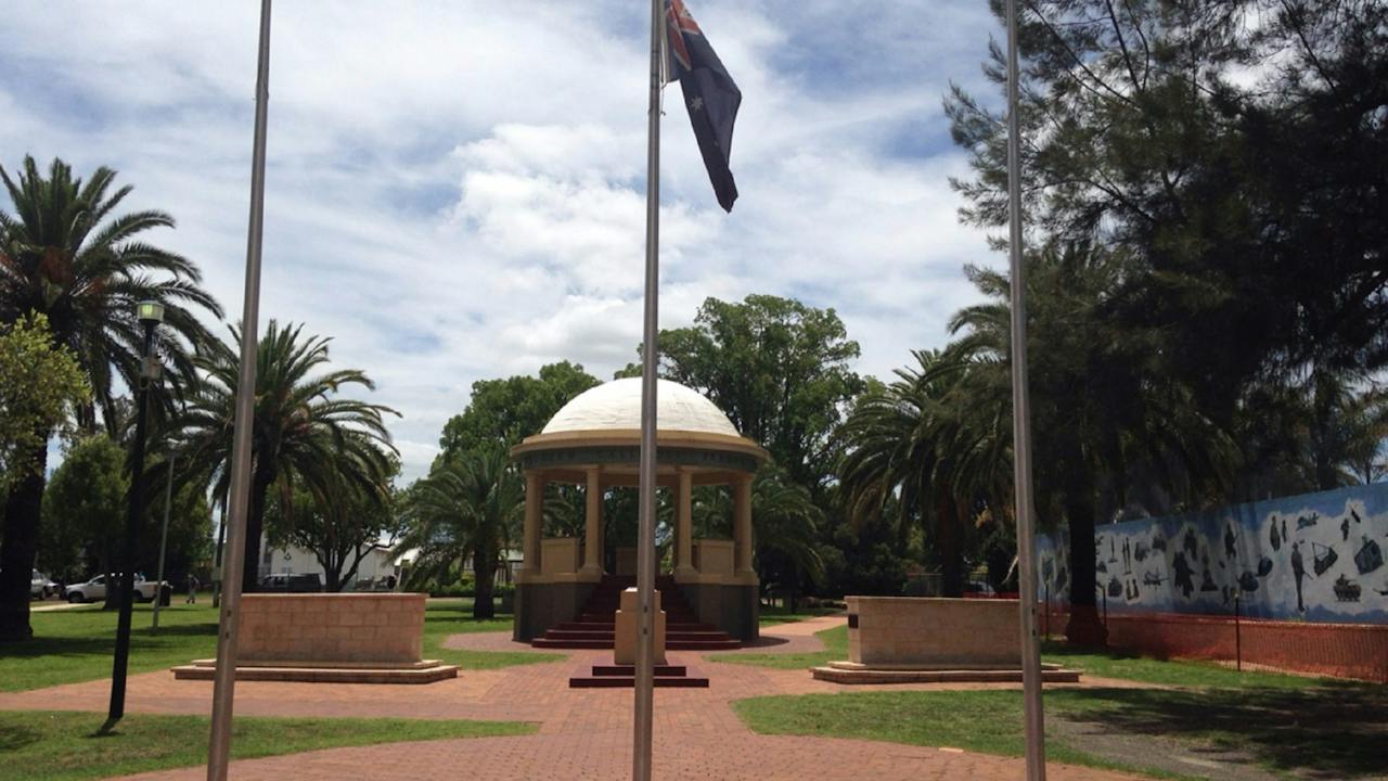
Kingaroy's beautiful Memorial Park is located near the heart of town and is the major formal park in the Shire. The War Memorial is located in the park and is a band rotunda constructed of eight classical columns, supporting a frieze and a domed roof. The frieze contains the names of the areas where the armed forces fought in World War I. Sir Thomas William Glasgow dedicated the memorial on 29 June 1932. To the west of the rotunda is the Stone of Remembrance honouring those who served from World War I to Vietnam. All ANZAC Day and Remembrance Day services are held there. The park has extensive flower gardens, paved paths, modern play equipment, picnic tables, barbecue facilities (coin-operated on William Street side) and amenities that also have disabled access. The park also offers an off-leash area for dogs on the Alford Street side. The Kingaroy swimming pool is beside Memorial Park on William Street and this adds to making the park a pleasant place to stop and have a quiet break and relax while taking advantage of the facilities.

Kingaroy QLD

0.0 km away

View place
South Burnett Rail Trail
Image credit: South Burnett Rail Trail

Natural Attractions

South Burnett Rail Trail

South Burnett Rail Trail Welcome to Queensland's first sealed rail trail, a 43.5km recreation trail between Kingaroy and Murgon in the beautiful South Burnett, only 2.5 hours from Brisbane. Whether you choose to cycle, run or walk the South Burnett Rail Trail is suitable for all ages. Dogs on leads are welcome, please clean up after your pet. The South Burnett Rail Trail starts at O'Neill Square in the centre of Kingaroy and progresses north. Visitors travelling the trail will enjoy picturesque surrounds and welcoming, country towns. Choose your own adventure, there's plenty to see and do as you journey through Kingaroy, Crawford, Memerambi, Wooroolin, Tingoora, Wondai and Murgon. Short distances between towns means a spot to refresh is never too far away. Enjoy a break and recharge with coffee at the cafes along the route or experience lunch at an authentic country pub. The South Burnett Rail Trail allows families to enjoy the great outdoors safely and encourages people of all ages to be active and enjoy fresh country air and a healthy lifestyle.

Kingaroy QLD

0.5 km away

View place
Kingaroy Art Gallery
Image credit: South Burnett Regional Council

Galleries, Museums and Collections

Kingaroy Regional Art Gallery

Kingaroy Regional Art Gallery is the place if you're looking for beautiful local art or a creative keepsake of your travels. It's the oldest public art space in the South Burnett and has a growing reputation as one of Southeast Queensland's most dynamic arts hubs. The gallery is run by not-for-profit Kingaroy Arts Team Inc, a group of art lovers intent on giving a diverse programme of exhibitions and events throughout the year. They delight in hosting exhibitions which break new ground, and can be fun, thought provoking or just plain quirky . The Gallery is supported by the South Burnett Regional Council which maintains the heritage-listed Art Deco building it occupies within the Kingaroy Information, Art and Heritage precinct (directly opposite the town's iconic peanut silos). 'Shop 38' is the Gallery's surprise package for locals and out-of-town visitors, as it presents a constantly changing showcase of South Burnett art and high-end craftwork. Shop 38 takes its name from the year the Art Deco-style former Shire Council Chambers were opened. The building is a destination in itself, retaining many handsome Deco features. Regular highlights include the biannual David Bryce Rural Art Award, the Queensland Winter Craft Festival June and July, Christmas pop up shop late November-December. KAT Members Art Show.

Kingaroy QLD

0.8 km away

View place
Peanut Thrusher
Image credit: SBRC

Galleries, Museums and Collections

Kingaroy Heritage Museum

Kingaroy's fascinating Heritage Museum is housed in what was the town's powerhouse from 1925 to 1952, and is now part of the Kingaroy Information, Art and Heritage Precinct. As Kingaroy is the Peanut Capital of Australia, the history of the local peanut industry is a focus of the collection, with exhibits of agricultural machinery showing the ingenuity and inventiveness of the local farmers and tradespeople. Machinery for farming peanuts was not available in the early 1920s, so farmers invented their own. The first being a bicycle powered thresher built in 1909, then a local farmer converted an American-made wheat thresher to thresh peanuts. In the late 1920s. Mr Harry Young designed and built his very own dinosaur – a stationary peanut thresher. These machines are on display in the museum along with other prototypes of peanut harvesting machinery designed and built by local inventors. Some of their ideas are still in use today. The entry to the Museum can only be accessed through the Kingaroy Visitor Information Centre.

Kingaroy QLD

0.9 km away

View place
Birdwatching in the South Burnett

Natural Attractions

Birdwatching in the South Burnett

With more than 350 recorded species, the South Burnett is a bird watchers dream. The region is known for the Black-breasted Button-quail and Glossy Black-Cockatoo, but expect to see the likes of the Red-rumped Parrot, Regent Bowerbird, Rainbow Bee-eater, Dollarbird and Spiny-cheeked Honeyeater too. A diverse array of habitats from dry rainforest and hoop pine forests, to expansive water masses, open woodlands and soft vine scrub, ensures prolific bird life year round. Try these local hot spots: Lake Barambah, Nanango Fauna Sanctuary, Mudlo Conservation Park Kilkivan, Wooroolin Wetlands; Gordonbrook Dam; Boat Mountain Regional Park, Bunya Mountains National Park. Viewing platforms, lookouts and walking tracks are great vantage points, but keep your eyes peeled wherever you are, as you can spot birds along quiet country roads, in parks and urban areas. The South Burnett is ideally situated two and a half hours from Brisbane, the Sunshine and Fraser Coasts. It is fringed by the pine-clad Bunya Mountains to the south-west, the hoop-pine covered Blackbutt Range to the east and the historic Burnett Range to the north. Pack your walking shoes, picnic, hat, bird book and binoculars and record your own list of sightings in the South Burnett.

Kingaroy QLD

1.0 km away

View place
Lions Park, Kingaroy

Parks and Gardens

Kingaroy Lions Park

Kingaroy Lions Park is located in Kingaroy Street, near the heart of town. It is a pleasant small park with roofed picnic tables, play equipment, a coin operated barbecue and disabled toilet facilities. This park is a good place to break your journey to relax and plan your drive around the South Burnett. Children will love the colourful playground equipment and the fun photo cut out frames of a peanut and a navy bean! Both crops have contributed much to the development of the Kingaroy area. Kingaroy's famous Peanut Van is beside the park and what better way to finish off your meal than by sampling local produce. Lions Park is also the location for South Burnett Regional Council's dump point for caravans. Adjacent to Lions Park is Bjelke-Petersen Recreation Area - a large green open space with walking and cycle paths, centred on Kingaroy's Town Common. It was developed on reclaimed land created by the town's flood mitigation scheme in the early 1980s.

Kingaroy QLD

1.4 km away

View place
Picnic area at Apex Park
Image credit: South Burnett Regional Council

Parks and Gardens

Kingaroy Apex Park and Lookout

A peaceful rest stop, Apex Park was the site of the first public hospital in Kingaroy and was developed by the Apex Club in the mid 1960s. The large trees you see today are the original plantings from the hospital grounds. A resident of the area donated the steam engine in the centre of the park. There is a memorial in the park in recognition of the great contribution of Matron Norma McDiarmid (1915-1944) erected by Kingaroy Past and Present Nurses Association. A walking track through native bush takes you to the lookout on Coral Street. The viewing platform affords panoramic vistas of Kingaroy and surrounds including the iconic peanut silos, Tarong Power Station and Coolabunia Hill (home to the late Joh and Lady Florence Bjelke-Petersen). Towards the south-west, are expansive views of the Bunya Mountains. There is a large playground and towering shade trees perfect for relaxing under. Bring a picnic and enjoy a pleasant afternoon in the peaceful surroundings. All play equipment is on rubber-based soft fall material designed to reduce impact. There is a wood barbecue under the sheltered picnic area and toilet amenities available.

Kingaroy QLD

1.7 km away

View place
Kingaroy Rotary Park

Parks and Gardens

Kingaroy Rotary Park

On the eastern side of Kingaroy, Rotary Park offers a large covered picnic table and barbecue providing a welcome area for travellers to break their journey. Travel east along Haly Street until the lights at Fisher Street. The park is just through the lights on the right. The park is ringed by tall shady trees, which provide welcome shade on hot days. Children delight in playing on the modern play equipment and there are wide grassed areas to play in. Toilet facilities with disabled access are available here as well.

Kingaroy QLD

1.7 km away

View place
Steps to top Mt Wooroolin
Image credit: SBRC

Natural Attractions

Mount Wooroolin Lookout

You'll find great views from Mount Wooroolin Lookout, just over four kilometres west of Kingaroy. Established in 1988 as a bicentennial project by Kingaroy Shire Council, the area features a grassed area with picnic tables and wood barbecues. The elevated viewing platform offers 360 degree panoramic views of the surrounding countryside: Coolabunia Hill, the Bunya Mountains, Queensland's second oldest National Park and Tarong Power Station, which generates approximately one fifth of Queensland's power. To the northwest is pretty Gordonbrook Dam, the source of Kingaroy's water supply. The ramp to the viewing platform is smooth for disabled access, but care needs to be taken, as it's quite steep. The nature reserve is 160 acres of endangered eucalypt woodland and dry vine forest. Bird watchers are often rewarded with sightings of Regent Bower Birds, Black Breasted Button Quail and Eastern Shrike-tit. Visitors are advised to take care while ascending or descending the narrow sealed road to the top; it's not suitable for cars towing caravans or trailers.

Kingaroy QLD

3.0 km away

View place
Kingaroy Observatory
Image credit: Kingaroy Observatory

Observatories and Planetariums

Kingaroy Observatory

Kingaroy Observatory is Queensland's largest self-funded public outreach stargazing attraction, located 250M along Geoff Raph Drive up from the airport terminal. They have three, Meade 14 inch telescopes to show you the Universe and Planets up close! One of these telescopes is et-up Equatorial for both Visual and Astrophotpgraphy. They also have Qld's very first electronic digital colour eyepiece , called a SMARTEYE that shows everything in colour. During your night visit, the astronomer points out various constellations and stars using a registered green laser pointer, and gives an ongoing commentary of what you are viewing in the telescopes. The observatory has a ramped entrance, making it easy for walking, wheely walkers and wheelchairs. Each telescope can be adjusted up and down to suit any height, including those in a chair. Bookings are essential. Book online from their website's calendar, seen on the home page. The observatory is owned and operated by retired Research astronomer, James aka Dr Jim Barclay who has over 65 years in Astronomy. His passion and knowledge of the Universe will astound you ! This facility has plenty of off-street and roadside parking. They conduct Basic to Advanced Astro-photography and Astronomy workshops and the Astronomer can be hired out for School visits and community events.

Taabinga QLD

5.3 km away

View place
Wooroolin Wetland

Natural Attractions

Wooroolin Wetland

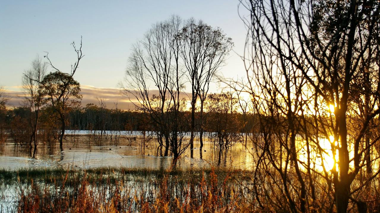
The Wooroolin Wetland is located at the township of Wooroolin, 16 kilometres north of Kingaroy along the Bunya Highway. Wooroolin Wetlands was declared a fauna sanctuary in 1973, now classified as a palustrine wetland, a non-tidal, inland, seasonally flooded, vegetated swamp. After successive floods in 2011 and 2013, the wetland burst its banks and Wooroolin was flooded for the first time in recorded history. A bird hide and two walking trails have been established for naturalists to fully appreciate resident and migratory fauna. However the walking trails are only accessible during dry periods and can be accessed from Wooroolin Sports Ground. Over 25 different birds have been sighted including nankeen kestrels, striated pardalotes and golden-headed cisticola. Over two kilometres of endangered vegetation has been fenced to help restrict access and protect the local and regional species. Revegetation is taking place in this eucalypt woodland and particular attention is being paid to the endangered Queensland Blue Gum. Wooroolin State School planted 80 native trees in 2003 and will continue with an annual tree-planting program. Nesting boxes have been provided as alternative habitats for sugar gliders and possums. Interpretive signage has been erected to promote project achievements, local information, wildlife and tracks.

Wooroolin QLD

14 km away

View place
Gordonbrook Dam

Natural Attractions

Gordonbrook Dam

Gordonbrook Dam is the sole water supply for Kingaroy and a peaceful spot to unwind. Originally built in 1941 as a water supply for the Royal Australian Air Force Training Base during WWII, the dam wall was raised in 1987 to inundate an area of 229 hectares - the dam we have today. Take in the beautiful dam views from the viewing platform or a variety of walking tracks along the waters edge. Enjoy a picnic at the tables provided and use the wood fired barbecues. The dam provides a haven for over 100 different species of birds. Bring your binoculars and camera to record sightings. The area is a significant migratory water bird site with sightings of Jacanas, White Breasted Sea Eagles and Pygmy Geese as well as the more common water birds such as Black Ducks and Egrets. Camping is not permitted at the dam along with swimming, fishing, sailing and low horse-power boating due to blue/green algae in the water.

Kingaroy QLD

15 km away

View place
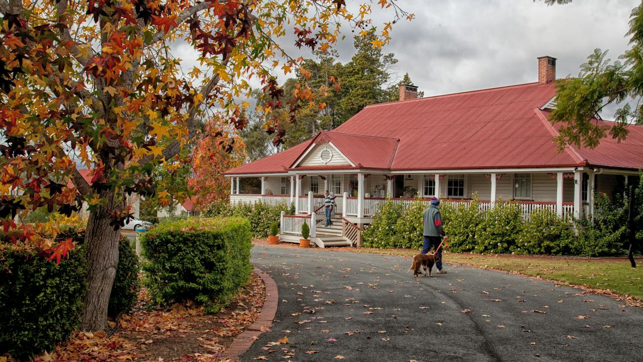
Ringsfield House during the autumn months in the South Burnett
Image credit: South Burnett Regional Council

Galleries, Museums and Collections

Ringsfield House and Museum, Nanango

Ringsfield House is more than just a large Queenslander; it has a link to thousands of people in the South Burnett, and home to many stories as the sunshine state's fourth oldest town. Ringsfield House began as a magnificent family home designed by the well-known Architect Robin Dods. From 1908 until 1942 when the family aged and moved away. When the house was first built it had open verandahs. The original owners, Mr and Mrs James William Davies Graham would attend to their children using a secret passageway through the cupboard in the main bedroom which lead to the nursery. From 1942 to 1970, it became a four-ward maternity hospital. Some 3,000 - 4,000 births were registered at Ringsfield House. Hundreds of those people still live in the local area. By 1973 the house was a Lifeline refuge for deserted wives and their children and continued in this capacity for a further 20 years, it then became derelict. In 1992 to 1996, the then Nanango Shire Council, restored Ringsfield House as a Museum and Historical Centre. From November 2017, Ringsfield House operated as a museum, a cafe, a tourist destination, a restaurant, and an events venue. It continues to draw people far and wide to experience the beauty, peace, and tranquillity that Nanango has to offer.

Nanango QLD

22 km away

View place
Bike Power
Image credit: SBRC

Galleries, Museums and Collections

Nanango Visitor Information Centre & Energy Centre

The Nanango Visitor Information Centre is located on 41 Henry Street Nanango. This visitor information centre offers a one stop shop for travel information including maps, brochures, and itineraries. Staffed by skilled and knowledgeable locals, the Information Centre can provide advice on the things to see, things to do and where to eat. The South Burnett Energy Centre reflects the past, the people and the energy technology that developed the region and continues to mould its future. The visually exciting displays are located in a building formerly owned by Tarong Coal and incorporate a number of time lines and interactive displays as well as the original engines that supplied energy to Nanango for the first time in 1933. Come along to experience and discover the history of power generation in the South Burnett. Power up your very own virtual power station. Peddle a bike to generate all forms of energy with the ultimate result of a "gobstopper". Ponder over the original working motors which provided the first reticulated power to Nanango in 1933.

Nanango QLD

22 km away

View place
An old timber wagon on show at Tipperary Flat, Nanango
Image credit: South Burnett Regional Council

Historical Sites and Heritage Locations

Tipperary Flat

Tipperary Flat, situated at the southern entrance to Nanango adjacent to Lions Park and the BP Service Station, is a well equipped picnic area featuring a walking trail leading visitors around the historic displays with informative interpretive signs provided. In early days, Tipperary Flat was used for sports days and get-togethers with other families who lived close by and the name originated from the first settlers who came from Ireland. A walking track extends to the Tarong turnoff past ‘Hannibal’, the first Tarong Coal Dragline Bucket, and has become a popular pastime for residents, visitors and pets. Adjacent to Tipperary Flat is an existing stand of Bunya Trees, a special icon of the natural and cultural heritage of the South Burnett, which acknowledge the original inhabitants. Tipperary Flat is an informative rest stop on your journey through the South Burnett.

Nanango QLD

22 km away

View place
Reg McCallum Park
Image credit: South Burnett Regional Council

Parks and Gardens

Reg McCallum Park

Located in Henry Street, Nanango, this attractive park, Reg McCallum Park, is named after the former Mayor of the Nanango Shire, Reg McCallum, who had been the Mayor for over 25 years. The facilities include public toilets with wheelchair access, parenting rooms, free showers, playground, tables and chairs. The South Burnett Energy Centre - Nanango (Information Centre) can also be found across the road, which provides services that include: the Tarong Power Display, information on attractions, accommodation and businesses, as well as offering history research, a range of souvenirs and other goods.

Nanango QLD

22 km away

View place
Lions Park - Nanango

Parks and Gardens

Lions Park - Nanango

Lions Park is a lovely stop just off the D'Aguilar Highway, on the south side of the township of Nanango. Facilities include toilets, a barbecue, a playground for the kids, shelter and tables. This park is alongside Tipperary Flat, which is a tribute to the Pioneer Days. The Peanut Wagon is also located nearby.

Nanango QLD

23 km away

View place
Music Festival at Pioneer Park, Nanango
Image credit: South Burnett Regional Council

Parks and Gardens

Pioneer Park

Pioneer Park is located on the western side of Sandy Creek and beside Drayton Street, and was once called Nanango Park when it was first developed in 1919. This reserve between the Primary School and the Railway Station was used as a memorial to the soldiers of the First World War. Camphor Laurel and Pepperina Trees were planted on the eastern side of the creek and assigned to the school to care for them. Due to lack of public interest, this reserve was returned to its original state when the fences and trees were broken down and cattle were allowed to graze on the land. Pioneer Park came into being in 1978 when Joe Anderson became deeply involved with the concept. It wasn't until 1982 when the Nanango Rural Youth Club installed picnic tables and a barbecue. Development continued over the years. However, the old curved railway bridge across Sandy Creek and railway station still remain to remind us of what once used to be.

Nanango QLD

23 km away

View place
Nanango Fauna Reserve
Image credit: Visit South Burnett

Natural Attractions

Nanango Fauna Reserve

Just ten minutes out of Nanango, the peaceful Nanango Fauna Reserve offers many different environments to explore, from seasonal waterholes to eucalypt woodland, acacia scrub, and dry vine scrub. It is a bird watcher's delight with a variety of species to be found including the Yellow-Faced Honeyeater, Australian Darter, Varied Sittella, Nankeen Night Heron, and Little Black and Little Pied Cormorant.

Nanango QLD

23 km away

View place
Coronation Park view from pub
Image credit: SBRC

Parks and Gardens

Coronation Park

Coronation Park is part of Wondai's attractive streetscaping. Situated in the centre of Wondai Central Business District, the Park is well utilised by both residents and visitors. There are gardens, covered picnic tables, benches, a public toilet (with disabled access), a bus shelter and a covered pavilion area. Enjoy a break here before exploring the heritage attractions of Wondai.

Wondai QLD

25 km away

View place
Kumbia

Galleries, Museums and Collections

Kumbia Federation Heritage Centre

In this collection you'll find a treasure trove of historical photographs, local historical records and artefacts relating to the early residents of Kumbia. The collection is thanks to the efforts of the Kumbia and District Historical Society (established 1980) and the Kumbia Hall Committee who joined forces to preserve and present as much local history as possible for the benefit of future generations and those interested in local history. Of particular note is memorabilia from the early 1900s and a large collection of historic photos of the district, many of which were the work of local freelance photographer Harold Mears. After his death in 1977, the Historical Society was successful in acquiring his entire collection of 13000 negatives. Many are of the local district, people and events. Many of the photos have been printed off and are available for sale as postcards. To carry on from Harold Mears' era the Society has been given a collection of slides of local interest, these are the work of Mr Ernie Garrett and covers the 1950s to the 1970s.

Kumbia QLD

25 km away

View place
Wondai Heritage Museum Entrance
Image credit: South Burnett Regional Council

Galleries, Museums and Collections

Wondai Heritage Museum

Extending over 1,600 square metres, and divided into several differently themed environments, the Wondai Heritage Museum offers an uncluttered insight into the development, and the people, of the Wondai town and district spanning 120 years. Military memorabilia and social development is the theme of the Formal Museum, which features, in particular. the bugle captured by local resident Jim Houston and played by him at the 1945 Japanese surrender at Morati. The relocated 1910 Wondai Hospital operating theatre houses implements and history of a medical nature, and makes up the Hospital Complex. On a larger scale, the Machinery Shed houses many meticulously restored items, from sulkies and threshers to the extensive “Vince Miller” collection of timber tools, and that grand old octogenarian the “Dennis Fire Engine”. The 1930’s Slab Barn, complete with authentic shingle roof, is a fine example of pioneer construction, and now houses tools used by blacksmiths, cobblers, shearers and horsemen. For so long the hub of Wondai, the 1920’S Oddfellows Hall houses a display of intricate lodge regalia, but principally featuring theatrically-styled settings depicting, schoolroom, laundry, kitchen, bedroom, cinematic and printing room in a sauntering walk back through time. And did they mention it's fun! Yes it is!

Wondai QLD

25 km away

View place
Dingo Creek Park

Parks and Gardens

Dingo Creek Park

Looking for a shady place to have lunch or let the children run free for a while? Dingo Creek Park, on the northern outskirts of Wondai, is the ideal spot. With lots of open space, shady trees, a covered children's play area, free electric barbecues, covered tables and benches, it is a great place to picnic or to take a break from driving. In good seasons the creek runs, attracting lots of bird life. On public holidays, over long weekends and during school holidays, a Driver Reviver station operates in the park. The park also serves as a gateway to Wondai's walking trails, inviting visitors to explore the natural beauty of the region.

Wondai QLD

25 km away

View place
Bjelke-Petersen Dam

Natural Attractions

Bjelke-Petersen Dam

Bjelke-Petersen Dam, also known as Lake Barambah or BP Dam, is just 15 kilometres from Murgon, at Moffatdale in the South Burnett. It is a popular and well-equipped area for recreational freshwater fishing, birdwatching, boating, picnicking and camping/caravanning. Picnic areas, barbecues, a general store, a caravan and recreation park and a boat ramp with a large car park make this the ideal place to relax for a day or extended stay. Bjelke-Petersen Dam covers 2,500 hectares and holds 1,450,000 megalitres of water, which is used for irrigation and water supply to Murgon and Cherbourg's towns. Koalas, wallabies and kangaroos can be seen around the lake, while the birdlife includes black swans, ducks, pelicans and cormorants. Bjelke-Petersen Dam is a popular freshwater fishing spot. A stocked impound permit is required to fish. The dam is routinely stocked with Golden Perch (or Yellowbelly), Australian Bass and Silver Perch, and you can also catch red claw (no permit required). Yallakool Camping and Recreation Park offer several accommodation options from powered and unpowered campsites to cabins and villas.

Moffatdale QLD

30 km away

View place

What is happening now?

Search dated events, markets, live music, sport and community activities.

Explore Events

Planning by place?

Use Things to Do for attractions and experiences that are not tied to one event date.