Places worth discovering

Things to Do

Find attractions, experiences and places to visit. Events remain the best way to see what is happening on a particular date.

Looking for a dated event? Explore Events

163 places

Explore local places

Adelaide River Railway Station (the new railway line is in the foreground).

Historical Sites and Heritage Locations

Adelaide River Railway Siding and Railway Bridge

The Adelaide River Railway Siding and Railway Bridge were constructed as part of the first leg of the North Australia Railway (NAR) which operated from 1888 until 1976. The bridge was one of the first to be constructed on the Palmerston to Pine Creek line and was one of the largest along this section of work. Constructed in 1887-88 the bridge was first crossed on 3 December 1888 by the Silverton. In 1941-42 the bridge was fitted with timber decking to allow single lane vehicular access during Wet Season flooding. It was further upgraded in 1952. The last train crossed the bridge on 30 June 1976, but it was used for road traffic until the Edwin Verburg Bridge was opened on 27 March 1980. The Railway Siding was the first main station complex on the North Australia Railway from Darwin to Pine Creek and had the only refreshment room on the line. During World War II it was of major significance because Adelaide River was a major military centre with the main hospital situated north of the township along with a number of Australian and Allied bases in the area.

Adelaide River NT

0.7 km away

View place
Memorial in the foreground, new railway line and historic station in the background.

Historical Sites and Heritage Locations

Memorial to Railway Workers Adelaide River

The memorial honours railway workers who worked under strict military conditions, carrying out work while under threat of enemy fire during the Second World War. It consists of a small brass plaque fixed to a granite stone. Honours Railway Workers, who worked under strict military conditions, carrying out work while under threat of enemy fire, and also some injured men during the 1942 to 1945 period in the Adelaide River area.

Adelaide River NT

0.7 km away

View place
Entrance to property upon which sits the remnants of the 4RSU unit alongside the Pell Airstrip

Historical Sites and Heritage Locations

WWII Pell Airstrip Camp A 4RSU Workshop, Adelaide River

Pell Airfield was named in honour of Major Floyd J Pell, who was killed during the first Japanese attack on Darwin on 19 February 1942. It was developed as part of the Aerodrome Development Program in early 1942 as an aircraft salvage, repair and servicing facility in contrast to airfields further north at Sattler, Strauss and Livingstone, which served as fighter strips. No. 4 RSU (Repairs and Salvage Unit) arrived at Pell in late 1942 and was one of a number of Repair and Salvage units to occupy the site, remaining there until May 1945. The unit undertook a number of salvage missions in remote and dangerous areas of the Top End of the Territory and carried out servicing to a range of operational aircraft types. No. 4 RSU relocated to Winnellie in mid-1945 and Pell was abandoned shortly after. The remaining camp, workshops areas and taxiways are relatively intact and combine to present a significant precinct representing the activities of a unit that saw none of the glamour of the operational flying units but was instrumental in the salvage, repair and return to operational service of a range of aircraft types.

Adelaide River NT

0.7 km away

View place
Adelaide River Pioneer Cemetery
Image credit: Heritage Branch, NT Government.

Historical Sites and Heritage Locations

Adelaide River Pioneer Cemetery

Located 150 metres south of the Adelaide River Railway Bridge the small cemetery contains a number of graves marked by headstones, wooden markers and star pickets. The Adelaide River Pioneer Cemetery was the first European cemetery in Adelaide River. It is uncertain when the cemetery was established but it is believed that the first burial was of a young gold-miner, Edwin Allen, who died on 16 November 1874. The last burial at the cemetery was for John George Chapman on 1 September 1971. He was buried in the grave occupied by his mate Alf Hatt, hence the two grave markers for the one grave.

Adelaide River NT

1.3 km away

View place
Tjaynera Falls (Sandy Creek)
Image credit: George Hiley

Natural Attractions

Tjaynera Falls (Sandy Creek)

Escape to the serenity of Tjaynera Falls (Sandy Creek) in the magnificent Litchfield National Park, 90km south of Darwin as the crow flies. The carpark here was the site of a timber cutting camp in the mid-1990s. Walk the 1.4km through the open valley lined with paperbarks to relax in the clear waters of the plunge pool at the base of the falls. Enjoy the stunning views of the open valley, sit down to a picnic lunch and relax by the waterhole. Accessible only by four-wheel drive vehicle, these falls attract less traffic than the readily accessible waterholes elsewhere in the park, and with campground facilities, make for an idyllic spot for a weekend away. The falls are located 1.7km south of Blyth Homestead, a structure built in 1929 and serves as a reminder of the tough conditions faced by the early pioneers. Road closures are in place over the wet season. Visit nt.gov.au/parks to check access. Camping should be booked online prior to arrival.

Batchelor NT

18 km away

View place
Church entrance
Image credit: Heritage Branch, NT Government

Historical Sites and Heritage Locations

St. Barbara’s Catholic Church

Built in 1954, St Barbara’s Catholic Church is significant because it is historically connected with the uranium mining industry at Rum Jungle. The church, which was built on the site of the former 1940s Royal Australian Air Force Chapel, was constructed by Irish miners employed at Rum Jungle by the British firm George Wimpey and Co. Pty. Ltd. The church retains much of its original features and fabric and demonstrates economic design principles. The method and materials used in constructing the church walls (recycled timber and prefabricated steel) are unique and architecturally significant. St. Barbara’s Church was named after the patron saint for architects, builders, carpenters, construction workers, explosives workers, geologists and miners, all of whom worked on the Rum Jungle uranium project. St. Barbara also protects against explosions and mine collapse. The church represents the provision of worship for the past and present community in and around Batchelor.

Batchelor NT

22 km away

View place
2 Squadron RAAF Hudson and personnel Batchelor N.T. Oct 1942

Historical Sites and Heritage Locations

Batchelor Airfield and Anti-Aircraft Battery

The Batchelor Airfield played a key role during World War II, used by both Australian and allied forces. Located just south of Darwin, the airfield supported heavy bomber operations and served as a vital logistics and refuelling hub during the Pacific campaign. Nearby, you'll also find remnants of an anti-aircraft battery, once part of a broader defence system designed to protect the airfield and surrounding region from Japanese air raids. Today, visitors can explore the site and get a sense of the strategic importance Batchelor held during the war.

Batchelor NT

22 km away

View place
Interpretative area and observation area for the site marked by a section of timber slat fence.

Historical Sites and Heritage Locations

Rum Jungle Mine Manager’s House

This house is a tangible reminder of the Australian Government’s commitment to develop uranium exploration, recovery and ore processing for the supply of uranium oxide to the USA and UK for atomic weapons development programs during the 1950s and 1960s. It’s a reminder of the government’s financial commitment towards the biggest single industrial enterprise in the NT during that period. The building’s design was adapted to the climatic conditions of the tropics, which included the use of lightweight materials such as asbestos cement sheeting, corrugated iron roofing and extensive use of louvre windows that could be adjusted to suit prevailing weather conditions and maximise ventilation. Large overhanging vented eaves and vented gables helped transmit cool air to the warmer regions of the roof space. The house was frequented by national and international high ranking government and private enterprise officials, including ex-Prime Minister of Australia Sir Robert Menzies and the Duke of Edinburgh, Prince Phillip. The house is an excellent example of an amended `elevated G type' tropical designed house and is the largest elevated G type house at Batchelor. It is one of only three remaining at the town and has both social and architectural significance.

Batchelor NT

22 km away

View place
Interpretative panels at the Batchelor Road entrance.

Historical Sites and Heritage Locations

WWII No1 RAAF Medical Receiving Station

This site is comprised of the remnants of the No1 RAAF Medical Receiving Station. It remains relatively intact and combines to present a significant precinct representing the activities of an essential service unit. The site is located approximately 1 kilometre south-west of the intersection of the Stuart Highway and Batchelor Road. The remnants are largely concrete floor slabs of various sizes.

Batchelor NT

22 km away

View place
Batchelor Primary School site - now Parks & Wildlife Office.

Historical Sites and Heritage Locations

Former Batchelor Primary School

The two-classroom Primary School built by the Rum Jungle uranium mining company, Territory Enterprises Pty Ltd, is similar in design to the company's executive housing. The school is elevated on concrete piers, is a timber framed building clad with asbestos cement sheeting and corrugated iron roof. The Former Batchelor Primary School (built 1953) is of social and historical importance to the Territory. The school is a tangible reminder and example of an early education facility built in response to the growth of the mining township of Batchelor and the need to provide for an expanding population during the 1950s.

Batchelor NT

22 km away

View place
Batchelor Museum

Galleries, Museums and Collections

Batchelor Museum

Batchelor has a unique history which the Museum keeps alive, showcasing aspects of aboriginal culture and the Federal Government’s agricultural plans of 1911. In WWII, Batchelor became a strategic base for the Pacific region. Rum Jungle Uranium Mine was established in 1952, the major economic activity in Australia at the time. With so much to take in, expect to spend an hour or two at this fascinating museum.

Batchelor NT

22 km away

View place
Block B with the later Block C in the background to the left

Historical Sites and Heritage Locations

Rum Jungle Single Womens Quarters

The site comprises two dormitory style accommodation blocks constructed in the mid-1950s for single employees of the Rum Jungle uranium mine. Each building consists of 6 bedrooms with separate kitchen, dining and ablution facilities. The buildings are nominated ‘Block A’ and ‘Block B’. There is a third building on the site nominated ‘Block C’ but this is of a much later date and is smaller. ‘Block B” is the only heritage listed building.

Batchelor NT

23 km away

View place
Blyth Homestead
Image credit: Tourism NT/Shaana McNaught

Historical Sites and Heritage Locations

Blyth Homestead

The historic Blyth Homestead is found in Litchfield National Park, on the Reynolds River 4wd track. The homestead site serves as a reminder of the tough conditions faced by pioneers in remote areas. Built by the Sargent Family in 1928, who also built and operated a tin mine nearby, the homestead was abandoned in the early 1960s. It has recently been restored and an interpretive display presents the trials and tragedies of this remote site. Please note that access to the homestead is by four-wheel drive only and is regularly inaccessible between November and April due to the tropical wet season.

Batchelor NT

28 km away

View place
Oldest art on the planet
Image credit: Zebra STONE

Galleries, Museums and Collections

Zebra Stone

Located on the edge of Litchfield National Park, Zebra Stone is a unique, family-owned gallery where ancient history meets modern artistry. This small business offers visitors a rare opportunity to acquire a piece of the Australian Outback found nowhere else on Earth. Zebra Stone is world-renowned for its striking, natural rhythmic iron patterns. Formed over 1.2 billion years ago, the stone remains a geological mystery, with scientists still debating how its precise patterns were created. Originally found in the East Kimberley, this rare material now only exists in isolated pockets of the Northern Territory. The family team manages the entire journey of the stone, from the labor-intensive mining process to the final, high-gloss polish. Every item is hand-cut, ensuring that no two pieces are identical. The exclusive collection features handcrafted jewellery, sculptural homewares, and bespoke stone tables. To maintain the integrity of the work and sustainability of resource, Zebra Stone sells exclusively to the public via its own gallery. This allows visitors to meet the family and gain first hand insight into the mining and manufacturing process. It is an essential destination for those seeking a rare, ancient treasure from the heart of the Northern Territory.

Finniss Valley NT

29 km away

View place
Magnetic Termites under a wet season sky.
Image credit: Parks and Wildlife Commission NT

Natural Attractions

Magnetic Termite Mounds

One of Litchfield National Park's most impressive sights is the hundreds of Magnetic Termite mounds standing up to two metres high on a wide flood plain. Up to 100 years old, these structures are unique to the northern parts of Australia. Stroll along the boardwalk and marvel at these enormous magnetic compasses, with their thin edges pointing north-south and broad backs facing east-west. Learn about these mounds and the larger Cathedral Termite mounds nearby at an information shelter that provides a fascinating insight into these remarkable creatures and their habitat. The viewing area with accessible boardwalks is just off Litchfield Park Road.

Batchelor NT

31 km away

View place
Litchfield National Park
Image credit: Tourism NT

Natural Attractions

Litchfield National Park

With 2WD accessible roads into most of the main waterfalls, it’s no wonder Litchfield National Park is one of the most popular spots in the Top End. Mix and match the attractions to make your own ‘Litchfield Loop’. Enjoy a day trip and discover popular swimming spots and short walks, or stay longer to experience the variety of campgrounds. Those who want a 4WD experience can find one along the Reynolds Track or to Central Valley - be well prepared. For keen walkers, try the Tabletop Track. Swimming and road access can change at certain times of the year. We recommend you check online before you visit. Campsite and multi-day walking fees for the Tabletop Track apply, and must be booked online before you visit.

Litchfield Park NT

34 km away

View place
Creek at Southern Campground in the early dry season.

Natural Attractions

Tabletop Track

Discover isolated and rugged landscapes of the Tabletop Range on this multi-day bushwalk in Litchfield National Park. The 39 - 46 km walk is suitable for experienced, fit and well-prepared bushwalkers. If walking the complete loop, you'll encounter scenic pools and waterfalls, savanna woodlands; monsoon forests; and rough, rocky country. You can reach the Tabletop Track via access tracks at Florence Falls, Wangi Falls and Walker Creek. Complete the full loop or choose a shorter section. If camping, you must stay at one of the three campgrounds on the Tabletop Track, or at designated campgrounds elsewhere in the Park. Book in advance to secure your spot.

Litchfield Park NT

34 km away

View place
Buley Rockhole
Image credit: Tourism NT/Backyard Bandits

Natural Attractions

Buley Rockhole

Enjoy a refreshing swim in the cascading pools of Buley Rockhole. This popular swimming spot, in the magnificent Litchfield National Park, is a great place to cool off and wind down after exploring the park. Wade through the pools, absorb the scenic bush surrounds or sit and relax, as the cool water rolls over your shoulders. Open for most of the year.

Litchfield Park NT

36 km away

View place
Florence Creek, Litchfield National Park.
Image credit: Parks & Wildlife Commission NT

Natural Attractions

Florence Creek walk

Florence Creek walk is an easy 3.2 km track between Florence Falls and Buley Rockhole in Litchfield National Park. Start at either end and follow the track through cool monsoon rainforest and open savannah woodland. As you go, look out for birdlife, including kingfishers, honey-eaters, fairy-wrens and pigeons. You might be lucky enough to see black flying-foxes (bats) roosting in the trees, or spot evidence of other wildlife such as nocturnal brown bandicoots or wallabies. At either end you can swim safely in the plunge pool at Florence Falls or the series of waterfalls and rock holes at Buley Rockhole.

Litchfield Park NT

36 km away

View place
Florence Falls

Natural Attractions

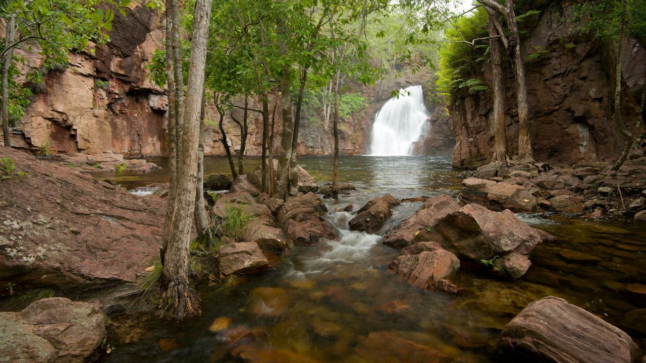
Florence Falls

Florence Falls is a popular swimming spot in Litchfield National Park. The spectacular falls cascade into a plunge pool, set in a pocket of monsoon forest. Florence Falls shares the same access road as Buley Rockhole. The falls flow year-round but are most spectacular during the wet season and early dry season. Two walking tracks lead to the falls. The shortest path is via a lockout and then down 160 steps. You can also access the falls via the 1 km Shady Creek Walk that takes you through savanna woodland and monsoon forest. Camping is available nearby at Florence Falls 2WD or Old 4WD campgrounds. Bookings are essential and must be made online before you visit. This park requires visitors to the NT to have an NT Parks Visitor Pass.

Litchfield Park NT

36 km away

View place
Interpretive signage at the Burrundie railway siding off the Goldfields Loop Road.

Historical Sites and Heritage Locations

Burrundie Explosive Magazines

The magazines are significant for their association with the construction of the North Australian Railway which was an important factor in the opening up of the Top End of Australia. The underground magazine, built in 1885, demonstrates a high degree of technical achievement. Designed in Glasgow by Nobel's Explosives Co Ltd it consists of an underground concrete chamber with a vaulted entrance stairway. It is one of two known to exist in the Northern Territory. The above ground magazine was built in 1896. It consists of a rectangular storage area with a vaulted ceiling. A system of air vents has prevented the ingress of water and has been very effective in stabilising air temperature and humidity. There is evidence that this magazine continued to be used for explosives until World War 2. The magazines are the only intact buildings in or around the Township of Burrundie.

Burrundie NT

39 km away

View place
Manton Dam Recreation Area
Image credit: Parks and Wildlife Commission NT

Natural Attractions

Manton Dam Recreation Area

Built in 1942 as Darwin's first reliable water supply, Manton Dam is now a popular year-round recreation area, located 70 km south of Darwin. It's an easy day trip and a favourite spot for water sports, picnicking and wildlife watching. Water sport enthusiasts can make the most of the powerboat and water ski zone—perfect for jet skis, powerboats and water skis. Please read and follow the by-laws displayed at the boat ramp and ski beach. Those after a quieter pace can enjoy the low-speed boating zone. Swimming is not recommended due to water quality and potential hazards. Picnic areas with barbecues and tables are located in shady spots (BYO firewood from outside the park). Bring your fishing rod and try your luck—if the fish aren't biting, you might spot ducks, waders and woodland birds along the banks. The area's varied habitats support a wide range of birdlife, reptiles and mammals, making it a rewarding location for birdwatchers and nature lovers. Manton Dam's mix of open water and woodland fringe offers a relaxing escape close to Darwin, whether you're boating, fishing or just enjoying the natural surrounds. Purchase an NT Parks Visitor Pass before you arrive. NT residents are exempt.

Darwin River Dam NT

41 km away

View place
The Lost City
Image credit: Tourism NT

Natural Attractions

The Lost City – Litchfield National Park

The Lost City is a series of large sandstone outcrops that evoke the remains of an ancient civilisation. A short walking track allows you to stroll among the towering rock formations. The Lost City is accessible via a 10km dirt track off Litchfield Park Road. The track is strictly 4WD only and conditions vary depending on the time of year. Caravans are not permitted on the track.

Batchelor NT

41 km away

View place
Tolmer Falls

Natural Attractions

Tolmer Falls

Tolmer Falls is one of the most spectacular waterfalls in Litchfield National Park, cascading over two high escarpments into a deep plunge pool. Located near the park's western boundary, the falls are accessible by sealed road and sit about 85 km south of Darwin (as the crow flies). A short 400 m walk leads to two viewing platforms perched at the top of the gorge, offering sweeping views of the dramatic falls. You can return via the 1.6 km Tolmer Falls loop walk, an easy 45-minute circuit that is rocky in parts. The track winds through classic Top End sandstone country, past Tolmer Creek, a tributary, and pristine rock pools. Swimming is not permitted at Tolmer Falls. The falls were named by explorer Frederick Henry Litchfield in honour of Alexander Tolmer, a colleague of his late father in the South Australia Police. Purchase an NT Parks Visitor Pass before you arrive. NT residents are exempt.

Batchelor NT

42 km away

View place

What is happening now?

Search dated events, markets, live music, sport and community activities.

Explore Events

Planning by place?

Use Things to Do for attractions and experiences that are not tied to one event date.